Tornado Map
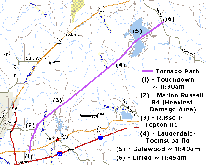
Below is a rough map I have made showing the path the tornado took. Below that are some basic stats on the tornado.
Tornado touchdown:
Approximately 11:30am just south of US 11/80 and west of Sweet Gum Bottom Rd,
about 2 miles WSW of Russell.
Tornado dissipated: Approximately 11:45am just northeast of Kewanee Rd,
about 2 miles SE of Lauderdale.
Approximate Length: 11.5 miles
Average Forward Speed: 46 MPH
Damage Rating (on the Fujita Scale): F2 (approximate wind speed 113-157
MPH)
Average path width: approximately 100-200 feet
Maximum path width: approximately 800 feet (~1/8 mile)
Back to 12/16/00 Russell-Dalewood Tornado
![]()
Page last modified 31 December, 2003