![]()
Illinois Highway Scenes
This page documents photos from various locations in Illinois.
|
| Eastbound I-24 on the approach to the Ohio River bridge. Photo by Adam Froehlig, taken in 2001. |
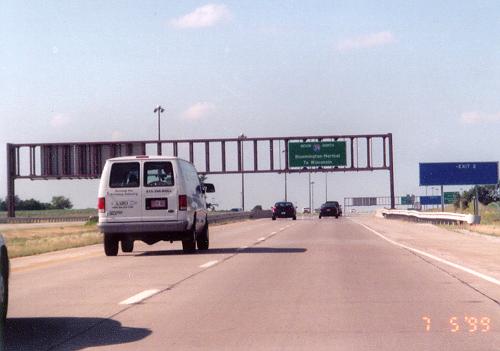
| One of the first signs encountered along northbound I-39, after its beginning at I-55 near Normal, IL. Photo by David Greenberger, taken July 5, 1999. |
|
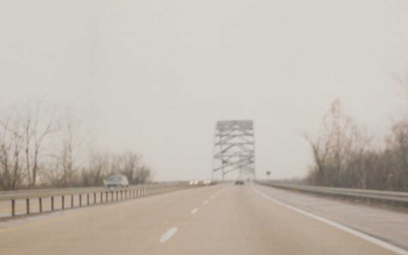
| A bridge over I-39 in central IL. Note the lack of a center support pier. Photo by Adam Froehlig, taken in 1999. |
|
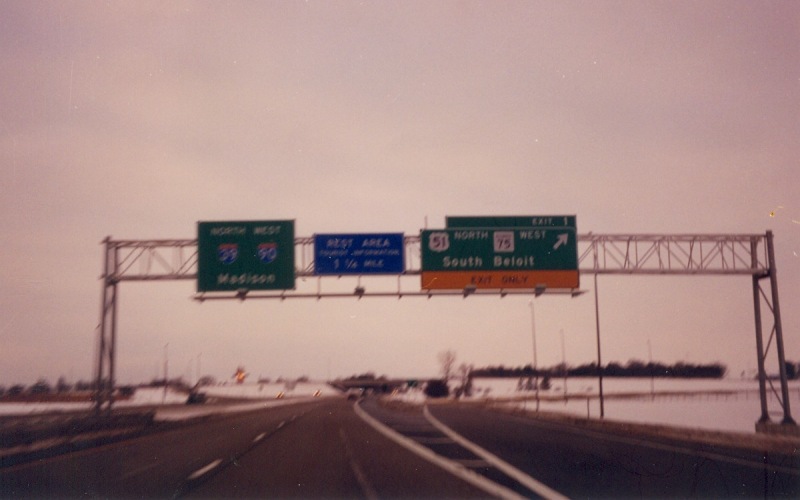
| Northbound I-39/I-90 at the last exit in Illinois before entering Wisconsin. Photo by Adam Froehlig, taken in 2001. |
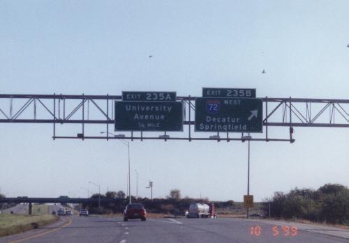
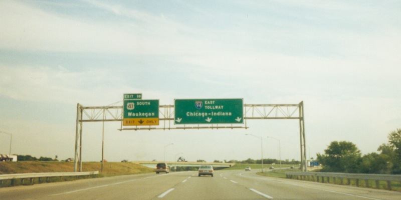
| Guide signage along southbound I-57, at the exit to westbound I-72 near Decatur, IL. Photo by David Greenberger, taken October 5, 1999. |
|
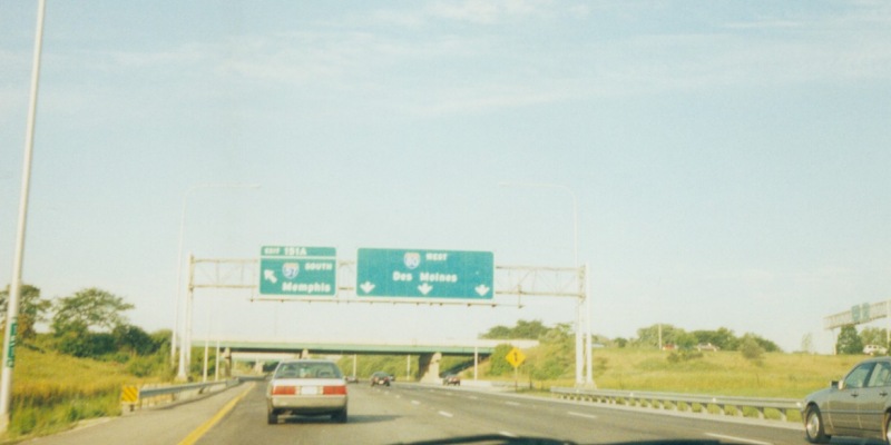
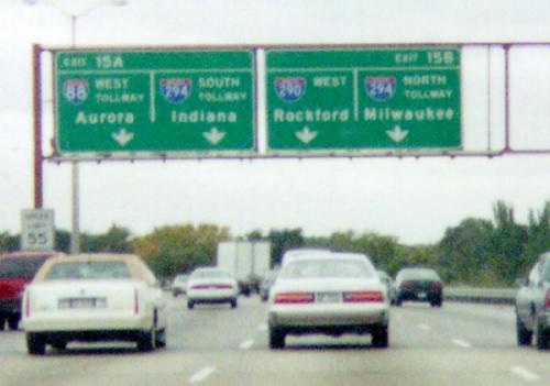
| Westbound I-80, at the left-side exit to southbound I-57. Photo by Adam Froehlig, taken in 2000. |
|
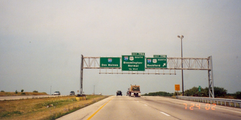
| Westbound I-80 at I-39, near La Salle. Photo by Adam Froehlig, taken July 24, 2002. |
|
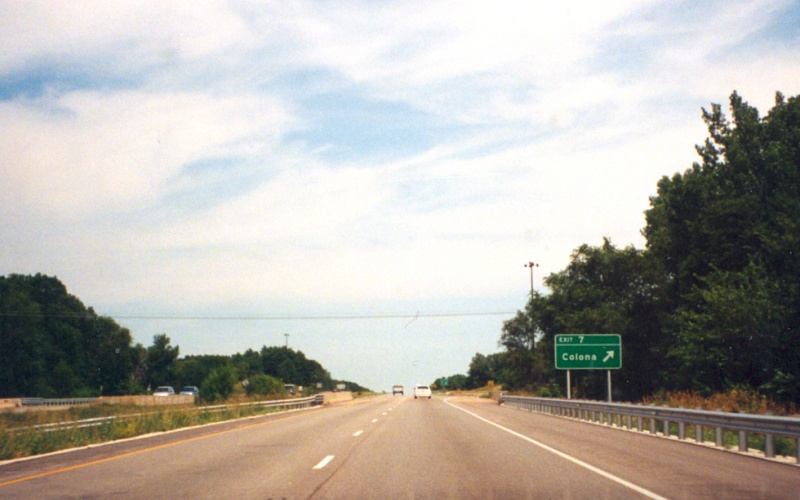
| Westbound I-80 at the Colona exit, on the outskirts of the Quad Cities area. Photo by Adam Froehlig, taken July 24, 2002. |
|
| East(sic south-)bound I-94, just south of the Wisconsin line. This interchange marks the north end of the Tri-State Tollway. Photo by Adam Froehlig, taken in 2000. |
|
|
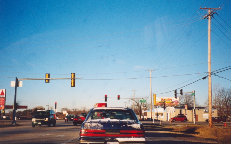
A Chicago-style ramp meter. This is an on-ramp to westbound I-290 (Eisenhower Expressway) from IL 43/Harlem Ave. Photo by Brandon Gorte. |
| Westbound I-290 in the western Chicago suburbs, right before one gets to the "Hillside Strangler" and the split to I-88. Photo by David Greenberger. |
|
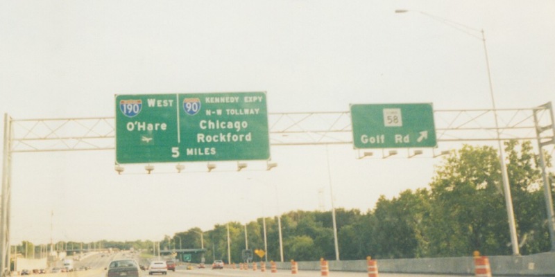
| Southbound I-294 on the Tri-State Tollway, at the IL 58 exit. Note the lack of exit numbers...this is normal on Illinois tollways. Photo by Adam Froehlig, taken in 2000. |
|
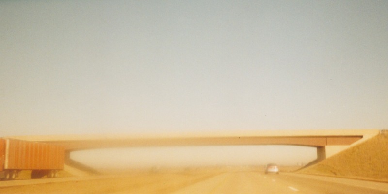
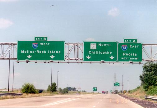
| This is the western end of I-474, bypassing Peoria, IL. The freeway continues northward as IL 6. Photo by David Greenberger, taken July 5, 1999. |
|
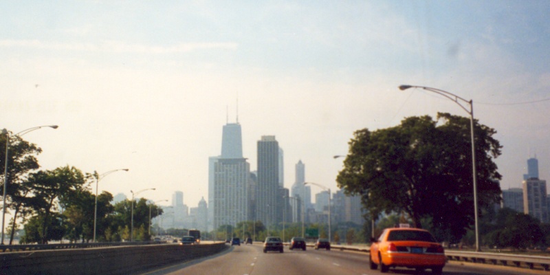
| Southbound Lakeshore Drive/US 41, looking at the Chicago skyline. Photo by Adam Froehlig, taken August 11, 2002. |
|
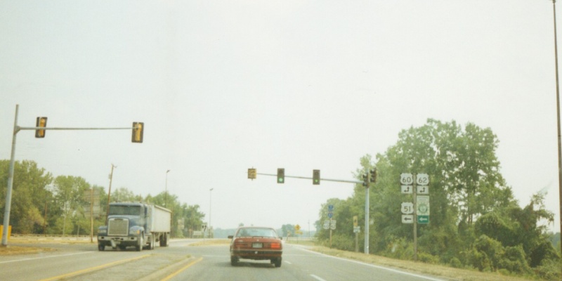
| Southbound US 51 at its junction with US 60/US 62, near the southern tip of Illinois. Just ahead to the right is the US 60/62 bridge over the Mississippi River. Just to the left is the US 51/60/62 bridge over the Ohio River. Photo by Adam Froehlig, taken prior to 2003. |
|
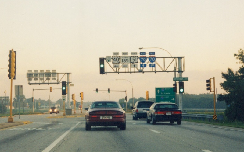
| Northbound US 51 in Vandalia, with US 40/IL 185 turning left and the I-70 junction just ahead. Note the overhead signal/trailblazer shield mast arm. Photo by Adam Froehlig, taken July 24, 2002. |
|
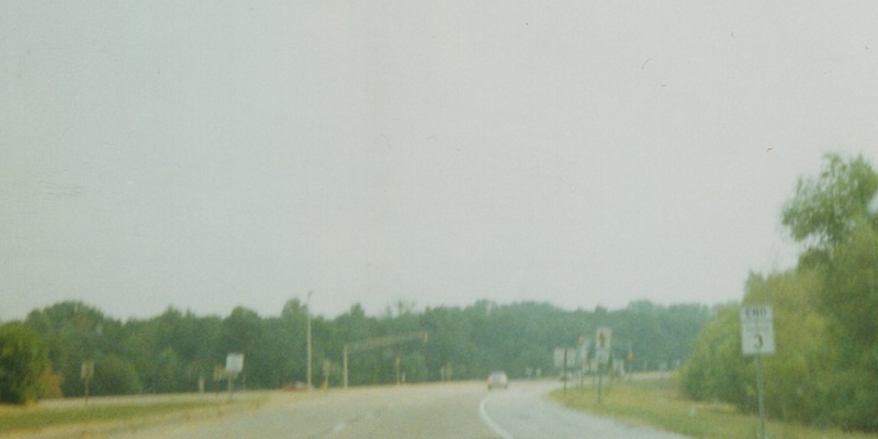
| An old, blurry view of IL 3's southern terminus near Cairo. Photo by Adam Froehlig, taken prior to 2003. |
|
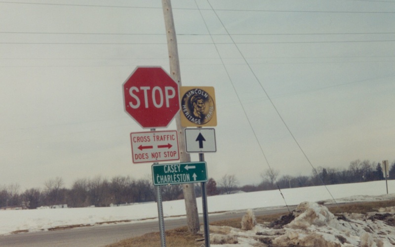
| Westbound IL 16, where IL 49 turns south. Note both the Lincoln Heritage Trail sign and the stop signs for IL 16. Photo by Adam Froehlig, taken prior to 2003. |
|
| Westbound IL 173 at IL 131 near Zion. The Wisconsin border is two miles to the north (to the right). Photo by Adam Froehlig, taken December 21, 2001. |
|
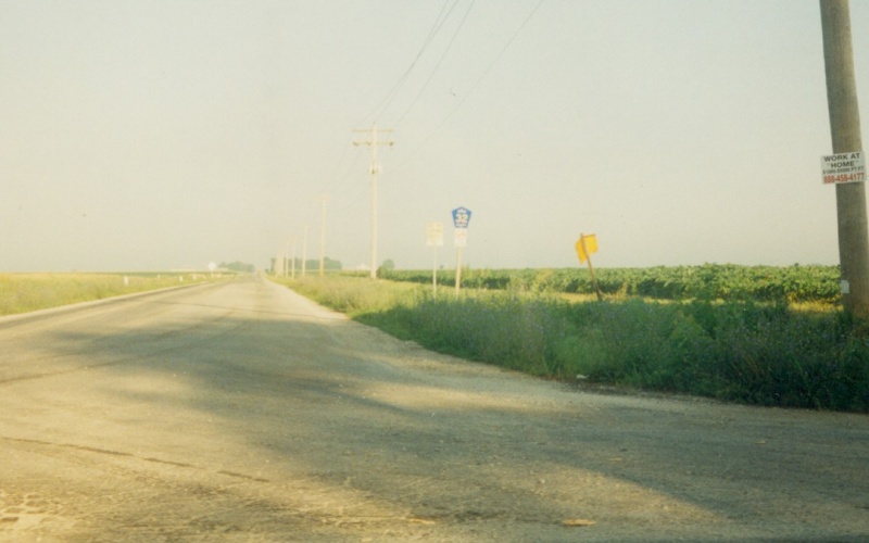
| A Macon CR 32 shield, as seen from northbound IL 128 near Dalton City. Photo by Adam Froehlig, taken July 24, 2002. |
|
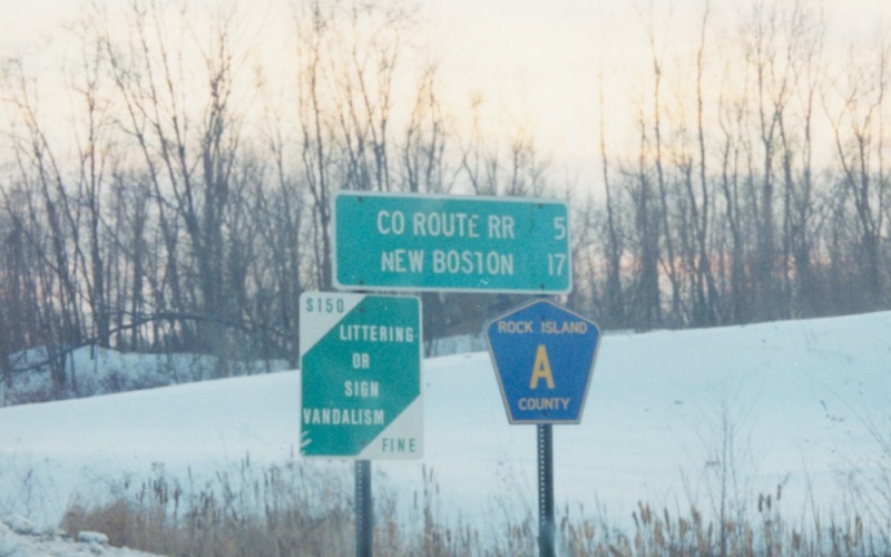
| Rock Island "County Road A" shield, located just south of IL 92. Strangely, Illinois highway maps as early as 1997 show this road as CR 11 instead. Photo by Adam Froehlig, taken prior to 2002. |
Back to Illinois Photography
Back to Highway
Photography
![]()
Page last modified 18 February, 2008
(C) 2008-2003, Adam Froehlig