Minnesota State Highway 55
|
Western Terminus |
Eastern Terminus |
| ND/MN State Line near Fairmount, ND | At US 61 in Hastings, MN |
These photographs primarily show Highway 55 through south Minneapolis, including its reconstruction and construction of the parallel Hiawatha LRT line, but also includes other photographs from along Highway 55. Included are terminus photos for both Hwy. 55 and Hwy. 62.
Eastern Terminus Photos
|
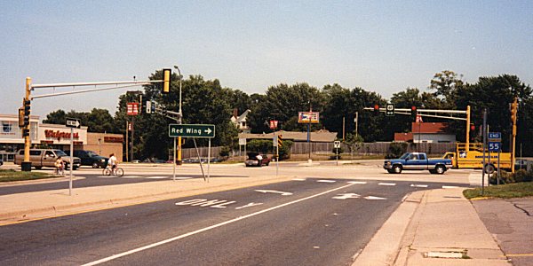
| Overall view of the Vermillion St/11th St E intersection in Hastings. US 61 follows Vermillion St through the city. Photo by Monte Castleman. |
|
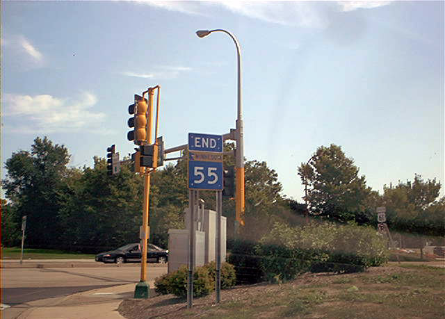
| Close-up of the END shield. Photo by Don Greiskalns. |
Eastbound Photos
 | At the time, a temporary road connection existed just north of MN 62, which served as a temporary access to the VA Medical Center during construction of the Hiawatha LRT Line. Photo by Adam Froehlig, taken April 24, 2003. |
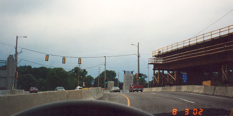
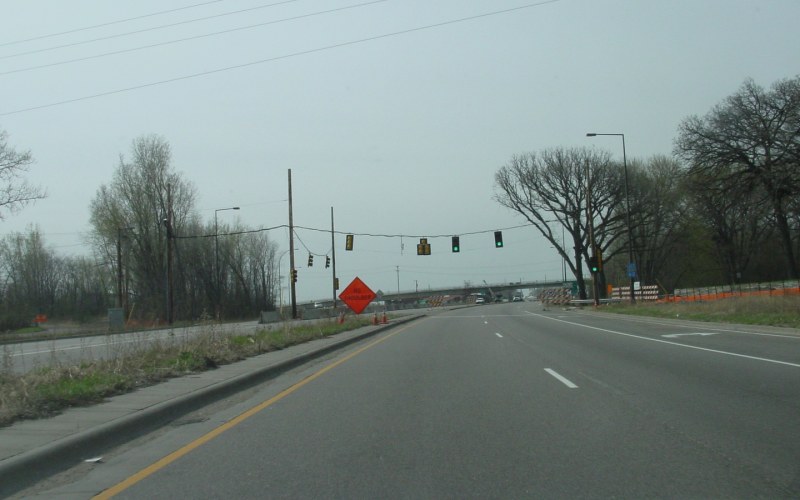
 | During most of the early 2000s, a temporary intersection existed at the MN 55/MN 62 junction, as seen here. Construction of an interchange at the junction was held up several times due to various reasons...many stemming from real or perceived effects to nearby Camp Coldwater, a natural spring. However, redesign of the interchange to include a liner allowed construction to be completed in 2004. Also under construction here was a Hiawatha LRT Line overpass over the junction. Photo by Adam Froehlig, taken April 24, 2003. |
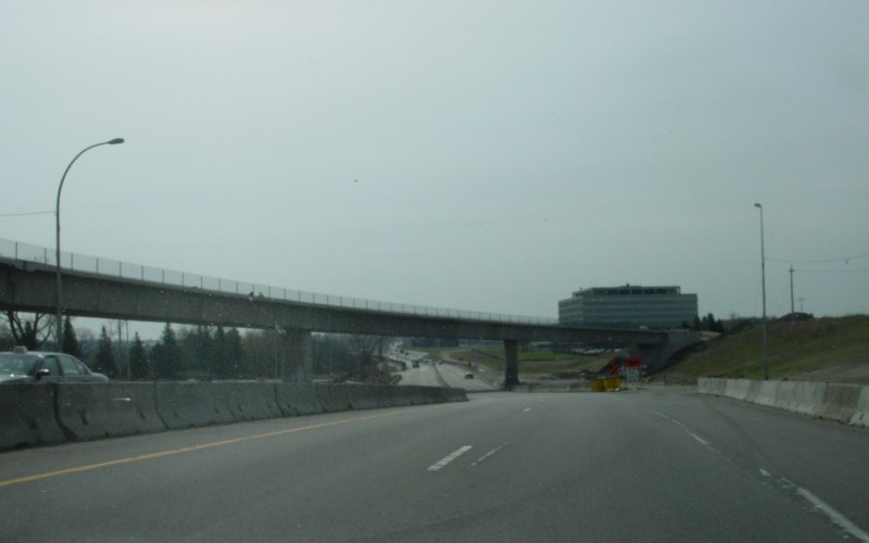 | Just east of the junction with MN 62, the Hiawatha LRT line crosses over MN 55 enroute to the Airport. As part of the MN 55/MN 62 interchange project, reconstruction of this segment of MN 55 was also underway. Photo by Adam Froehlig, taken April 24, 2003. |
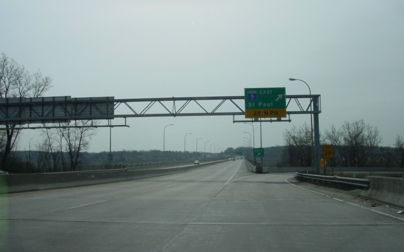 | Just before the start of the Mendota Bridge is the loop ramp to MN 5 EAST. Photo by Adam Froehlig, taken April 24, 2003. |
 | Heading eastbound across the Mendota Bridge. The bridge, built in 1926, is one of the longest concrete arch bridges in the world and is listed on the National Register of Historic Places. It initially had a 60-ft-wide single deck which provided for 4 rather narrow lanes and a very narrow sidewalk. Inspections found the bridge deck deteriorating, but the arches were sound. MnDOT rebuilt the bridge from the arches up in 1993-94, providing for a 4-lane divided facility with shoulders and an 8-ft-wide bike/ped path on the north side. Photo by Don Greiskalns, date unknown. |
|
|
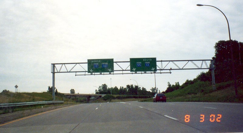
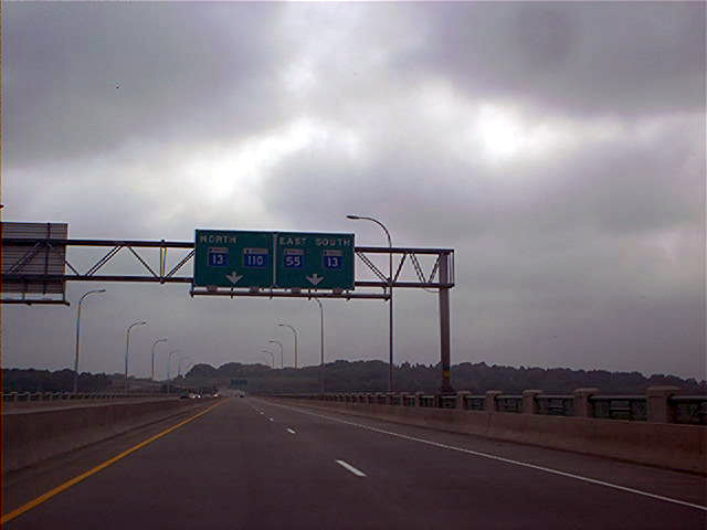
The eastbound split between MN 55 and MN 110, just past the Mendota Bridge. Photo by Adam Froehlig, taken August 3, 2002. |
Westbound Photos
|
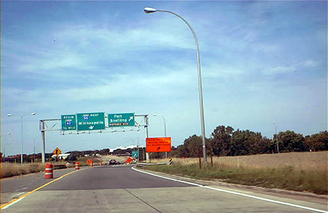
| Overhead signage for the exit from westbound MN 55 to Fort Snelling, just west of MN 5. Construction related to the now-completed MN 55/MN 62 interchange is in the far background. Photo by Don Greiskalns, date unknown. |
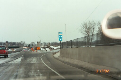 | Although construction at the interchange overall had stalled at the time this photo was taken, the ramp to continue on westbound MN 55 is open. Photo by Glenn Olson, taken March 17, 2002. |
|
|
A westbound view, at what was the time a "temporary" MN 55/MN 62 intersection. This one shows the progress that had been made on the LRT overpass. Photo by Adam Froehlig, taken August 3, 2002. |
|
|
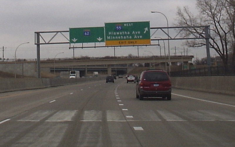
Westbound approaching the now-completed intersection. MN 55 exits off of itself while MN 62 continues straight ahead. Photo by Don Greiskalns, taken March 3, 2006. |
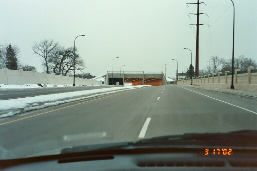 | Westbound approaching the new tunnel under Minnehaha Pkwy The leftmost tunnel is for the LRT tracks. Photo by Glenn Olson, taken March 17, 2002. |
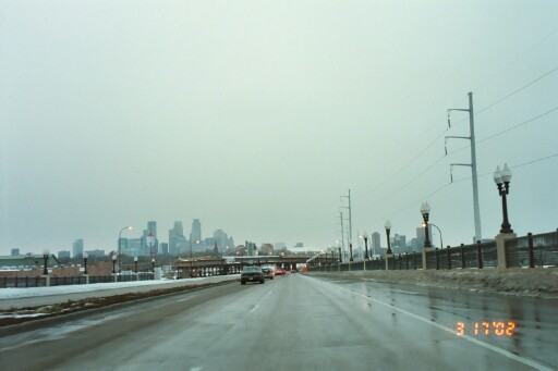 | Westbound approaching 28th St. Photo by Glenn Olson, taken March 17, 2002. |
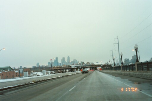 | Closer to the intersection, here's a better view of the bridge the Hiawatha LRT line will take over MN 55. Photo by Glenn Olson, taken March 17, 2002. |
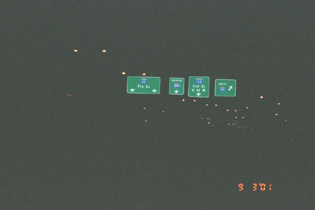 | A nighttime view of overhead guide signage on westbound MN 55/Hiawatha Blvd, approaching the ramps to I-94 west and I-35W north. Soon, westbound MN 55 will join I-94 here and the route through downtown will be "turned back" to the city. Photo by Glenn Olson, taken September 3, 2001. |
Go to MN Highway
Endings
Go to Highway Photography
![]()
Page last modified 17 May 2008
(C) 2006-2003, Adam Froehlig