U.S. Highway 169 in Minnesota
|
|
Southern Terminus |
Northern Terminus |
| Minnesota | IA/MN State Line at Elmore, MN | At US 53 in Virginia, MN |
| Nationally | At US 64 in Tulsa, OK | At US 53 in Virginia, MN |
This page photo-documents US 169 in Minnesota. Click on a thumbnail to view a larger photo.
Southern Terminus
|
|
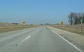
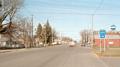
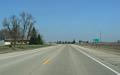
Northbound US 169 entering Minnesota and the border town of Elmore. Photo by Adam Froehlig, taken April 17, 2007. |
|
|
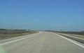
Entering Iowa along southbound US 169. Photo by Monte Castleman, taken April, 2002. |
Northern Terminus
Northbound Photos (these photos are shown in order of progression)
|
|
In Elmore. Photo by Adam Froehlig, taken April 17, 2007. |
|
|
At Milepost 1, heading north towards Blue Earth. Photo by Adam Froehlig, taken April 17, 2007. |
|
|
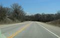
Faribault CSAH 2 "shares a mile" with US 169 north of Elmore. In reality, the road is still just US 169, but signage further up shows CSAH 2 as continuing east of US 169 about a mile north. Photo by Adam Froehlig, taken April 17, 2007. |
|
|
Approaching Blue Earth. This is MnDOT's standard "BEGIN SPEED LIMIT xx, x/x MILE" sign. In this case, the speed limit drops to 30 MPH in 1/4 mile. Photo by Adam Froehlig, taken April 17, 2007. |
|
|
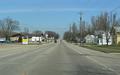
Entering Blue Earth on northbound US 169. MnDOT standard practice is to include the population on the city limit sign (in this case, 3,621 people). Photo by Adam Froehlig, taken April 17, 2007. |
|
|
A railroad overpass for a Union Pacific line that extends southeast into Iowa. Photo by Adam Froehlig, taken April 17, 2007. |
|
|
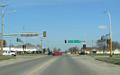
One of only two traffic signals in Faribault County (both along US 169 in Blue Earth). Prior to the completion of I-90 in 1978, US 16 turned east here. Photo by Adam Froehlig, taken April 17, 2007. |
|
|
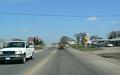
Near 3rd St in Blue Earth The divided highway section just ahead extends about 2 miles to north of I-90, and was built as a new-alignment section in 1978 in conjunction with the construction of I-90. Photo by Adam Froehlig, taken April 17, 2007. |
|
|
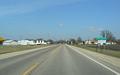
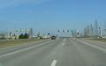
At Faribault CSAH 44/CR 104 on the north side of Blue Earth. This is the other traffic signal in the county, having been added due to most newer development being in this area (notice the WalMart in the left background). The I-90 overpasses are in the center background. Photo by Adam Froehlig, taken April 17, 2007. |
|
|
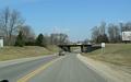
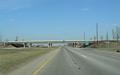
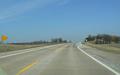
Two photos approaching and at I-90. Photo by Adam Froehlig, taken April 17, 2007. |
|
|
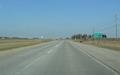
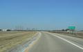
A distance sign just north of I-90. MnDOT will occasionally show three destinations on their distance signs. Photo by Adam Froehlig, taken April 17, 2007. |
|
|
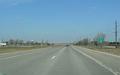
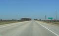
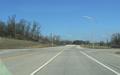
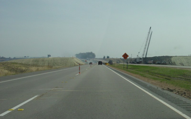
About a mile north of I-90 and just beyond Milepost 12 is where US 169 narrows back to 2 lanes. Photo by Adam Froehlig, taken April 17, 2007. |
|
|
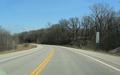
Faribault CSAH 6 is US 169's old alignment into Blue Earth from the north. This location marks the north end of the new-alignment section built when I-90 was built. Photo by Adam Froehlig, taken April 17, 2007. |
|
|
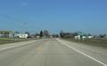
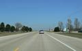
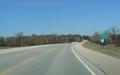
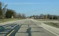
Entering Winnebago from the south. Photo by Adam Froehlig, taken April 17, 2007. |
|
|
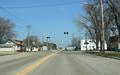
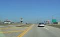
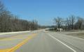
South side of Winnebago. The junction with MN 109 is up ahead. Photo by Adam Froehlig, taken April 17, 2007. |
|
|
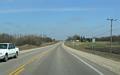
At MN 109. Photo by Monte Castleman, taken in 2004. |
|
|
US 169 crosses an Iowa, Chicago and Eastern rail line in Winnebago. Photo by Adam Froehlig, taken April 17, 2007. |
|
|
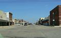
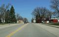
Two photos of "downtown Winnebago". US 169 has a short 4-lane undivided section with street parking in the downtown. Photo by Adam Froehlig, taken April 17, 2007. |
|
|
Heading north out of Winnebago. Occasionally MnDOT will use route shields on their distance signs, as shown here. Photo by Adam Froehlig, taken April 17, 2007. |
|
|
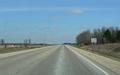
Entering Blue Earth County. Photo by Adam Froehlig, taken April 17, 2007. |
|
|
Approaching MN 30, just outside Amboy. Photo by Adam Froehlig, taken April 17, 2007. |
|
|
US 169 becomes a 2-lane divided section along its short duplex with MN 30. Photo by Adam Froehlig, taken April 17, 2007. |
|
|
The duplex is only about 1/3 mile long. MN 30 turns left here while US 169 continues ahead towards Mankato. Photo by Adam Froehlig, taken April 17, 2007. |
|
|
Distance sign just north of MN 30, showing 5 miles to Vernon Center and 24 miles to Mankato. Photo by Adam Froehlig, taken April 17, 2007. |
|
|
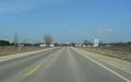
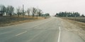
Approaching the small town of Vernon Center. Photo by Adam Froehlig, taken April 17, 2007. |
|
|
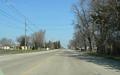
In Vernon Center. Photo by Adam Froehlig, taken April 17, 2007. |
|
|
Dropping into the Watonwan River valley near the (unincorporated) hamlet of Garden City. Photo by Adam Froehlig, taken April 17, 2007. |
|
|
The road to the right is CSAH 34. Note the right- and left-turn lanes. These were added when MnDOT reconstructed this segment in 1994. Photo by Adam Froehlig, taken April 17, 2007. |
|
|
To the right here is CSAH 38 into Garden City. To the left is CSAH 13. Photo by Adam Froehlig, taken April 17, 2007. |
|
|
Approaching MN 60. Photo by Adam Froehlig, taken April 17, 2007. |
|
|
Northbound US 169 "exits itself" onto the 4-lane highway it shares with MN 60 between here and Mankato. Photo by Adam Froehlig, taken April 17, 2007. |
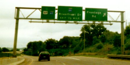 |
Guide signage on US 169/MN 60 in Mankato. US 169/MN 60 have a short "freeway" section in the city. Recently completed corridor studies recommend an eventual freeway section extending from MN 68 to US 14. Photo by Adam Froehlig, taken in 1999. |
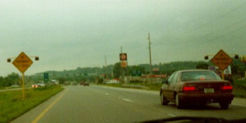 |
An example of Minnesota's "Be Prepared to Stop" when flashing signs, on NB US 169 approaching MN 282/Scott CSAH 9 in Jordan. Photo by Adam Froehlig, taken in 1999. |
|
|
At the north end of the Bloomington Ferry Bridge is the interchange with Hennepin CSAH 1 East. Technically, CSAH 1 duplexes with US 169 here for a mile, but is not truly signed as such. Photo by Adam Froehlig, taken April 23, 2003. |
|
|
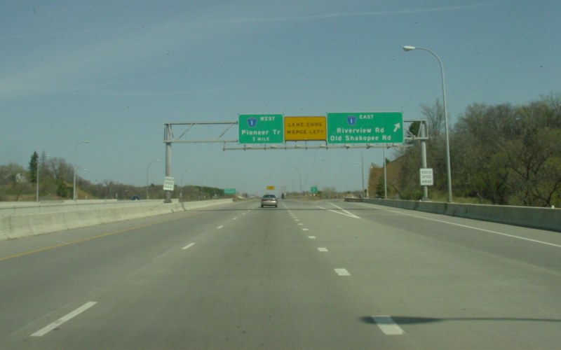
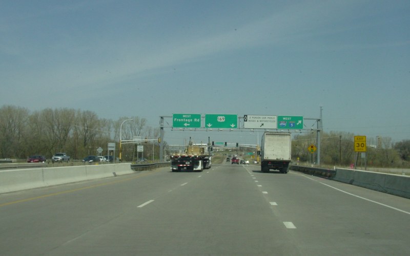
On the bridge over I-494. These bridges were rebuilt in the mid-90s, and the 3 loop ramps at the existing I-494/US 169 interchange were built at the same time. Long-range plans to build a full freeway-to-freeway interchange here have lagged due to lack of funding. Photo by Adam Froehlig, taken April 23, 2003. |
Southbound Photos (these photos are shown in order of progression)
|
|
Three photos from far southwestern Scott County. At the time, the US 169/MN 19 interchange was under construction, with all US 169 traffic in the vicinity shifted to the northbound lanes. Photos by Adam Froehlig, taken April 23, 2003. |
|
|
At what is now the MN 19 interchange, which at the time was under construction. Photo by Adam Froehlig, taken April 23, 2003. |
|
|
Overhead signage on southbound US 169 at the MN 112 interchange. Photo by Adam Froehlig, taken April 23, 2003. |
|
|
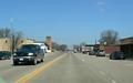
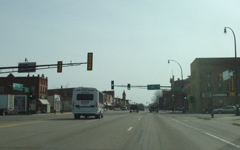
US 169 is a wide 5-lane street with street parking through downtown St. Peter. MN 99 joins from the east (left) here for a short US 169/MN 22/MN 99 triplex through St. Peter. Photo by Adam Froehlig, taken April 23, 2003. |
|
|
Southbound in downtown St. Peter, where the St. Peter Fire Department has hoisted the U.S. flag over the southbound lanes. Photo by Adam Froehlig, taken April 23, 2003. |
Go to MN Highway Endings
Go to Minnesota Photography
Go to Highway Photography
Go to Main Page
Go to Highways Page
![]()
Page last modified 24 May, 2008
(C) 2008-2007, Adam Froehlig