Rhode Island Highway Scenes
These photos were taken on a roadtrip with Doug Kerr. All photos were taken by the webmaster on January 3, 2001.
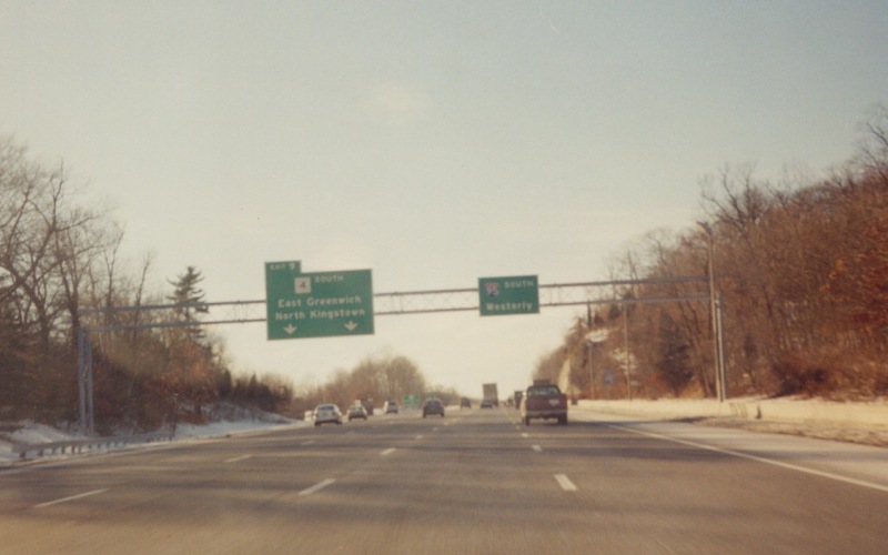
| Southbound on I-95 where RI 4 splits off on the left. |
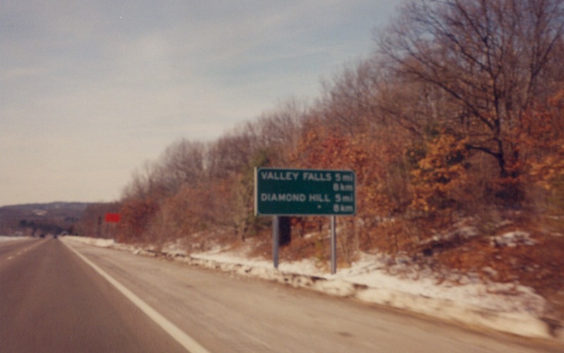
| First of five photos along southbound I-295, showing an unusual destination/distance sign with the distances in both miles and kilometers. This was near the Massachusetts line. |
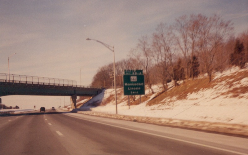
| Advance guide sign for the RI 146 interchange. Rhode Island uses sequential exit numbering, but notice that they use a "Mile 19" tab here as well. |
|
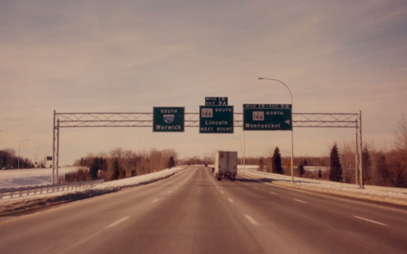
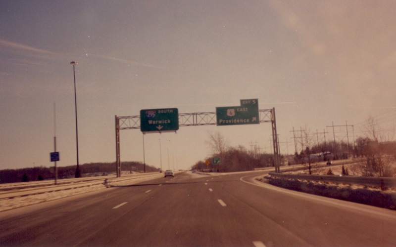
| Overhead guide signs at the RI 146 interchange. The "Mile 19" tabs are here as well. |
|
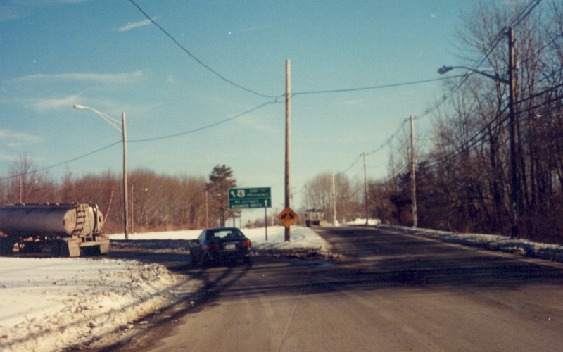
| Along the southbound I-295 C/D road where US 6 East splits off towards central Providence. |
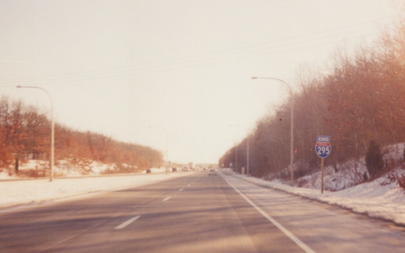
| END I-295 shield just before the merge with southbound I-95. Notice the use of a 2di-size shield for the end shield. |
| At Chopmist, US 6 splits off of Danielson Pike onto a "Bypass" route to the north. Though not signed here, BUSINESS US 6 continues along Danielson Pike. |
| BYPASS US 6 at the junction with RI 102. Note how the "Bypass" banner is below the shield instead of the usual placement between the directional banner and the route shield. |
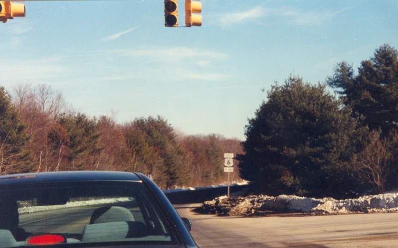
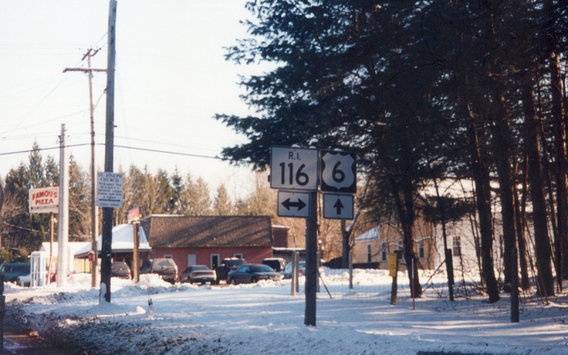
| Eastbound BYPASS US 6 at RI 116. Though this segment of the route is designated as BYPASS US 6, RIDOT considers it and not the Business route to be the mainline of US 6. |
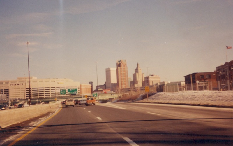
| A view of the Providence skyline, shortly before eastbound US 6 junctions with I-95. |
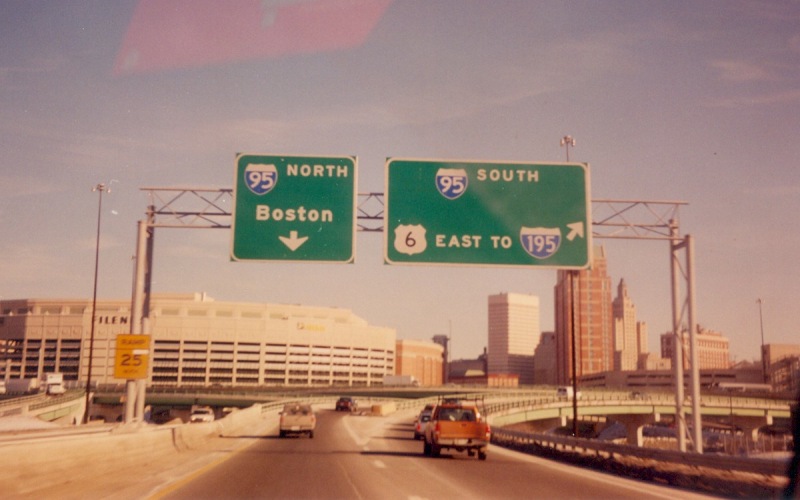
| A short distance later, with overhead guide signs at the ramps to I-95. |
![]()
Page last modified 22 January, 2006
(C) 2006 Adam Froehlig