I-494/MN 5 East Aerial Image
These images are courtesy of the National Agriculture Imagery Program, a program of the U.S. Department of Agriculture, and were taken in 2005.
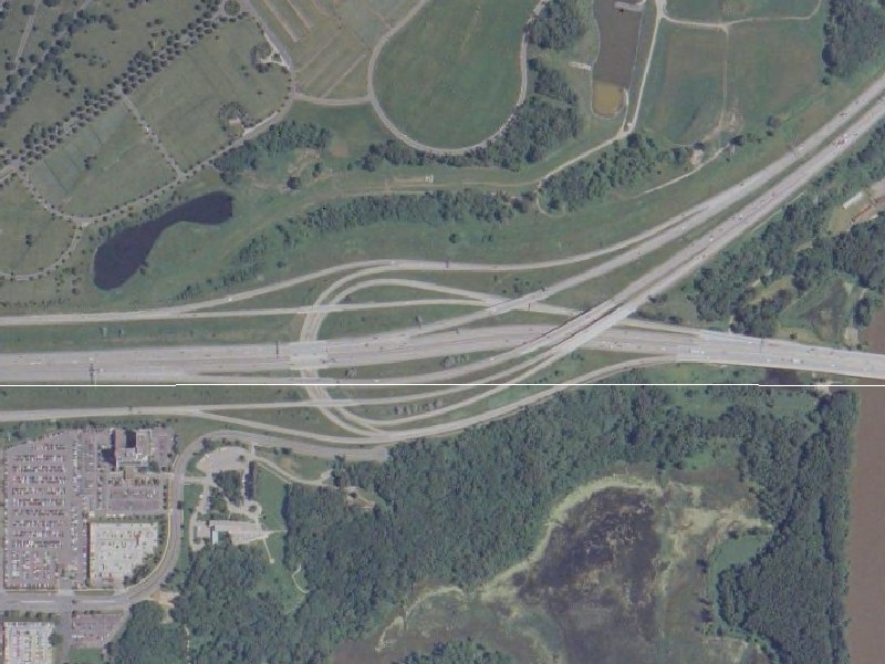
This view, at 6-feet-per-pixel resolution, shows the eastern I-494/MN 5 interchange in Bloomington. I-494 runs east-west. MN 5 runs northeast, and is duplexed with I-494 to the west. The Minnesota River is on the bottom right edge. Part of Fort Snelling National Cemetary is in the northwest corner, while Minneapolis-St Paul International Airport (MSP) is off the picture to the north. The white line depicts the border between Bloomington to the south, and unorganized airport/government territory to the north.
This image shows the interesting jumble of ramps that comprise the eastern I-494/MN 5 interchange, completed ca. 1982. For over 20 years before this, all there was previously was a simple freeway that followed MN 5. This unusual design was necessitated by the proximity of the Minnesota River and related wetlands. If you look closely, you can see that there are C/D roads connecting this interchange to 34th Ave.
Return to Twin Cites Aerial Images
Return to Twin Cities Highways
![]()
Page last modified 25 April, 2008