High Speed Rail (fantasy transit)
Background
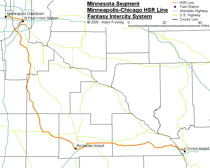
I include High Speed Rail (HSR) in my fantasy transit plan because it serves a transit function. This line, which in some circles is being considered for part of the real-life-proposed Chicago Hub Network, would connect downtown Minneapolis and the Minneapolis-St Paul and Rochester airports via high-speed rail, and would continue beyond Rochester to southern Wisconsin and Chicago, offering an alternative to the 7-hour-excluding-traffic drive or 1-hour-with-potential-delays airplane flight. The basis behind my HSR alignment is the "Rochester Rail Link Feasibility Study" completed in early 2003, which examined various speed and alignment options for a combined freight/passenger line between the two airports.
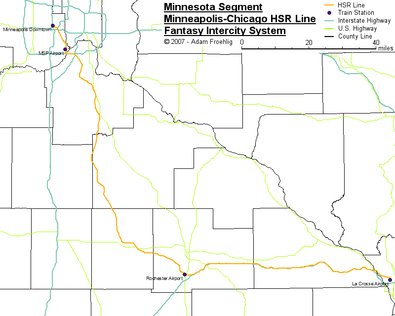
For the purposes of my fantasy system, this line would be an overall 150 MPH line, upgradeable to 185+ MPH in the future. The real life studies are considering beginning the line at either St. Paul's Union Depot (hereafter called Union Station) or at the Minneapolis-St. Paul International Airport. My initial idea on this line used the latter, with a connection north of the airport to downtown Minneapolis generally along the Hiawatha corridor. This current rendition of my high-speed rail idea also begins in downtown Minneapolis, but also goes through downtown St. Paul instead of through the airport area.
Description
Though it requires a slower overall speed as well as a change in Federal law should it ever become feasible in real-life, this HSR line utilizes parts of existing freight rail tracks in the Twin Cities metro area.
The line begins at the Minneapolis Downtown Intermodal station. Utilizing existing BNSF rail tracks, it heads northeast across the river, then east along the St. Paul Midway/Pierce Butler Route corridor. It loops around the north and east sides of downtown St. Paul and enters St. Paul Union Station from the east.
West of St. Paul Union Station, it briefly follows Canadian Pacific trackage to near the Smith Ave High Bridge, where it switches over to its own tracks. Southwest of the High Bridge, the line closely parallels Union Pacific tracks that cross the Mississippi River near Lilydale. The line continues to parallel the Union Pacific until the east side of Mendota, where it begins the climb out of the river valley utilizing a former rail right of way now used for the Big Rivers Regional Trail.
The line follows the regional trail/former rail corridor through Mendota, under MN 55, and over MN 13 and Pilot Knob Rd. Near Mendota Heights Rd, it follows the Progressive Rail tracks along the west side of MN 55 and MN 149 and the east side of MN 3 down to northern Rosemount (near 130th St W), where it splits off the tracks to the southeast, crossing Dakota CSAH 42 just east of the Dakota County Technical College.
South of Dakota CSAH 42, it generally follows a long-abandoned Chicago Great Western rail corridor along a Coates-Empire-Hampton-Randolph-Stanton-Dennison routing, with bypasses of Empire, Hampton, Randolph, and Dennison. From Dennison southeast to the east side of Kenyon, it blazes a new right of way. Then from Kenyon to north of Dodge Center, it also follows an abandoned Chicago Great Western rail corridor along the east side of MN 56, bypassing West Concord. It then goes along new right-of-way from the north side of Dodge Center to the south side of Kasson and on to the Rochester Airport.
East of the Rochester Airport, the line crosses over US 63, then follows the north side of I-90 eastward to where the I-90 median widens on the descent into the Mississippi River valley (about a mile east of Exit 266/Winona CSAH 12). Here, the line is on its own descent into the valley, crossing under I-90, then following just inside (to the left) of the eastbound I-90 lanes. About 3/4 mile west of the I-90/US 14/61 merge, the line splits off the eastbound lanes, crossing over the westbound I-90 lanes, US 14/61, Old Hwy 61, the CP rail tracks, and the main channel of the Mississippi River. The line then island-hops southeastward along the east side of the river's main channel and across Lake Onalaska to French Island ("West La Crosse"), where the line turns south and has a station in front of the La Crosse Airport terminal.
Beyond La Crosse, this high-speed line would extend to Madison, Milwaukee, and Chicago.
An earlier version of this map, using my original idea of routing the line through MSP Airport then to downtown Minneapolis, is here.
Travel Time Estimation (Minnesota segment)
| From | To | Distance (miles) | Travel Time | Cumulative Distance (miles) | Cumulative Time |
| Minneapolis Downtown | St. Paul Union Station | 11.6 | 18 min | 11.6 | 18 min |
| St. Paul Union Station | Rochester Airport | 94.1 | 54 min | 105.7 | 1 hr 12 min |
| Rochester Airport | La Crosse Airport | 66.7 | 42 min | 172.4 | 1 hr 54 min |
Travel times assume trains traveling at the speed limit with no stoppages or speed restrictions. Travel times also include 5 minutes per leg to represent slowdown approaching a station, speed-up departing a station, and station dwell time.
Back to Twin Cities fantasy transit system
Go to my suggested
freeway/expressway changes.
Go to my ideas for improving/upgrading Twin Cities area
interchanges.
Return to Twin Cites Highways
![]()
Page last modified 24 October, 2009