Fantasy Rochester, MN transit system
As an add-on to my thoughts on a fantasy transit system for the Twin Cities, below are a few thoughts on a fantasy Rochester system.
Rochester is a city that has been growing very rapidly over the past few decades, with strong anchors in both the world-renowned Mayo Clinic and in IBM. One byproduct of Rochester's rapid growth has been traffic, which recently culminated in a multi-year MnDOT project to rebuild US 52 through the city.
With the continuing rapid growth and expansion of the city, I came up with the idea of a fantasy transit system, as detailed below. This system consists of two east-west commuter rail lines, utilizing the former DM&E (now part of Canadian Pacific) tracks running through the city, as well as a north-south LRT line that connects downtown with the airport and IBM.
The lines (click on a line name for a more detailed map of that line):
| Line Name | Location | Description | Map Links |
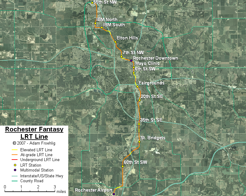
| Rochester | Rochester Airport to 55th St NW | North-south LRT line that generally follows the US 63/South Broadway corridor between the airport and downtown, follows 1st Ave W through downtown, then heads northwest to IBM and 55th St NW. |
|
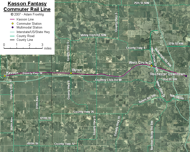
| Kasson | Kasson to Downtown Rochester | East-west commuter line using former DM&E tracks between Kasson and downtown Rochester. |
|
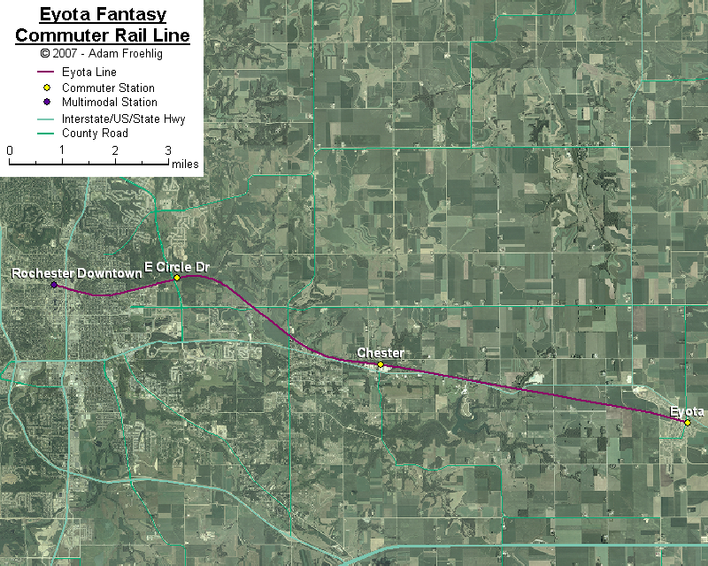
| Eyota | Downtown Rochester to Eyota | East-west commuter line using former DM&E tracks between downtown Rochester and Eyota. |
|
The following map shows the overall fantasy Rochester system:
Back to Twin Cities fantasy transit system
Go to my suggested
freeway/expressway changes.
Go to my ideas for improving/upgrading Twin Cities area
interchanges.
Return to Twin Cites Highways
![]()
Page last modified 24 December, 2007