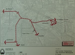
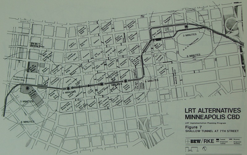
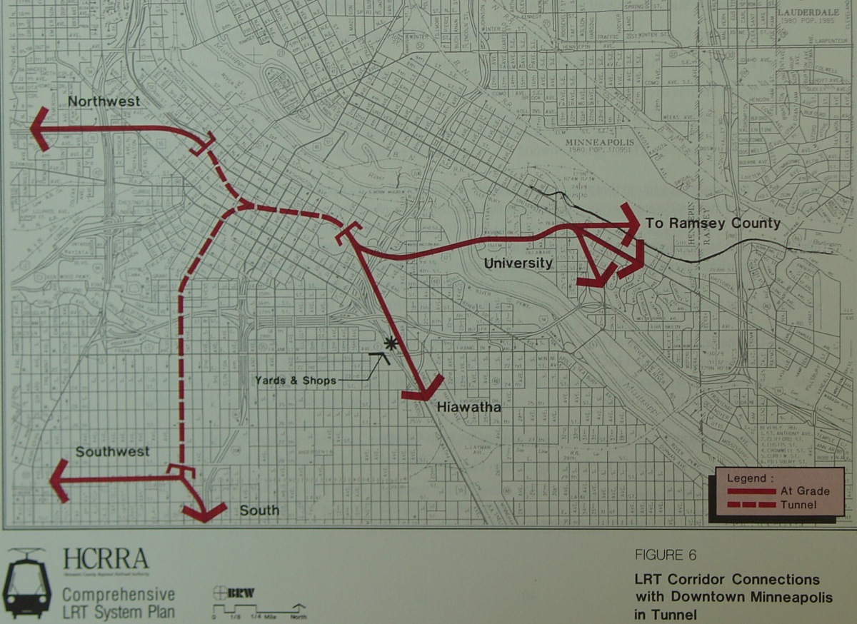
This map from the BRW study shows how the various corridors would tie into each other underneath downtown. Medium-size and large-size images are also available.

Transit Planning Map Scans
This page is a repository for those transit planning maps that I have either scanned in or take photos of. These maps were found in various documents, primarily at the MnDOT Library.
|
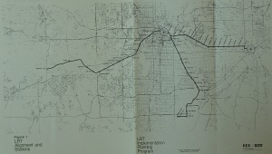
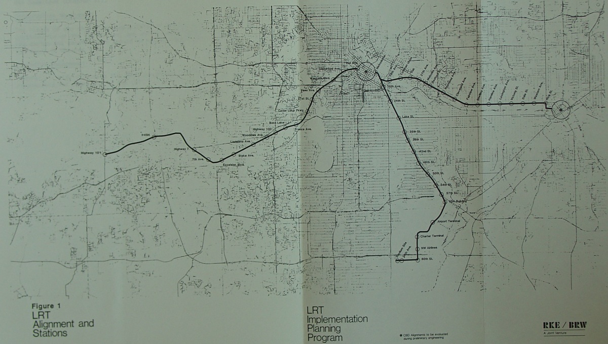
This map comes from a mid-1980s study by BRW which resulted in a recommendation for a 3-line LRT system. Coincidentally, a similar system is being pursued today, with the Hiawatha/airport line completed, and the Central and Southwest lines under study. Medium-size (800 pixel width) and large-size (1200 pixel width) images are also available. |
|
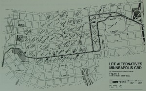
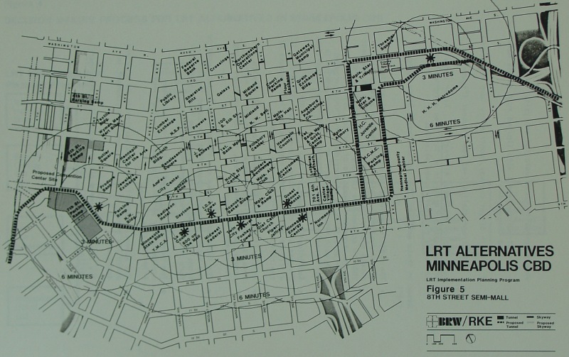
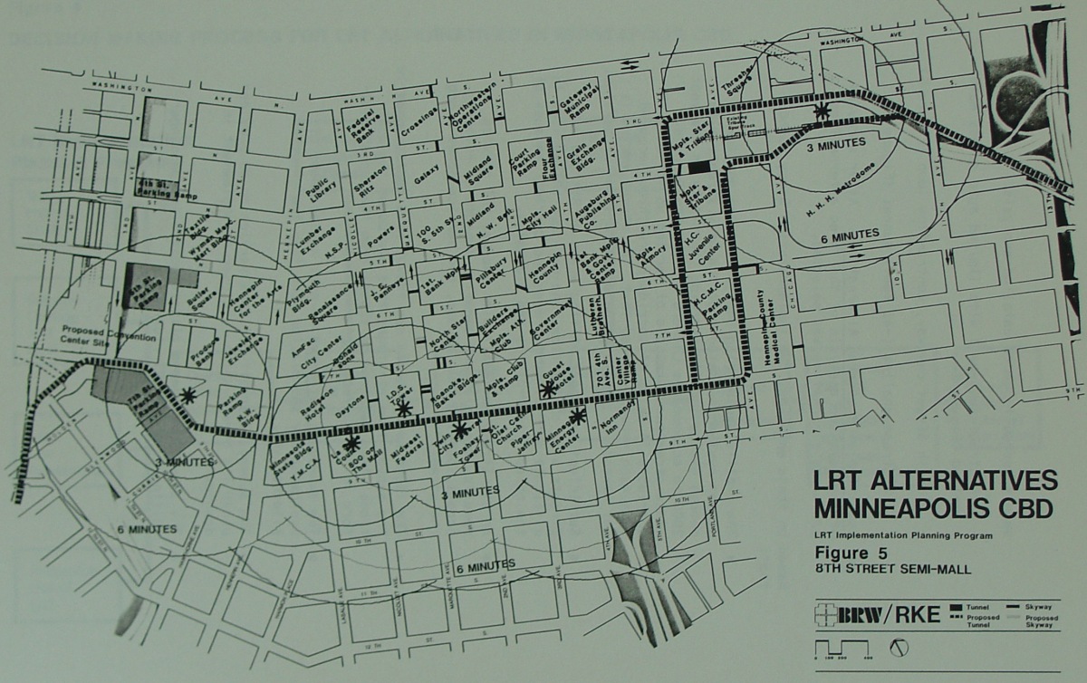
This map shows one of three options through downtown Minneapolis for the mid-80s-proposed system. This one would have utilized an 8th St "semi mall", with the LRT itself being underground in a tunnel. The LRT would have run a 1-way pair along Portland and Park between 8th St and 3rd/4th Sts. Medium-size and large-size images are also available. |
|
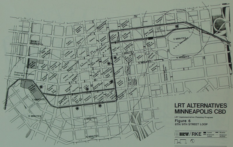
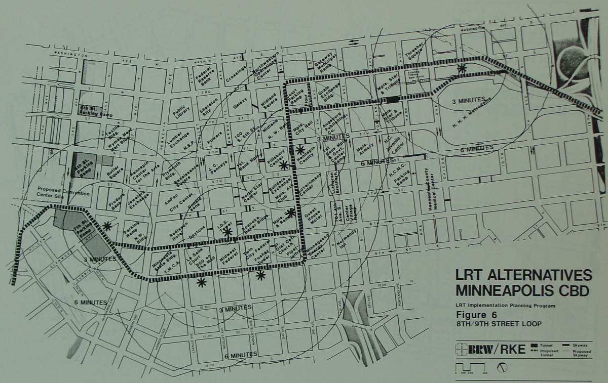
The second option proposed through downtown Minneapolis, this option also would have had LRT underground in a tunnel, using 3rd St/4th St and 8th St/9th St couplets, and running underneath 3rd Ave between the two. Medium-size and large-size images are also available. |
|
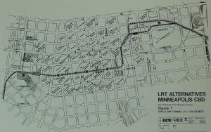
The third and final option through downtown Minneapolis ran a tunnel along 7th St instead. Medium-size and large-size images are also available. |
|
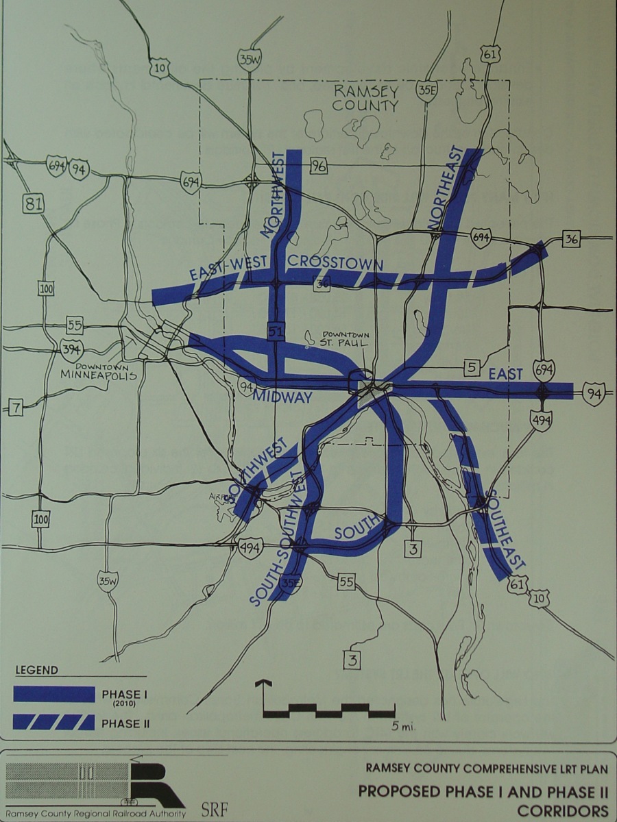
SRF Consulting performed a light-rail system study for the Ramsey County Regional Railroad Authority around 1990, pursuant to a push back then for heavy-duty light rail planning by the Metropolitan Council. This particular study shows the Hennepin County system that was proposed (Hennepin County's system was studied by BRW, as shown below). Medium-size and large-size images are also available. |
|
|
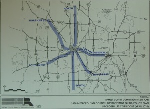
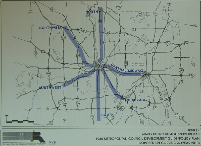
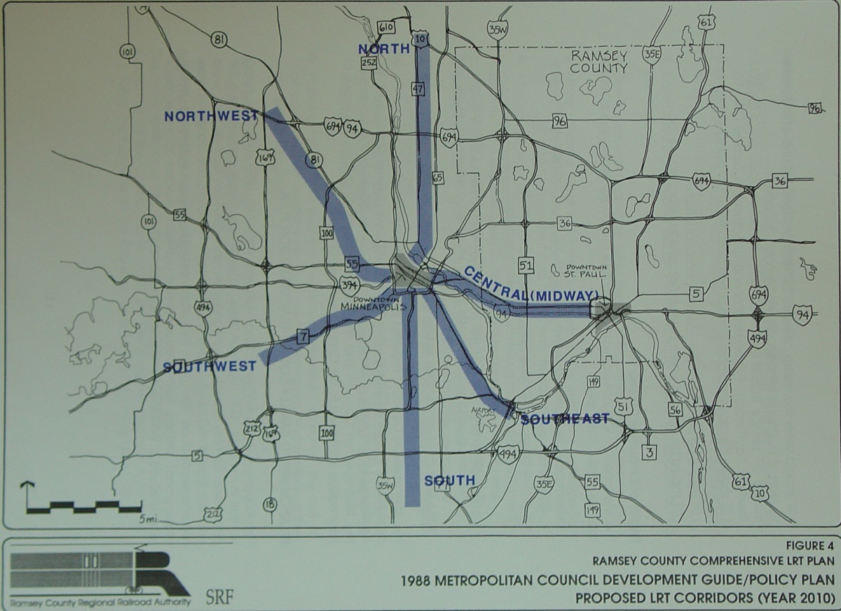
This was the Ramsey County LRT system proposed in the SRF study, again circa 1990. Medium-size and large-size images are also available. |
|
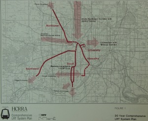
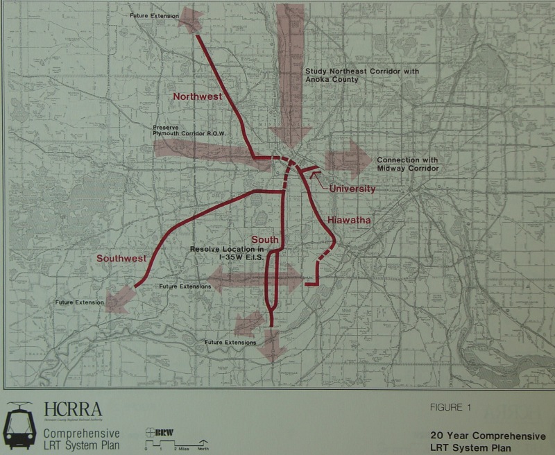
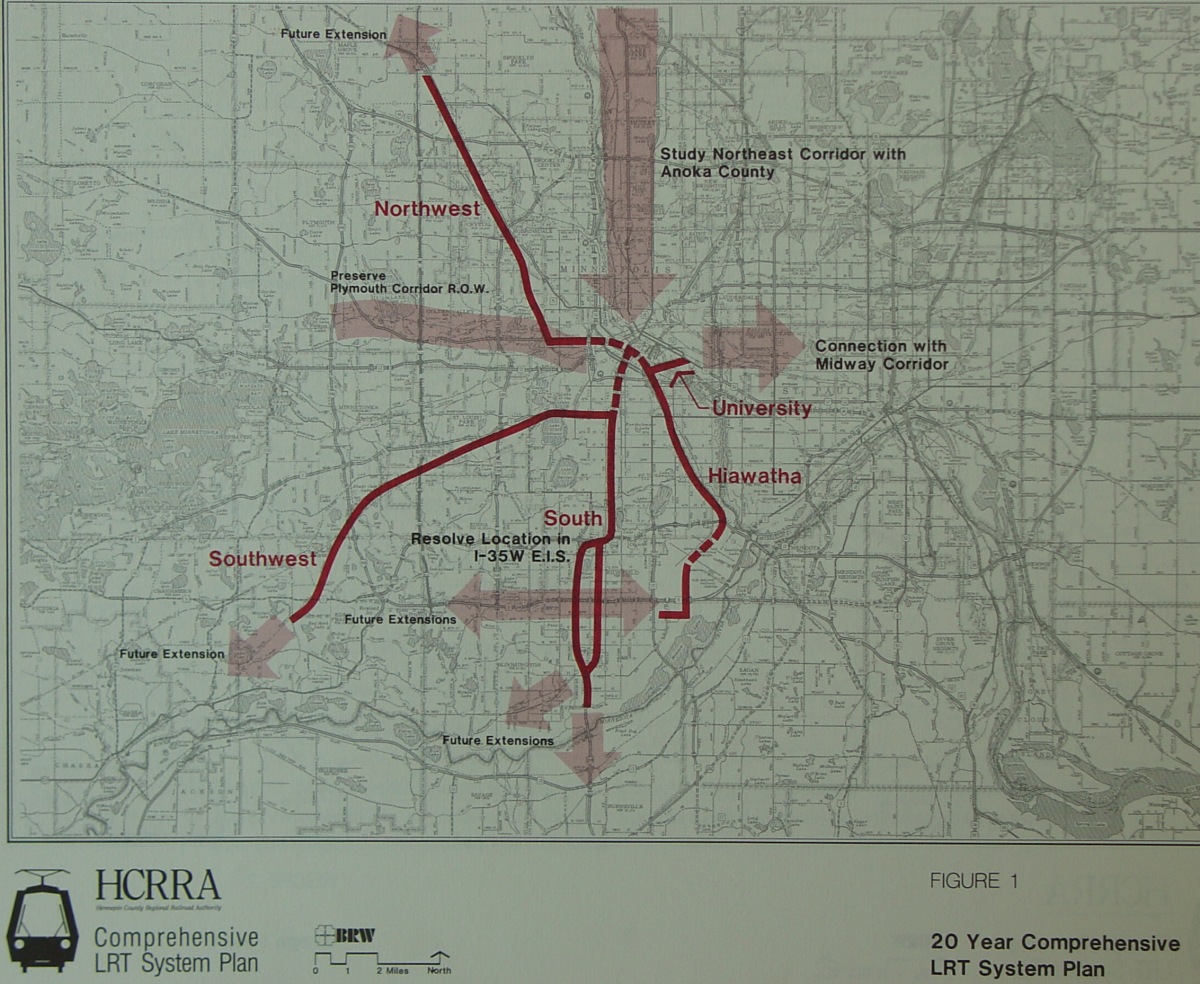
This was the ca. 1990 Hennepin County LRT system, as shown in the study done by BRW for the county. Medium-size and large-size images are also available. This page goes to a breakdown of length, cost, and estimated 2010 ridership for the proposed lines, as shown in Table 1 from the study. |
|
This map from the BRW study shows how the various corridors would tie into each other underneath downtown. Medium-size and large-size images are also available. |
|
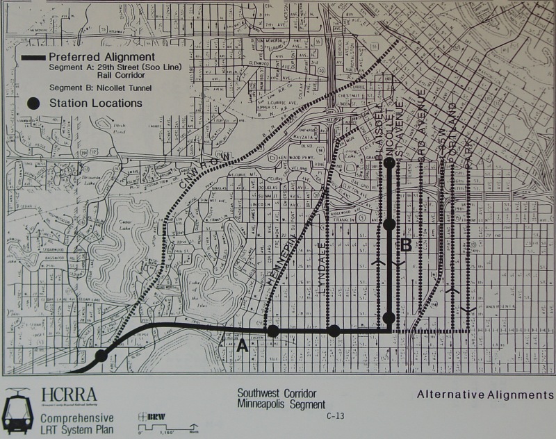
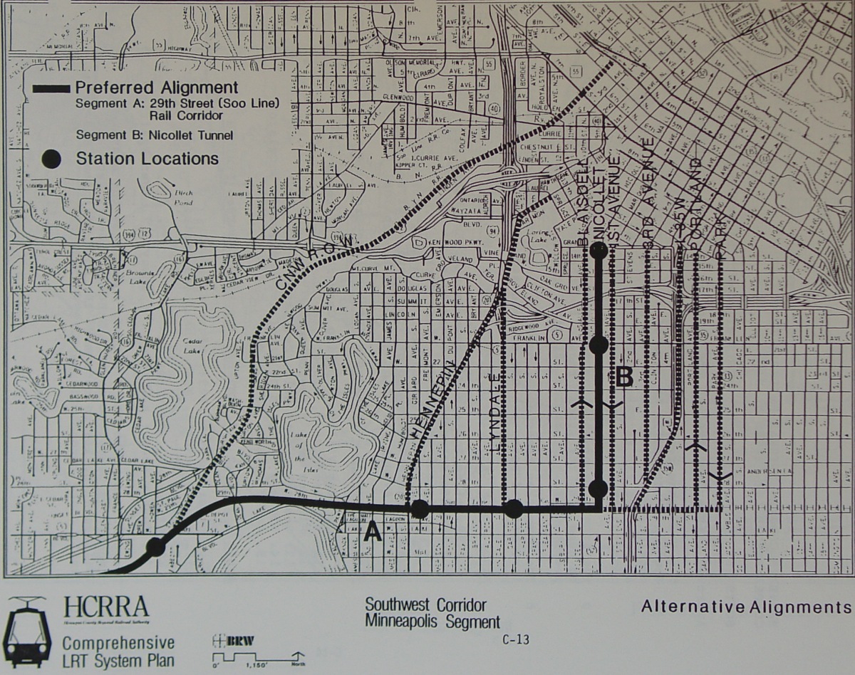
Also from the BRW study, this map shows the alternative alignments, and the then-recommended alignment, for connecting the Southwest line into downtown. Medium-size and large-size images are also available. |
|
|
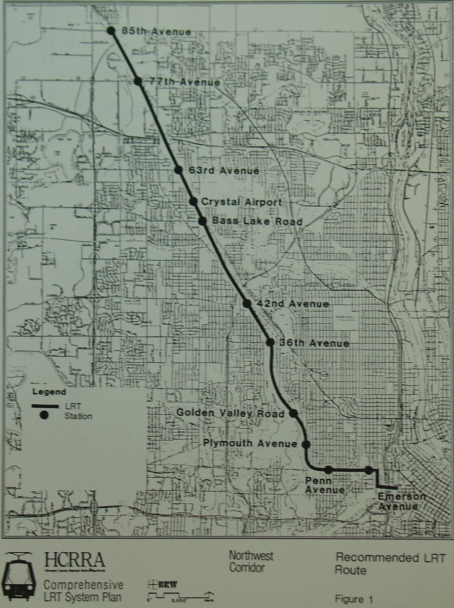
This BRW study map showed the recommended route for the Northwest line. This corridor has since morphed into today's Northwest BRT line project. Medium-size and large-size images are also available. |
|
|
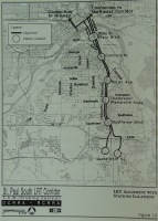
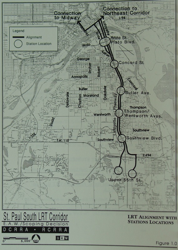
This map comes from the EAW and Scoping Decision document for what was proposed as the St. Paul South LRT corridor, running from downtown St. Paul south into Inver Grove Heights. IIRC, the study dates from the early 1990s. Medium-size and large-size images are also available. |
|
|
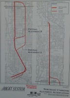
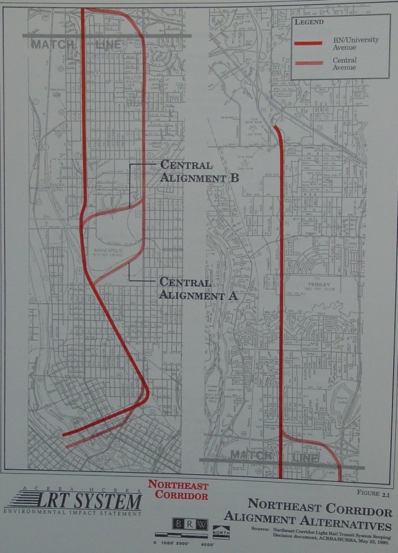
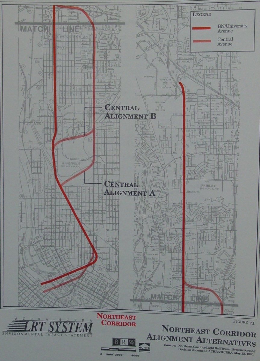
BRW did a separate study for Hennepin and Anoka Counties to plot out the proposed Northeast line. This study, dated 1990, showed alternatives for an LRT line running from downtown to Northtown Mall. Medium-size and large-size images are also available. |
|
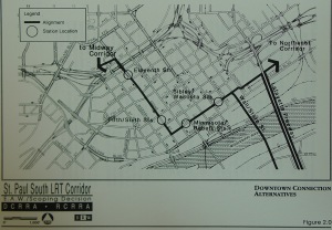
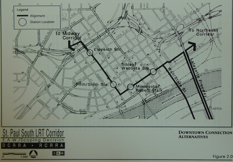
Also from the St. Paul South document, this map showed the alternatives for tying the St. Paul South corridor into downtown St. Paul. Medium-size and large-size images are also available. |
|
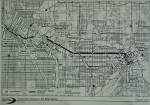
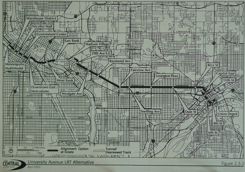
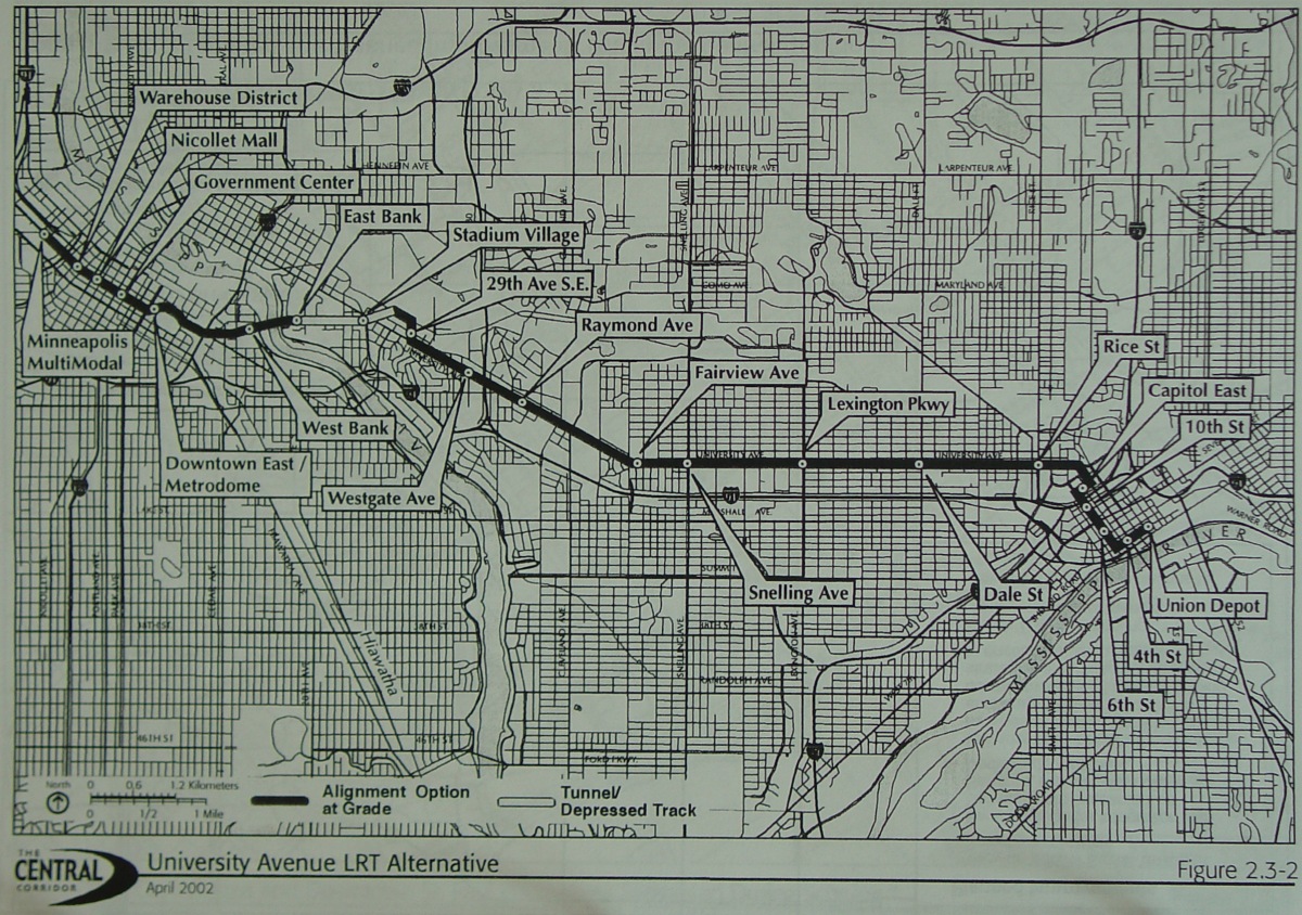
This is the LRT option for the proposed Central corridor connecting downtown Minneapolis and downtown St. Paul along the University Ave corridor. This was the option as it existed in April, 2002. Medium-size and large-size images are also available. |
Back to Froggie's Fantasy Transit System
Back to Froggie's Minnesota Rant
Click here to go to my suggested
freeway/expressway changes.
Click here to see graphics of my ideas for improving Twin Cities area
interchanges.
Return to Twin Cites Highways
![]()
Page last modified 04 February, 2006