Interstate Highway 10 in Mississippi
Skip down to Photographs
|
National Western Terminus: |
At CA 1 in Santa Monica, CA |
|
National Eastern Terminus: |
At I-95 in Jacksonville, FL |
|
National Distance: |
2,460 miles |
|
States Served: |
California, Arizona, New Mexico, Texas, Louisiana, Mississippi, Alabama, Florida |
|
Mississippi Western Terminus: |
LA/MS State Line at the Pearl River, Hancock County |
|
Mississippi Eastern Terminus: |
MS/AL State Line east of Moss Point, Jackson County |
|
Mississippi Distance: |
77.2 miles |
|
Counties Served: |
Hancock, Harrison, Jackson |
|
Cities/Towns Over 5,000 Population: |
Gulfport, Biloxi, D'Iberville, Moss Point, Pascagoula |
|
Highway Duplexes: |
None |
|
Junctions With: |
MS 67, MS 43, MS 603, US 49, MS 605, MS 67, I-110, MS 15, MS 609, MS 57, MS 613, MS 63 |
|
Legislative Names: |
Vietnam Veterans Memorial Highway (LA/MS line to
MS/AL line) Stephen E. Ambrose Memorial Highway (LA/MS Line to MS 43/603) Castiglia Interchange (interchange at US 49) |
|
6+ lane segments: |
From MS 43/603 to Diamondhead/Exit 16 From Beatline Rd/Exit 28 to MS 609 |
|
MDOT's Vision 21 System: |
None |
Average Annual Daily Traffic Volumes (2004)
|
Hancock County: |
35,000 (At Pearl River) |
|
Harrison County: |
37,000 (W of Kiln-DeLisle Rd/Exit 20) 34,000 (E of Kiln-DeLisle Rd/Exit 20) 48,000 (E of Menge Ave/Exit 24) 37,000 (E of Beatline Rd/Exit 28) 45,000 (E of Canal Rd/Exit 31) 62,000 (E of US 49) 57,000 (E of Cowan-Lorraine Rd/Exit 38) 50,000 (E of MS 67) 59,000 (E of Cedar Lake Rd/Exit 44) 57,000 (E of I-110/MS 15) |
|
Jackson County: |
57,000 (W of MS 609) 50,000 (E of MS 609) 49,000 (E of MS 57) 40,000 (E of Gautier-Vancleve Rd/Exit 61) 46,000 (E of MS 613) 39,000 (E of MS 63) 35,000 (E of Franklin Creek Rd/Exit 75) |
Current/Upcoming Projects Listed in the STIP
|
Year: |
Location: | Type of Work: | Funding: |
|
2005 |
I-110/MS 15 to MS 57 | 6-lane widening | $10 million |
|
2006 |
Diamondhead/Exit 16 to Beatline Rd/Exit 28 | PE for 6-lane widening | $20,000 |
Froggie's Notes:
- I-10 is the primary
east-west Interstate across the southern U.S. Within Mississippi, the
route was generally built about 5-10 miles inland, both because of existing
development along the coast and to facilitate hurricane evacuation along a route
that would be less likely to flood over due to its inland nature vice a more
coastal routing. This feature became evident during Hurricane Katrina,
where most of the post-hurricane problems along I-10 simply involved debris
removal.
- At its closest point (just west of I-110), I-10 is still 4 miles away from the
beach.
- Although I-10 was planned in the late 50s-early 60s, construction of it was slow compared to the other Mississippi
Interstates. The first section to open wasn't until 1966,
and that was a paltry 2 miles from Exit 75 east into Alabama.
There are many swamps and bayous along the coast, and the
environmental sensitivity associated with them is what hindered
construction. The last section near Pascagoula wasn't
complete until the early 1980s.
- The route carries a considerable amount of traffic, both regular and truck
traffic. Because of this, various business and commerce proposals have
called for expanding I-10. Combined with traffic increases as a result of
opening casinos along the Mississippi Gulf Coast, the Mississippi Legislature
authorized parts of I-10 to be included in the Gaming Roads Program. This
program has resulted in the 6-laning of I-10 between Beatline Rd (Exit 28) and
I-110/MS 15, as well as the planned widening east to MS 57.
- Although not part of the Gaming Roads Program, the segment between MS 43/603
and Diamondhead was recently widened to 6 lanes. The main driving force
behind this widening was the need to replace the bridge across the Jourdan
River.
Froggie Suggests:
- Provide a minimum of 6
lanes through the state of Mississippi.
- Widen to 8 lanes between US 49 and I-110/MS 15.
- Auxiliary lanes between the interchanges at MS 613 and MS 63.
- Interchange improvements and ramp additions as needed.
2004 Aerial Photos
All aerial photos are pulled from aerial imagery provided by the National Agriculture Imagery Program, via the Mississippi Automated Resource Information System.
|
|
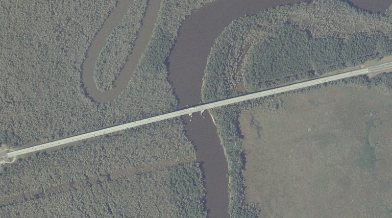
I-10 crossing the Pearl River, where the Louisiana/Mississippi state line is located in this area. |
|
|
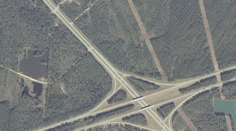
I-10's interchange at MS 607 is in the bottom center of this image. |
|
|
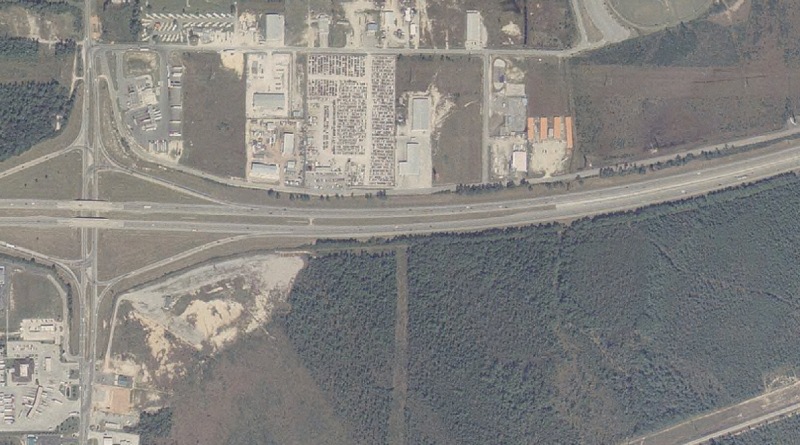
Just east of the I-10/Canal Rd (Exit 31) interchange. This is the general area where MDOT wants to build a freeway-to-freeway interchange as part of a project to build a freeway connector between I-10 and the Port of Gulfport. The proposed connector is officially listed as Future MS 601, although some recent planning documents have also referred to it as I-310. |
|
|
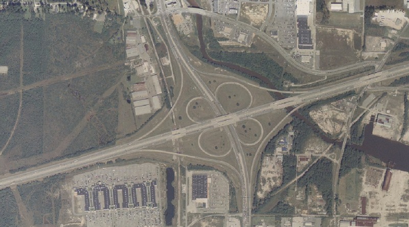
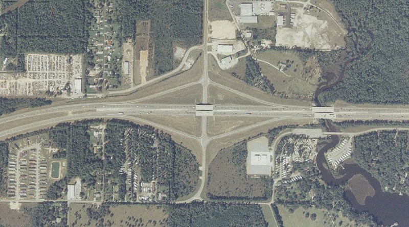
The I-10/US 49 interchange in Gulfport. I-10 runs left-to-right, US 49 runs bottom-to-top. There are traffic signals on US 49 at the bottom (Creosote Rd) and top (Landon Rd) of this image that are major bottlenecks along US 49. |
|
|
The I-10/MS 67 interchange, technically located in Biloxi (yes, Biloxi's city limits extend north of I-10 in some places). Two changes here in the future...first, MS 67 will be relocated onto a new-alignment 4-lane highway with a new southern terminus at MS 15, about a mile north of the I-10/I-110 interchange. Second, when/if MDOT gets their proposed "East Harrison County Connector" built, this interchange here will morph into a combination diamond and freeway-to-freeway interchange, with the connector running to the south. |
|
|
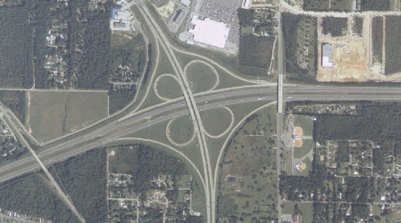
The I-10/I-110/MS 15 interchange in D'Iberville. I-10 runs left-right, I-110 runs south from I-10, while MS 15 runs bottom-to-top through the interchange. A westbound C/D road keeps traffic on the heavy NB-to-WB loop from weaving on the westbound mainline. |
|
|
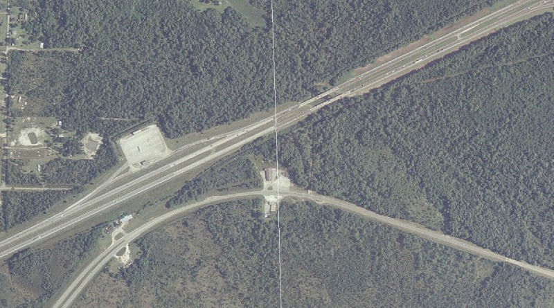
I-10 (and US 90 just to the south) at the Mississippi/Alabama state line. The thin white line running from top-to-bottom marks the state line. Notice the small clearing, located between I-10 and US 90 opposite the westbound weigh station. Prior to I-10's completion in Mississippi, that clearing was the location of a connection between the 4-lane US 90 in Mississippi and I-10 in Alabama. |
Eastern Terminus Photos
|
|
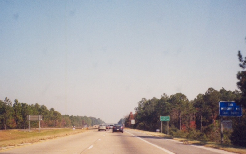
Eastbound I-10 heading into Alabama. Photo by Adam Froehlig, taken in November, 2001. |
|
|
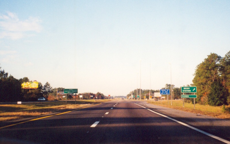
Same general location, looking westbound back into Mississippi. Photo by Adam Froehlig, taken in November, 2001. |
Western Terminus Photos
|
|
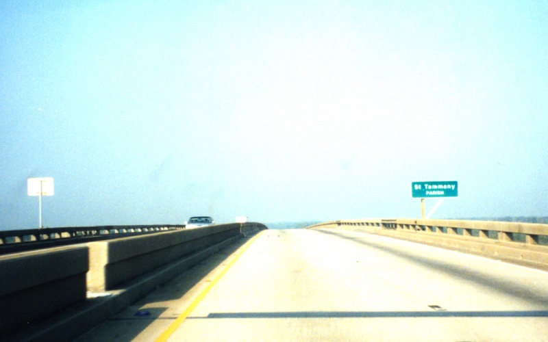
Westbound at the top of the Pearl River Bridge, crossing into Louisiana. Photo by Adam Froehlig, taken in 2001. |
|
|
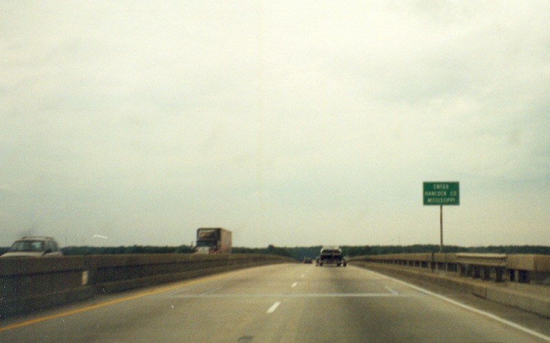
Going eastbound now, back into Mississippi. Photo by Adam Froehlig, taken in 2001. |
Other Photos
No photographs available.
Back to Top
Back to Mississippi Highways
Back to Highway Pictures
Back to Highways Page
Back to Main Page
Last Updated: January 15, 2006
(C) 2006-2005, Adam Froehlig