Hidden Mississippi Highway
923
|
Southern Terminus:
|
At the Louisiana/Mississippi state line west of
Osyka, Amite/Pike Counties |
|
Northern Terminus: |
At MS 584 west of Osyka, Amite County |
|
Distance: |
2.385 miles |
|
Counties Served: |
Amite, Pike |
|
Cities/Towns Over 5,000
Population: |
none |
Average Annual Daily Traffic Ranges
(2004)
|
Amite County: |
130 (near the state line) |
Froggie's Notes:
- This route follows
what's locally known as Line Creek Rd, and is actually the second MS 923 that
has existed. The previous MS 923 is now MS 571.
- One interesting bit is that the route appears to be following the Amite/Pike
County line for it's southernmost 1/4 mile or so before ending at the state
line.
Froggie Suggests:
- Decommission it and
turn it back to the county.
Photographs:
2004 Aerial Photos
All aerial photos are pulled from aerial imagery provided
by the National Agriculture Imagery Program, via the Mississippi Automated
Resource Information System.
|
 |
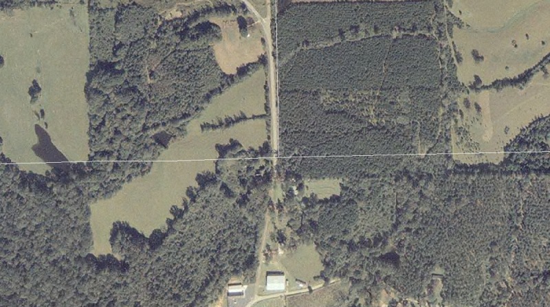
The southern end of MS 923 at the
Louisiana/Mississippi state line, delineated roughly by the white
line running left-to-right (it's slightly offset to the north of the
real border). The white line running north from the state line
is the Amite/Pike County line. |
|
 |
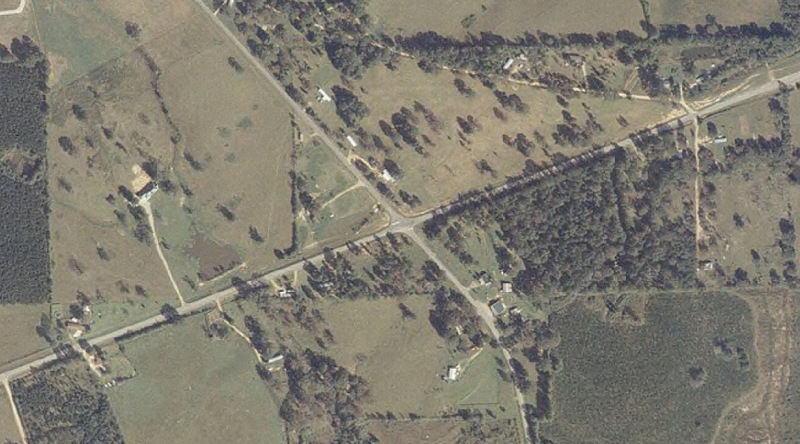
This image shows the northern terminus at MS 584. |
Other Photos
No photographs available.
Back to Mississippi Highways
Back to Highway Pictures
Back to Highways Page
Back to Main Page
Last Updated: February 10, 2006
(C) 2006, Adam Froehlig