Hidden Mississippi Highway 938
|
Western Terminus: |
At the northwest corner of the new MDOT District 7 Office site near McComb, Pike County |
|
Eastern Terminus: |
At US 51, 0.45 mile north of the old McComb north city line, Pike County |
|
Distance: |
0.75 miles |
|
Counties Served: |
Pike |
|
Cities/Towns Over 5,000 Population: |
McComb |
Average Annual Daily Traffic Ranges (2004)
|
Pike County: |
Not Available |
Froggie's Notes:
- It is almost impossible
to determine the location of this route from the maps. The description,
according to the 2004 Selected Statistics book, suggests that it follows George
Edwards Rd (formerly known as Summit Ave) west from US 51, about halfway between
the McComb and Summit city limits. Without knowing exactly where the MDOT
District 7 Offices are, it's impossible to know for sure.
- Furthermore, the 2000 and 2004 books are contradictory as to whether the road
is state maintained or locally maintained, with the 2004 book saying the latter.
Both books put the length at 3/4 mile, but this is hard to believe since there's
only half that distance between US 51 and the edge of I-55.
Froggie Suggests:
- Just keep it hidden.
Photographs:
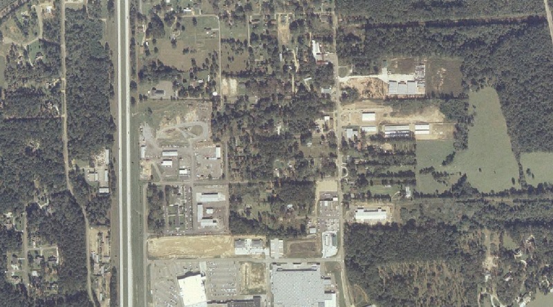
2004 Aerial Photos
All aerial photos are pulled from aerial imagery provided by the National Agriculture Imagery Program, via the Mississippi Automated Resource Information System.
|
|
This aerial image is my "best guess" as to where MDOT District 7 is located, and conversely MS 938. The north-south freeway is I-55, while US 51 runs north-south through the middle of the image. |
Other Photos
No photographs available.
Back to Mississippi Highways
Back to Highway Pictures
Back to Highways Page
Back to Main Page
Last Updated: February 9, 2006
(C) 2006, Adam Froehlig