![]()
Interstate 35 in Minnesota
|
Southern Terminus |
Northern Terminus |
|
|
Southern Segment (I) |
IA/MN State Line south of Albert Lea, MN |
|
|
Northern Segment (II) |
At MN 61 in Duluth, MN |
|
|
Nationally |
At US 83/BUS I-35/TX 359 in Laredo, TX |
At MN 61 in Duluth, MN |
This page documents photos from various locations along I-35 through Minnesota, including terminus photos.
Go to Northbound Photos
Go to Southbound Photos
Terminus Photos
Southern Terminus (I)
|
|
Minnesota's granite "Thanks for Visiting" sign, along southbound I-35. The Minnesota/Iowa line follows the road on the bridge. Photo by Jeff Morrison, taken May 19, 2004. |
Northern Terminus (I)
|
|
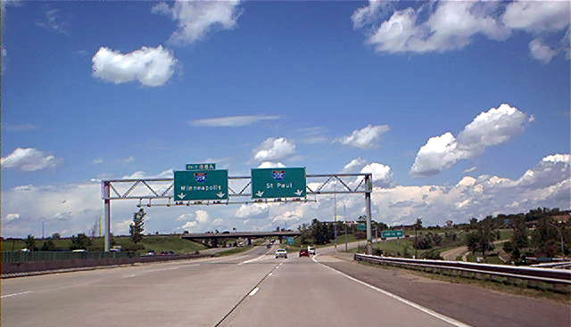
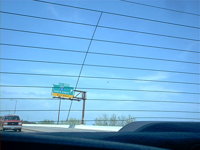
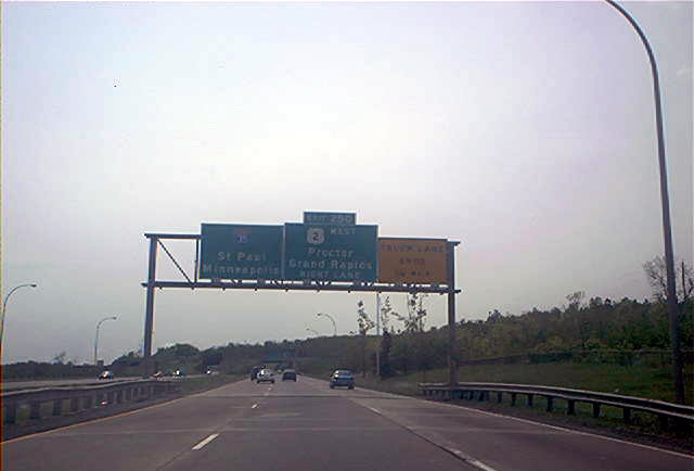
Overhead guide signs at the southern I-35E/I-35W split. Photo by Don Greiskalns. |
Southern Terminus (II)
|
|
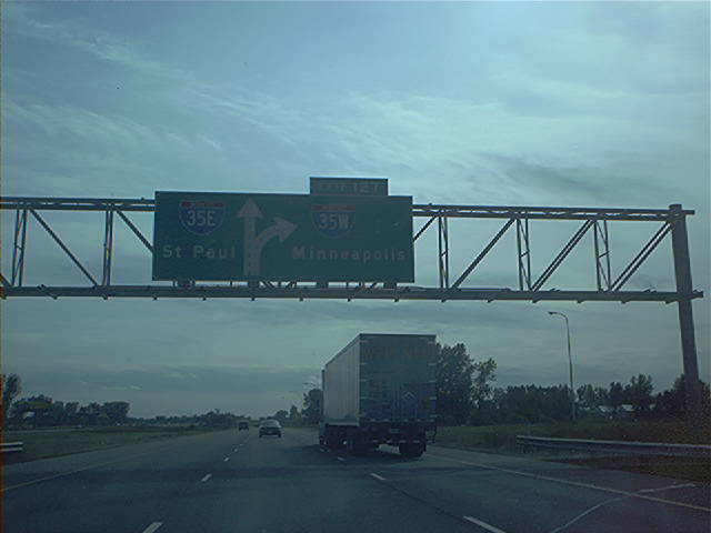
Overhead diagrammatic guide sign approaching the I-35E/I-35W split on southbound I-35. Photo by Don Greiskalns. |
|
|
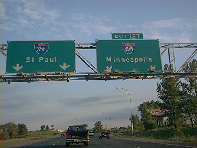
Overhead guide signs at the I-35E/I-35W split on southbound I-35. Photo by Don Greiskalns. |
Northern Terminus (II)
|
|
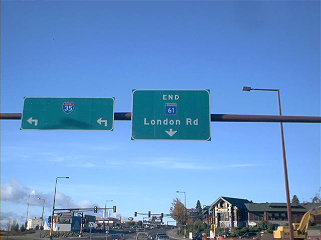
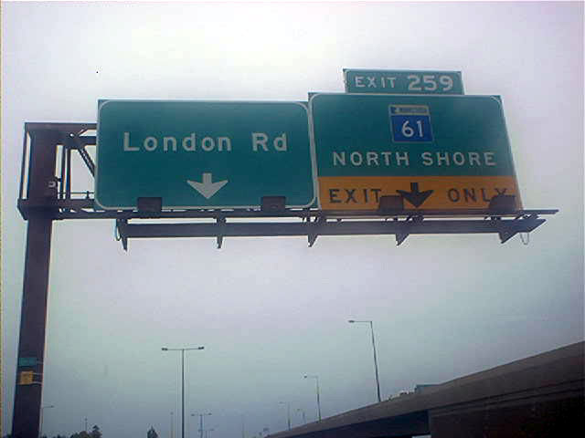
End MN 61 overhead at the same intersection where southbound I-35 begins. Photo by Don Greiskalns. |
|
|
Odd photo through the back window of a car. This guide sign is for the actual exit from northbound I-35 to northbound MN 61 at the terminus. Photo by Don Greiskalns. |
|
|
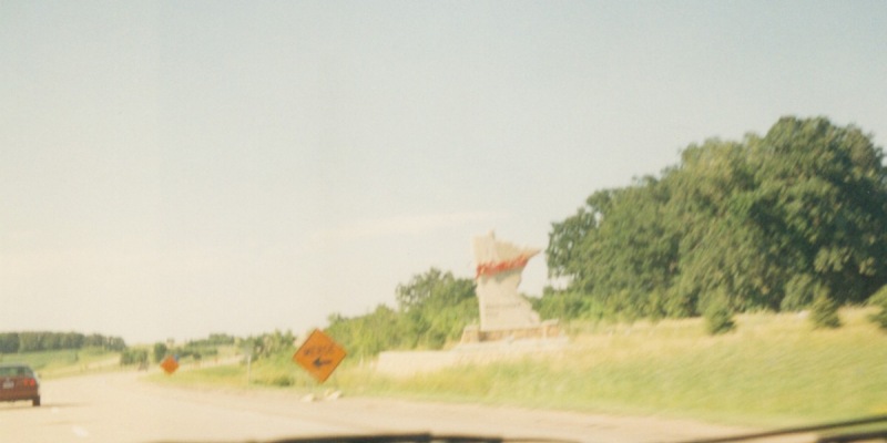
Blurry view of the Minnesota Welcome "sign" (which is really a large slab of granite), just north of the Iowa line. Photo by Adam Froehlig, taken in 1999. |
|
|
Brand new pavement along northbound I-35 at Exit 8 (US 65) near Albert Lea. Photo by Adam Froehlig, taken April 22, 2003. |
|
|
Northbound at Exit 11. Prior to construction of I-90, CSAH 46 used to be US 16. Photo by Adam Froehlig, taken April 22, 2003. |
|
|
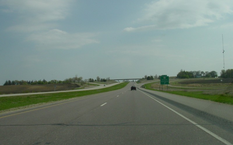
The on-ramp from US 65 forms an auxiliary lane approaching the I-90 interchange. Photo by Adam Froehlig, taken April 22, 2003. |
|
|
This image, from several years ago in Freeborn County, shows the standard way MnDOT handles traffic control when they reconstruct segments of rural Interstate. Due in part to the state's cold northern climate, in order to get a given segment rebuilt within one construction season, MnDOT will shut down that segment and move all traffic to the other carriageway, using yellow reflectors, several "No Passing Zone" signs, and a 55 MPH speed limit to handle 2-way traffic. Photo by Adam Froehlig, taken in 1999. |
|
|
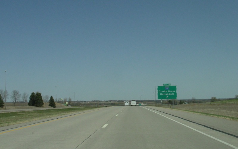
Northbound at Exit 18, where MN 251 begins. Photo by Adam Froehlig, taken April 22, 2003. |
|
|
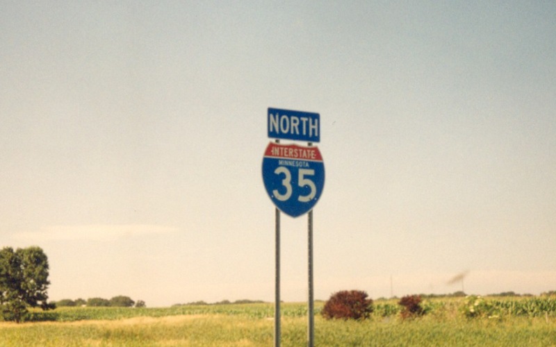
From somewhere in Steele County comes a northbound reassurance shield that includes the state name. Photo by Adam Froehlig, taken in 1999. |
|
|
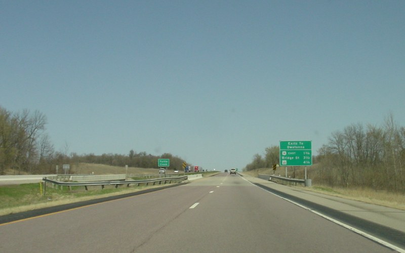
This is Minnesota's version of a "Town Next 3 Exits" sign, where they will include the intersecting routes (or streets) and the mileages to them. Photo by Adam Froehlig, taken April 22, 2003. |
|
|
Northbound at Exit 40, where US 218 ends and an I-35/US 14 duplex starts. Photo by Adam Froehlig, taken April 22, 2003. |
|
|
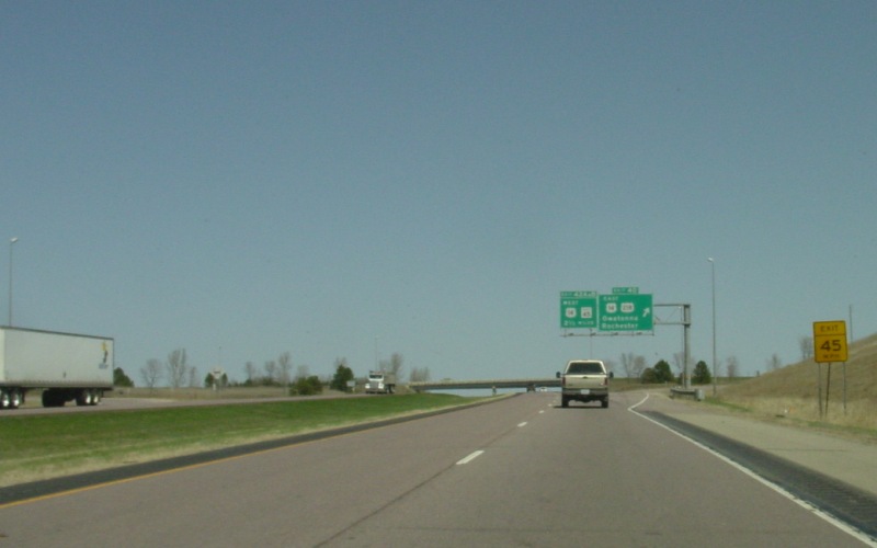
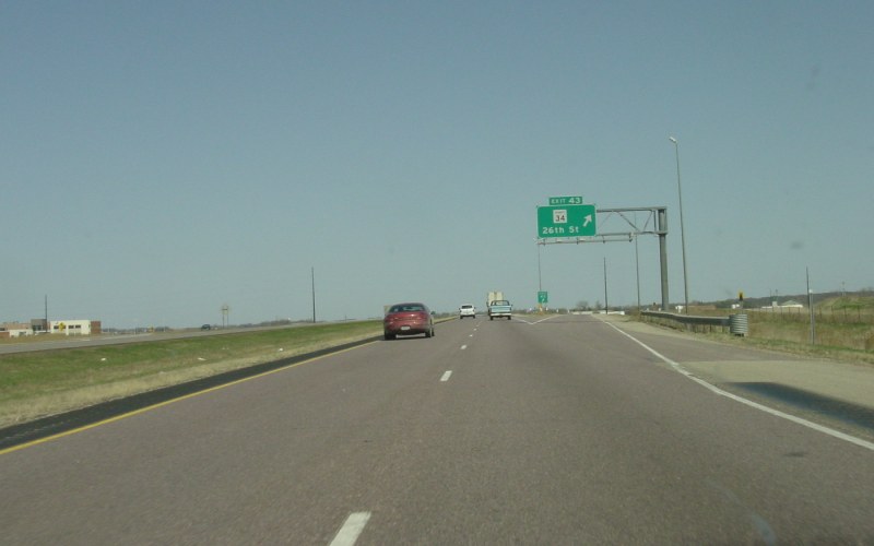
The last of the northbound Owatonna exits is at Exit 43, Steele CSAH 34, which also serves the Owatonna Airport. Photo by Adam Froehlig, taken April 22, 2003. |
|
|
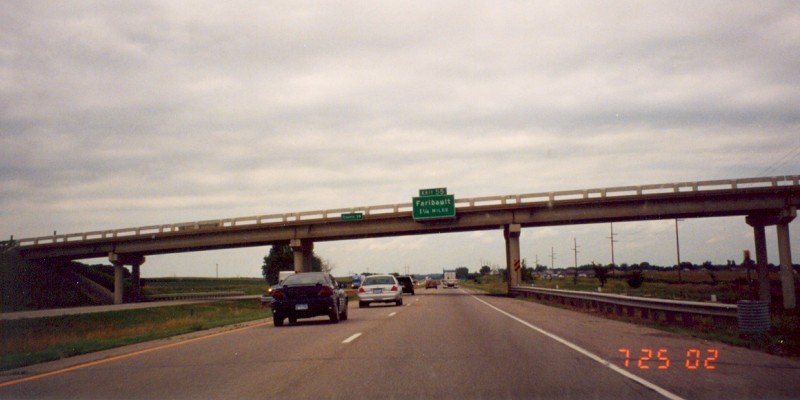
Northbound guide signage for Exit 55. This is one of the few rare instances in Minnesota where interchange guide signage only lists a control city and not a corresponding highway route or street name. Photo by Adam Froehlig, taken July 25, 2002. |
|
|
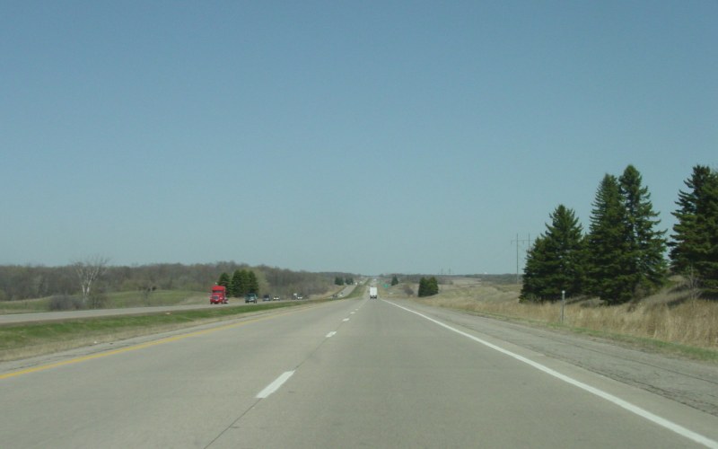
This wide open expanse with occasional hills and trees is typical of much of southern Minnesota. This view is south of Rice CSAH 1, roughly near milepost 64. Photo by Adam Froehlig, taken April 22, 2003. |
|
|
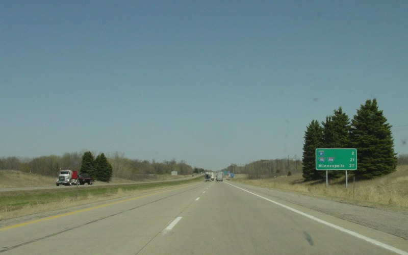
A typical MnDOT 3-destination distance sign. MnDOT often uses route shields on their distance signs, and on the Interstates usually posts the next exit, an intermediate control city (or in this case the 35E/35W split), and the next major control city. In the background is the Heath Creek Rest Area. Photo by Adam Froehlig, taken April 22, 2003. |
|
|
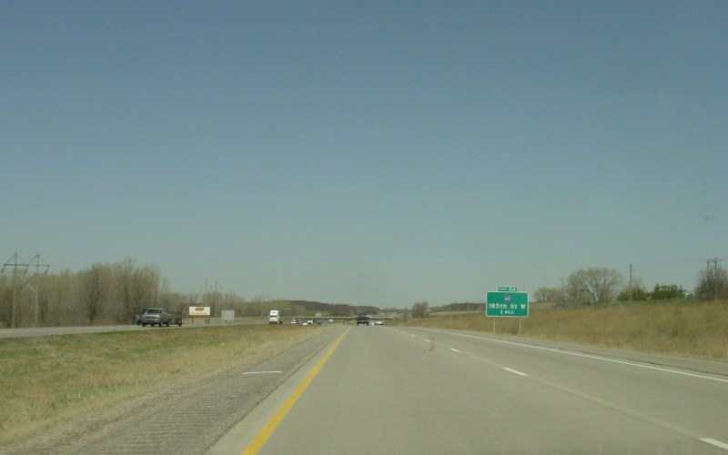
Previously a half-diamond to/from the north, the interchange at Dakota CSAH 60/185th St W was recently reconstructed into a full interchange. Photo by Adam Froehlig, taken April 22, 2003. |
|
|
Northbound at Exit 84. This interchange is more or less the start of the Twin Cities metro area. Photo by Adam Froehlig, taken April 22, 2003. |
|
|
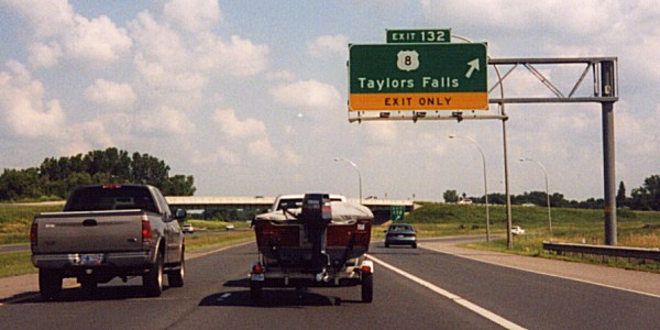
Northbound at Exit 132. US 8 leads off towards the Chisago Lakes area and Wisconsin. Photo by Monte Castleman. |
|
|
3 miles north of US 8's national western terminus is thus blurred photo of US 61's national northern terminus. Interchange reconstruction was underway at the time. Photo by Adam Froehlig. |
|
|
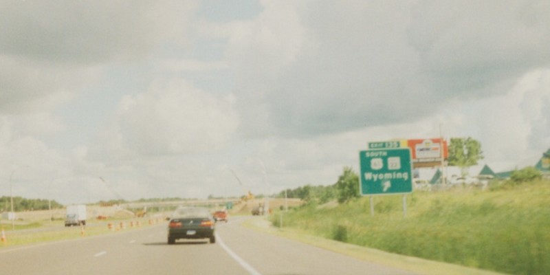
Northbound at Exit 159. MN 361 is a primarily local-access route that partially follows US 61's old routing. The route is a turnback candidate. Photo by Don Greiskalns. |
|
|
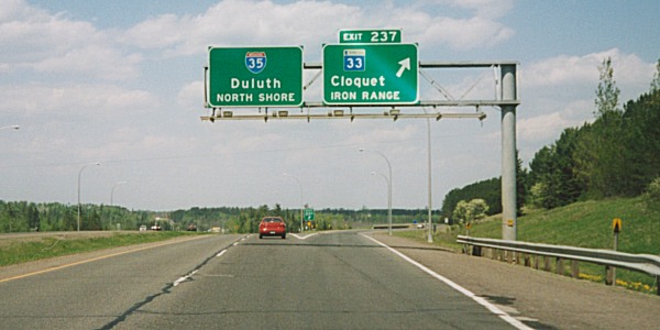
Overhead exit signage at Exit 237. MN 33 serves as a shortcut between I-35 towards the Twin Cities and US 53 towards Virginia and International Falls. Photo by Monte Castleman, taken June, 2002. |
|
|
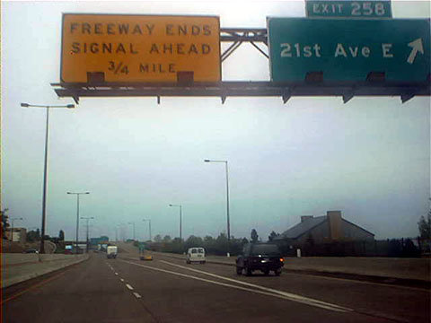
At the last exit before the terminus. This was the last segment of I-35 to open in the U.S., completed in the early 1990s. Photographer unknown. |
|
|
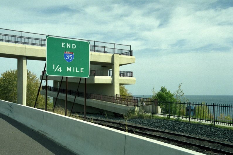
Advance ending signage approaching the north end at MN 61 in Duluth. Photo by Jeff Royston, taken October, 2001. |
|
|
One of the last guide signs on northbound I-35 before the terminus. Photo by Don Greiskalns. |
|
|
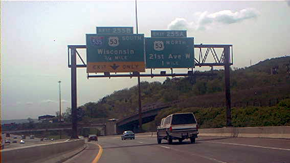
Guide signage approaching Exit 255B/A at I-535/US 53. US 53 duplexes with I-535 southward into Superior, Wisconsin. Photo by Don Greiskalns. |
|
|
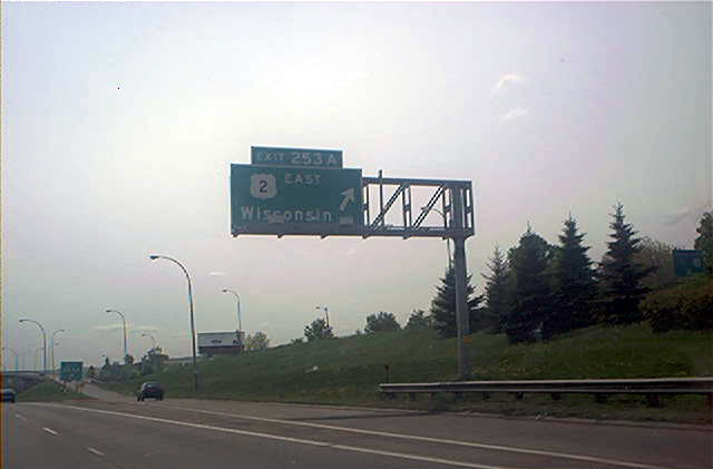
Southbound exit to US 2 East, which crosses the Bong Bridge into Superior, WI. Photo by Don Greiskalns. |
|
|
On the I-35/US 2 duplex, approaching the southern split of the two highways. Photo by Don Greiskalns. |
|
|
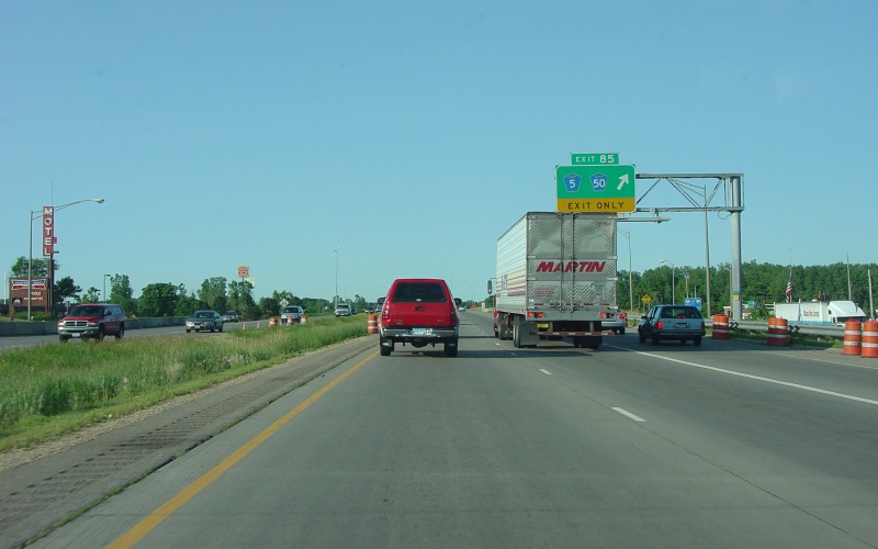
Southbound at Exit 85. MN 50 terminated here prior to 1994. Photo by Adam Froehlig, taken June 28, 2004. |
|
|
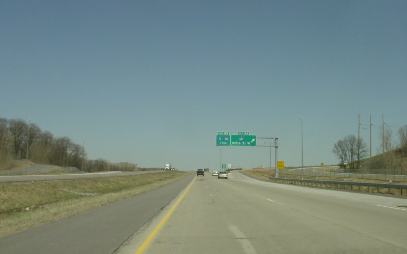
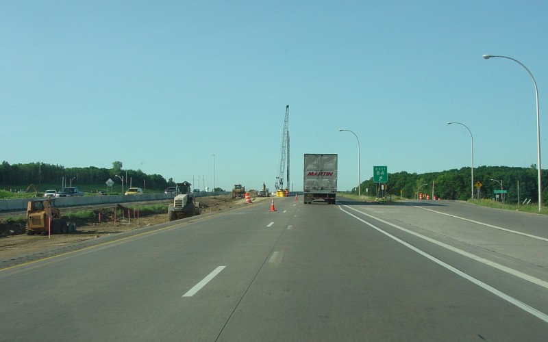
One mile down is Exit 84, which until about late 2004 was just a half-diamond to/from the north, but in a construction project related to the bridge replacement shown here was converted into a 5-ramp partial-cloverleaf with an EB-to-NB loop. Photo by Adam Froehlig, taken June 28, 2004. |
|
|
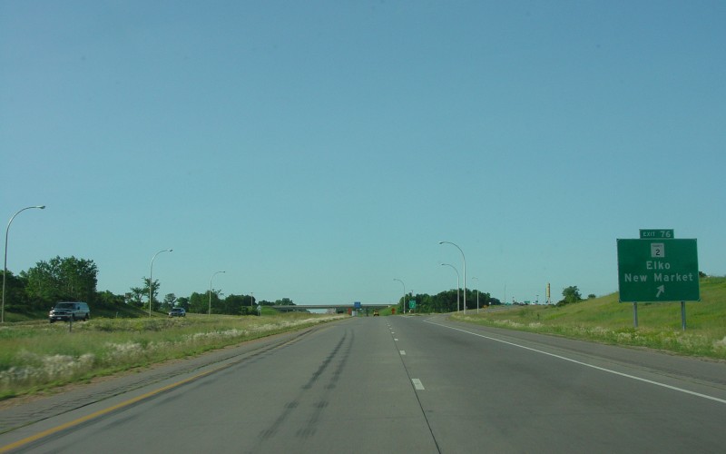
Exit 76, at Scott CSAH 2, was for four decades just a rural diamond interchange. Recently, explosive growth has turned Elko and New Market into exurbs of the Twin Cities metro, and traffic has grown to the point where CSAH 2 has been 4-laned for a few miles west of the interchange and interchange improvements are being considered. Photo by Adam Froehlig, taken June 28, 2004. |
|
|
Southbound at the Rice CSAH 9 overpass, a little south of Milemarker 63. Besides being at the south end of a wide-median section of I-35 (which is rare in Minnesota), this location is of note because Rice County wants to put an interchange here. Photo by Adam Froehlig, taken June 28, 2004. |
|
|
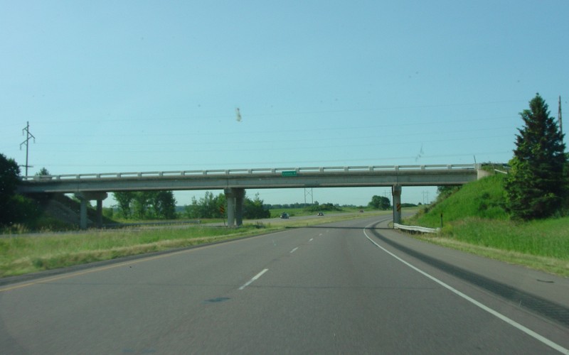
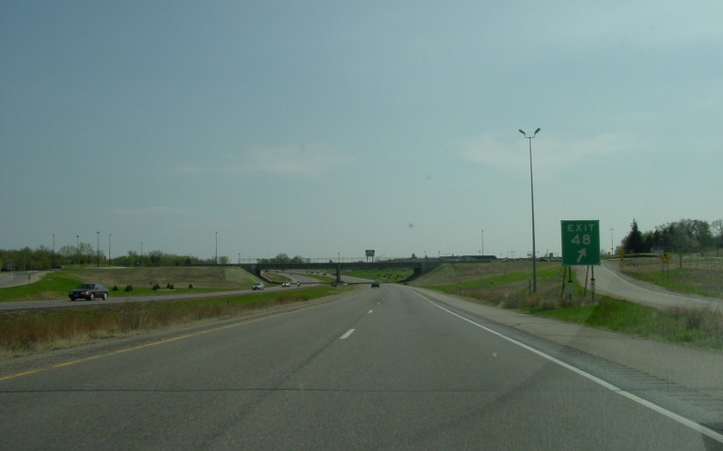
MnDOT recently constructed roundabouts at the ramp terminals at Exit 48 (Steele CSAH 12/23), near the Medford Outlet Center. Photo by Adam Froehlig, taken May 3, 2003. |
|
|
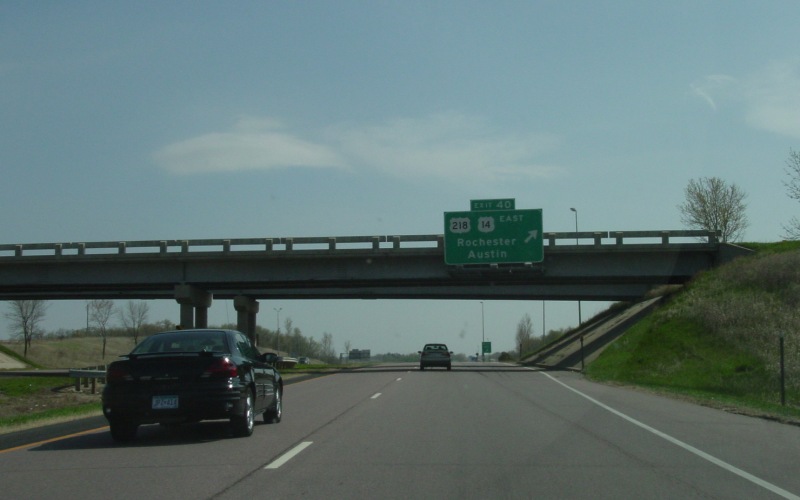
Southbound at Exit 40, where US 14 splits east towards Rochester and US 218 begins. Photo by Adam Froehlig, taken May 3, 2003. |
|
|
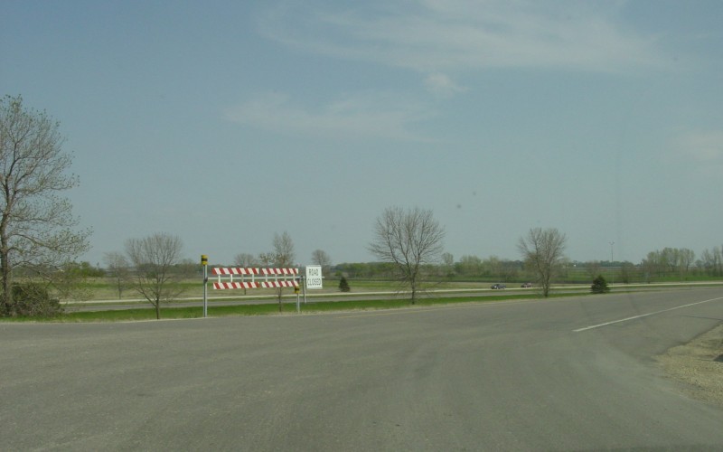
This closure gate is located at the southbound on-ramp from MN 30, and is one of several on I-35 in southern Minnesota. The reason behind having the gate is to help in closing the Interstate in the event of a major winter storm. Photo by Adam Froehlig, taken May 3, 2003. |
|
|
Freeborn CSAH 35 (generally called 'County 35' so as not to be confused with I-35) is at Exit 22. This interchange has family history with me as it was the exit to get to my grandparents in Hartland. Photo by Adam Froehlig, taken May 3, 2003. |
|
|
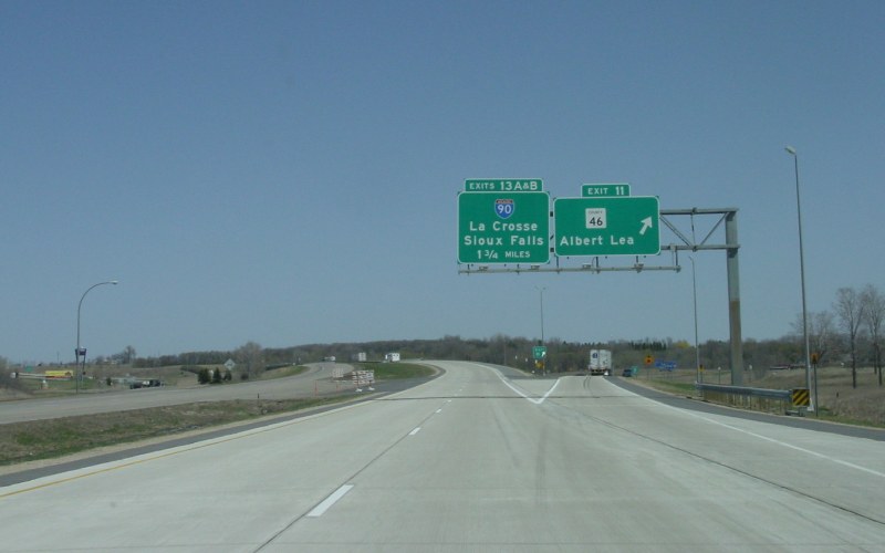
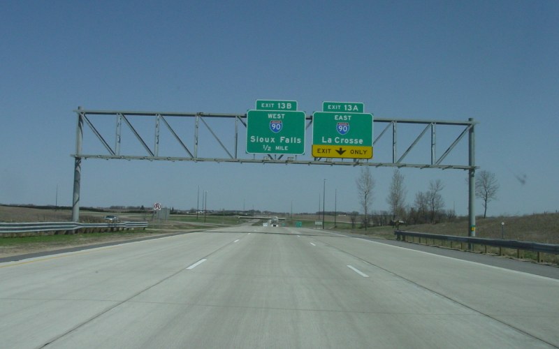
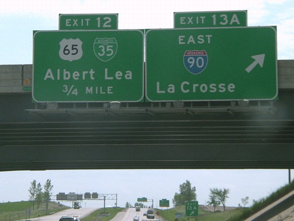
Overhead signs at the loop to eastbound I-90. The US 65 half-interchange (and the national northern terminus of US 65) is in the far background. Photo by Jeff Morrison, taken May 19, 2004. |
|
|
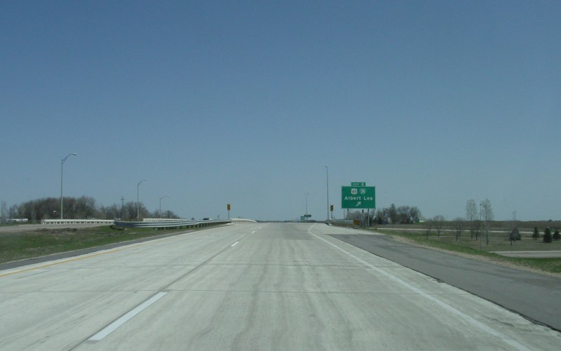
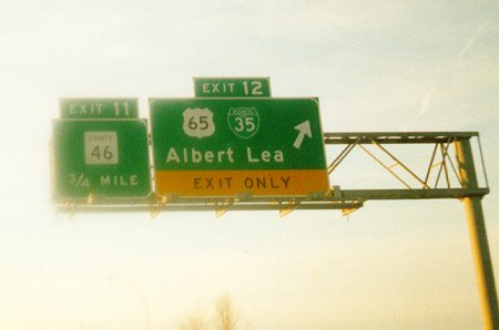
Southbound at Exit 12, where US 65 begins and leads into downtown Albert Lea. Photo by Adam Froehlig, taken December, 1998. |
|
|
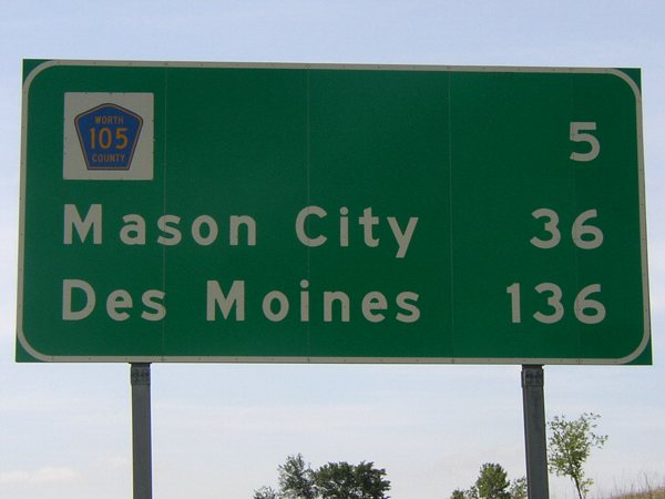
A close-up of the last distance sign along southbound I-35 before the Iowa line. The CR 105 shield used to be a state IA 105 shield before IA 105 was decommissioned. Photo by Jeff Morrison, taken May 19, 2004. |
I-35 at Interstate Guide
Go to MN Highway Endings
Go to Minnesota Photography
Go to Highway Photography
![]()
Page last modified 12 April, 2008
(C) 2006-2003 Adam Froehlig