Interstate 35W in Minnesota
|
Southern Terminus |
Northern Terminus |
| I-35/I-35E Junction in Burnsville, MN | I-35/I-35E Junction near Lino Lakes, MN |
This page documents photos from various locations along I-35W through the Twin Cities metro area, including terminus photos.
Photos of the I-35W Mississippi River bridge collapse are on this page.
Terminus Photos
|
|
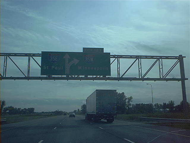
Overhead guide signage at the southern I-35E/I-35W split. Note that the exit number is for I-35W, as I-35's milemarkers and exit numbers are continued along I-35E. Photo by Don Greiskalns. |
|
|
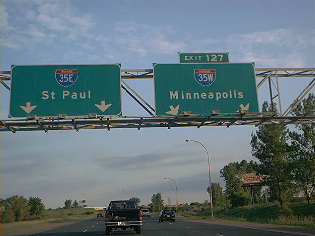
Overhead diagrammatic guide sign approaching the northern I-35E/I-35W split on southbound I-35. Photo by Don Greiskalns. |
|
|
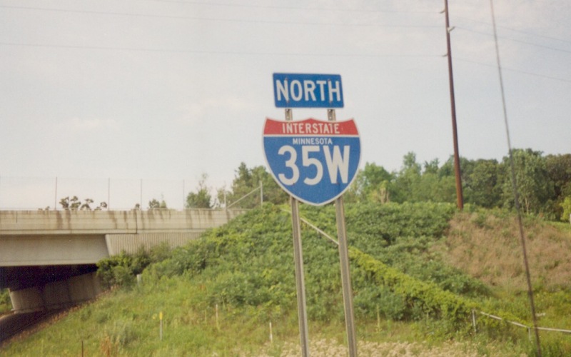
Overhead guide sign at the northern split itself. Photo by Don Greiskalns. |
Northbound Photos
 | A northbound reassurance shield which includes the state name. The Dakota CSAH 38/McAndrews Rd overpass is in the left background. Photo by Adam Froehlig, taken in 1999. |
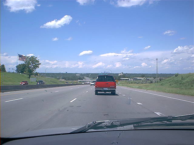 | This photo looks from Burnsville across the Minnesota River into Bloomington. If you look off in the far distance, you can see downtown Minneapolis. This photo is about 1/8th of a mile behind the next photo below...the bridge in the background (left of the red SUV) is MN 13. Photo by Don Greiskalns. |
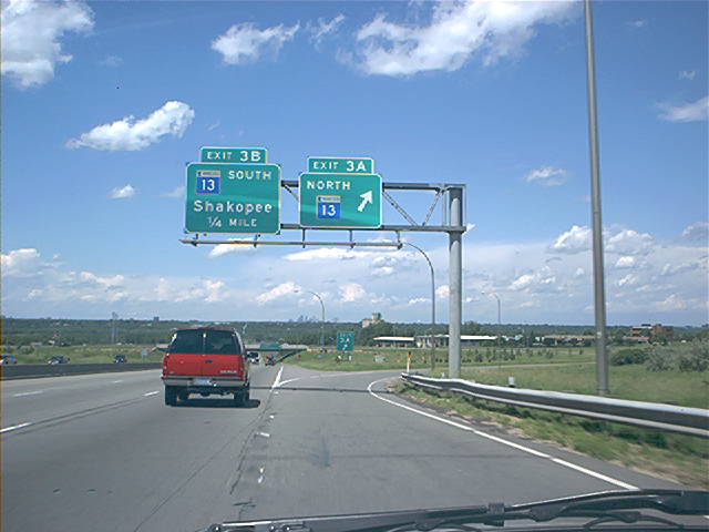 | At the MN 13 North exit. The I-35W/MN 13 interchange is a cloverleaf, one of several within the Twin Cities metro. Photo by Don Greiskalns. |
 | Northbound on the reconstructed segment between 76th St and 66th St. The unused sign support here was going to be used for a distance sign for the next three exits, based on what was at the time the plan for reconstructing the I-35W/MN 62 "Crosstown Commons". The Minnesota Legislature put that plan on hold in 2001 and ordered MnDOT to redesign the Commons to provide for additional capacity. That project is now expected to begin in 2006. Photo by Adam Froehlig, taken June 21, 2004. |
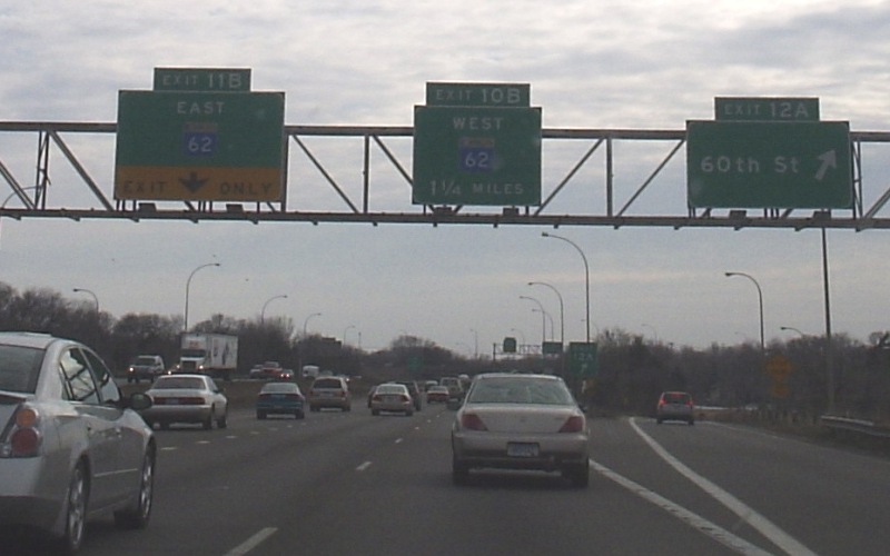
 | The exit to now-unsigned-MN 121 is also used to access westbound MN 62 and Lyndale Ave. This is one of several left exits in the Twin Cities metro, a practice now discouraged by Federal highway officials. Photo by Adam Froehlig, taken June 21, 2004. |
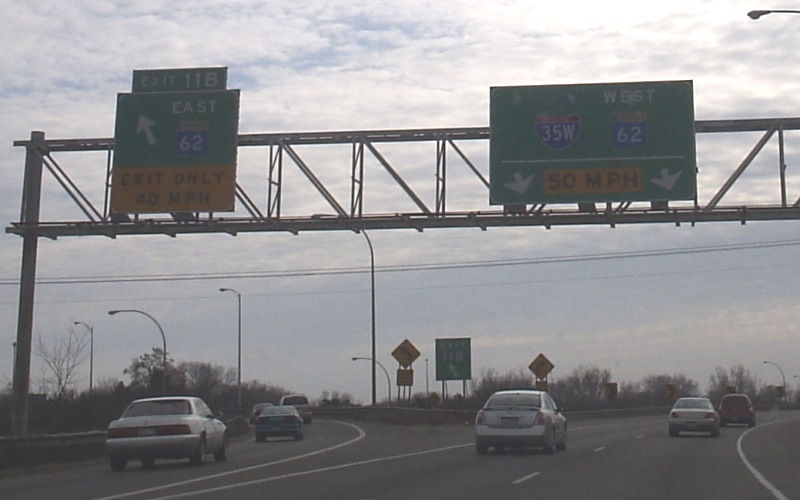
 | Northbound at the eastern end of the "Crosstown Commons", where MN 62 splits off to continue east. Photo by Don Greiskalns, taken March 3, 2006. |
 | Advance guide signage for the Diamond Lake Rd exit. The underpass at 60th St is just ahead of the signage. Given the distance involved, the "1/2 mile" in the sign really should be "1/3 mile" instead. Photo by Don Greiskalns, taken March 4, 2006. |
 | Northbound exit to Diamond Lake Rd in south Minneapolis. This segment of I-35W is extremely congested, with almost 180,000 vehicles a day traveling on only 6 lanes. The Crosstown Commons project mentioned above will provide 2 additional lanes (1 general/1 HOV) per direction up to 46th St. Photo by Adam Froehlig, taken June 21, 2004. |
 | Northbound exit to 46th St, which at one point was the decommissioned MN 190. This will be the northern endpoint for the above-mentioned Crosstown Commons project. Photo by Adam Froehlig, taken June 21, 2004. |
 | In early 2004, MnDOT began installed 1/10th milemarkers around the Twin Cities area, including this one in the I-35W median. Photo by Adam Froehlig, taken June 21, 2004. |
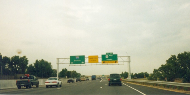
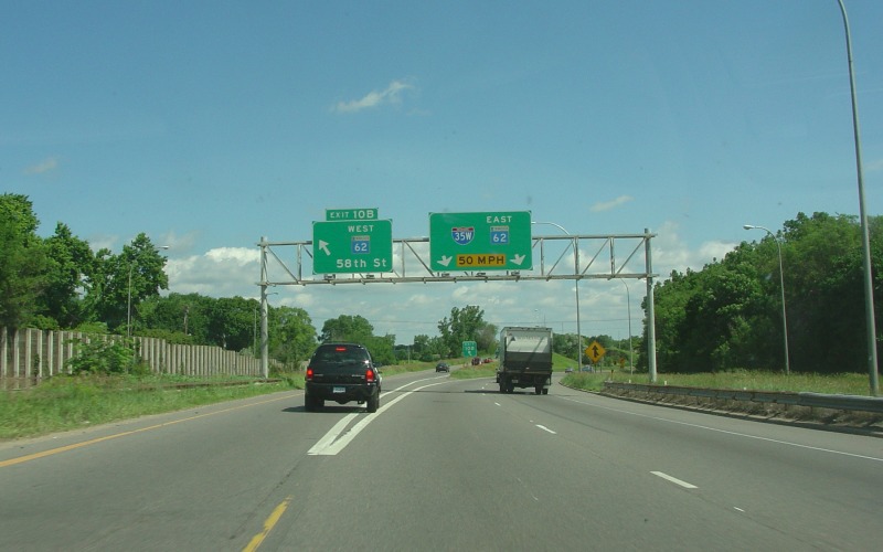
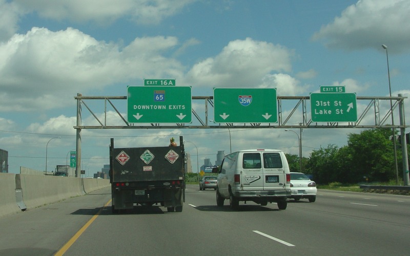 | Northbound exit to 31st and Lake Sts, with advance signage for the I-35W/MN 65 split near downtown. Photo by Adam Froehlig, taken June 21, 2004. |
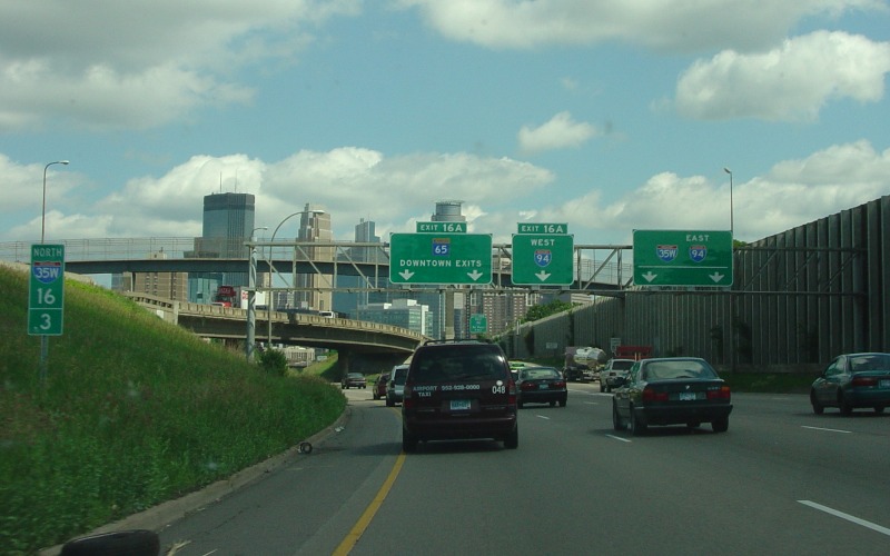 | At the northbound I-35W/MN 65 split. MN 65 is used to access I-94 West and downtown from northbound I-35W. Photo by Adam Froehlig, taken June 21, 2004. |
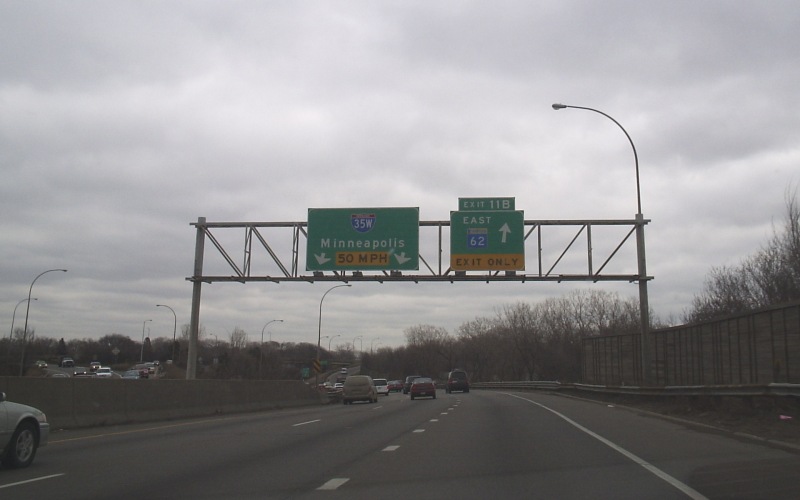
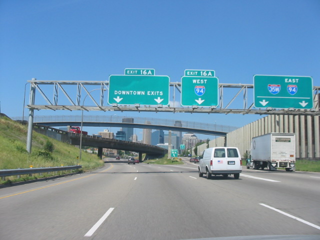 | About a year later, the MN 65 shield was removed, as MN 65 was eliminated through downtown Minneapolis in 2005. The freeway stub from I-35W to 10th St is still officially part of MN 65, but as the lack of signage indicates it is now a hidden route segment. Photo by Glenn Olson, taken in July, 2005. |
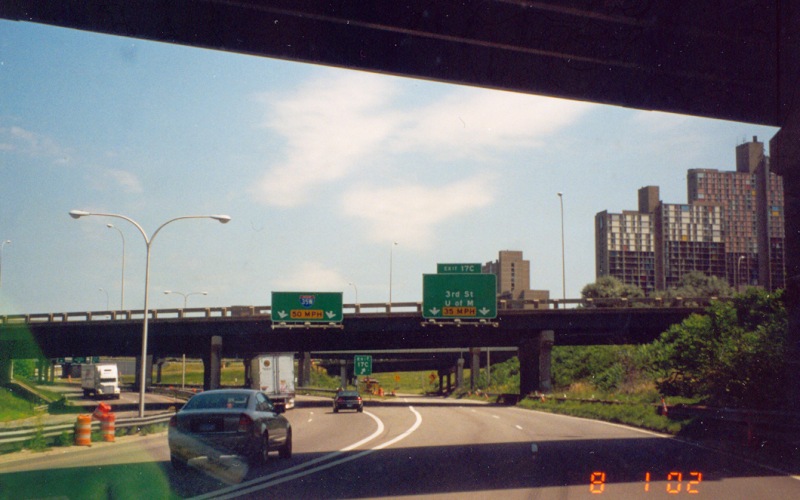 | When first built, US 12 was signed at this exit. Around 1988, US 12 was moved and the route at this exit became MN 122, which was conversely decommissioned in the late 1990s. This exit provides access to the east side of downtown and the University of Minnesota. Photo by Adam Froehlig, taken August 1, 2002. |
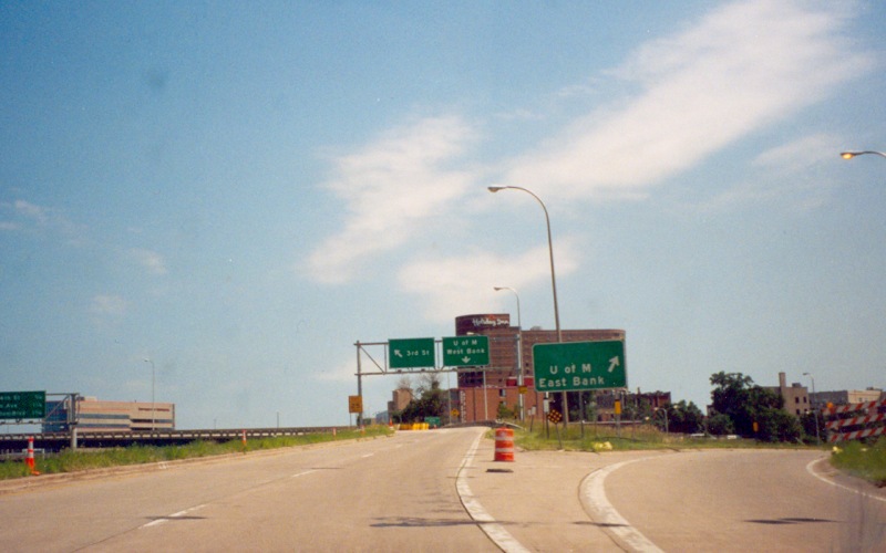 | The ramp in the above photo merges onto a C/D road. This location is where the ramp to the U of M departs from the C/D road. Photo by Adam Froehlig, taken August 1, 2002. |
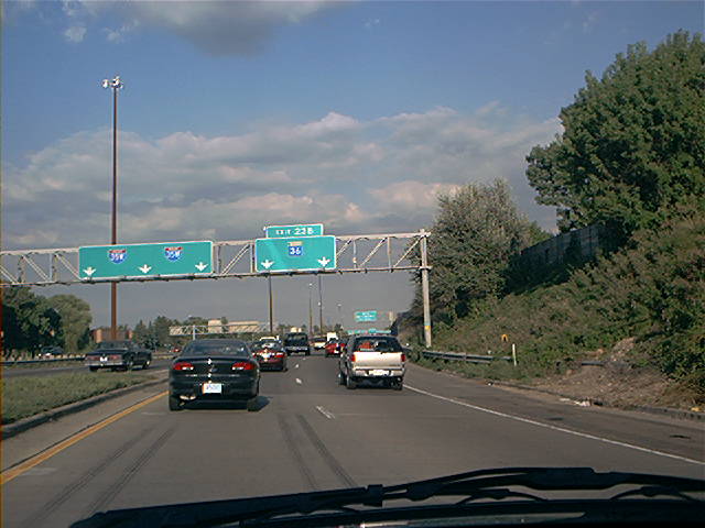
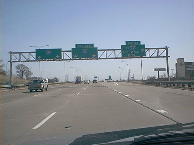 | In northeast Minneapolis, as one approaches the split with MN 36. There is no direct access to MN 280 from NB I-35W, hence the "TO MN 280" in the Exit 22 guide sign. Photo by Don Greiskalns. |
|
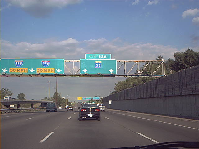
| The lanes for northbound I-35W and eastbound MN 36 briefly split at MN 280, then remerge before splitting again at MN 36's actual terminus. Photo by Don Greiskalns. |
|
|
At the MN 36 split in Roseville. Photo by Don Greiskalns. |
|
|
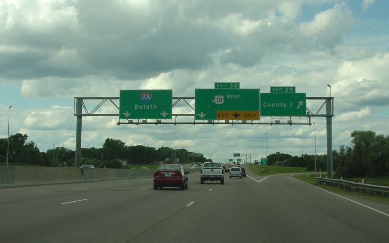
Northbound at the exit to County Road I. In the early road days, Ramsey County decided to assign letters to its road names north of the St. Paul city limits, with the east-west road 1 mile north of the city limits being County Road B, the road 2 miles north being County Road C, and so on. Photo by Adam Froehlig, taken June 26, 2004. |
|
|
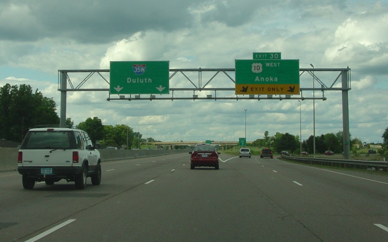
Northbound at the I-35W/US 10 split. When the new US 10 freeway alignment was completed in 1999, US 10 was rerouted to duplex with I-35W for about 2 miles. Photo by Adam Froehlig, taken June 26, 2004. |
|
|
Save general view as above, but from 5 years prior. The right lane on I-35W past US 10 ended before the next interchange at the time. Photo by Adam Froehlig, taken in 1999. |
|
|
Advance ending signage on northbound I-35W. The pavement on this section was recently replaced in full, to include concrete shoulders. Photo by Monte Castleman. |
|
|
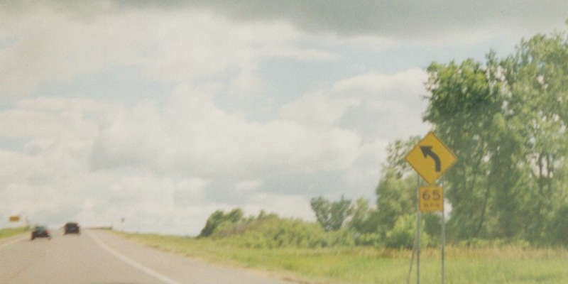
65 MPH curve sign near the northern terminus, which lies just past the curve. Photo by Adam Froehlig. |
Southbound Photos
|
|
Southbound at the County Rd H interchange, which is a partial interchange allowing access to/from CSAH 10, as the main 35W/US 10/CSAH 10 interchange itself is only a partial interchange. Photo by Adam Froehlig, taken in 1999. |
|
|
Southbound at the exit for MN 280. Photo by Don Greiskalns. |
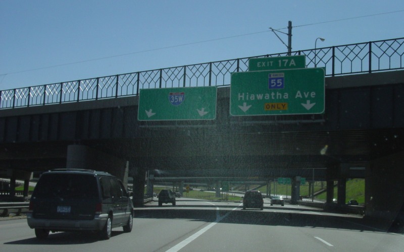 | Southbound I-35W/MN 55 split. Although MN 55 doesn't duplex with I-35W, there is a major traffic movement here, prompting a direct ramp from southbound I-35W to eastbound MN 55. Photo by Adam Froehlig, taken April 27, 2003. |
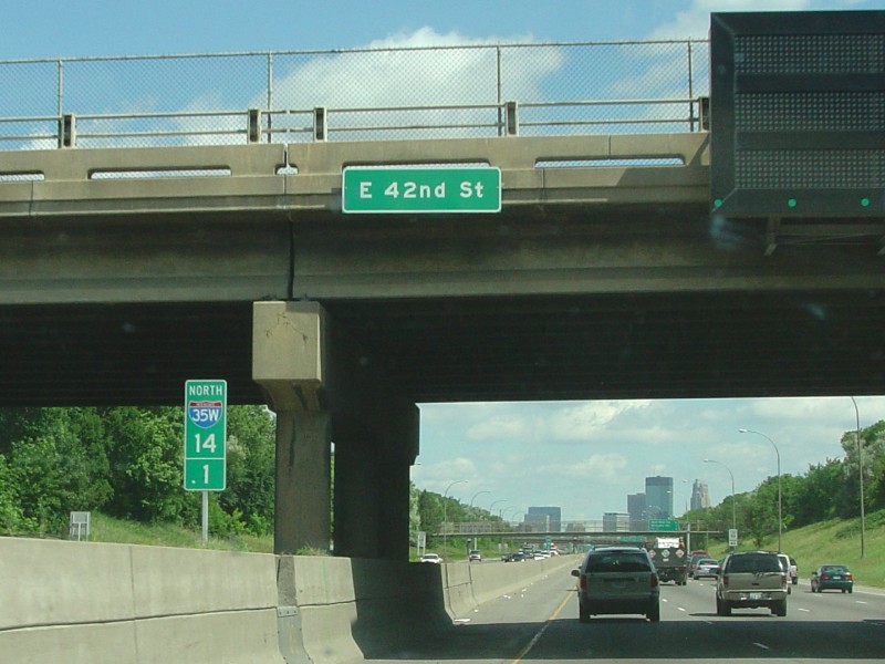
 | Watching Tigger go for a ride during rush hour. The 42nd St overpass is just ahead. Photo by Adam Froehlig, taken April 28, 2003. |
 | Getting on southbound I-35W from the Diamond Lake Rd on-ramp. Notice the sign prohibiting on-ramp traffic from weaving over to MN 62 East between 7am-7pm Mon-Fri. This weave will become more manageable with the Crosstown Commons project, as the Diamond Lake Rd onramp will merge onto a C/D road taking southbound I-35W traffic to MN 62. Photo by Don Greiskalns, taken March 4, 2006. |
 | Southbound at the 60th St exit, approaching MN 62. The off-ramp to 60th will also be located onto the C/D road as part of the Crosstown Commons reconstruction. Photo by Don Greiskalns, taken March 4, 2006. |
 | Southbound at the exit to MN 62 East. This movement will be relocated onto the proposed C/D road. Photo by Don Greiskalns, taken March 4, 2006. |
 | Southbound at the Lyndale Ave exit. The Crosstown Commons reconstruction will move this off-ramp onto what will be westbound MN 62. Photo by Don Greiskalns, taken March 4, 2006. |
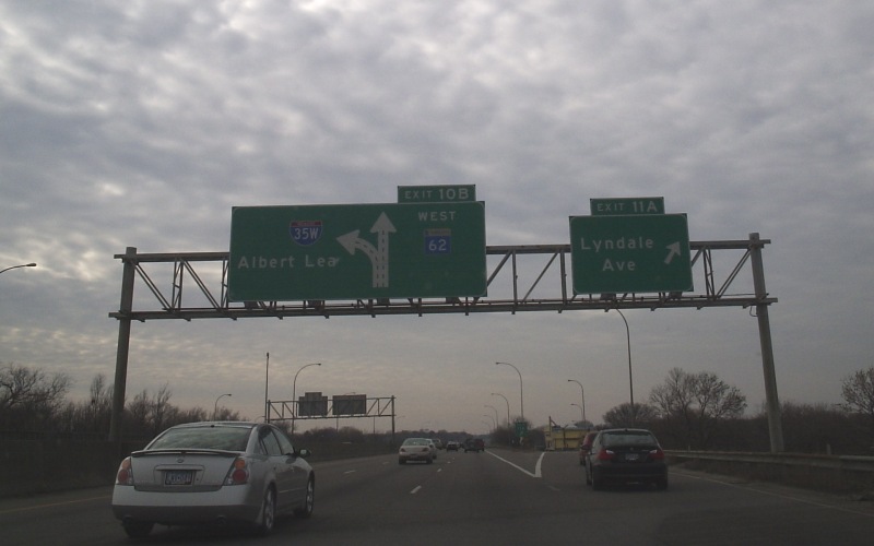
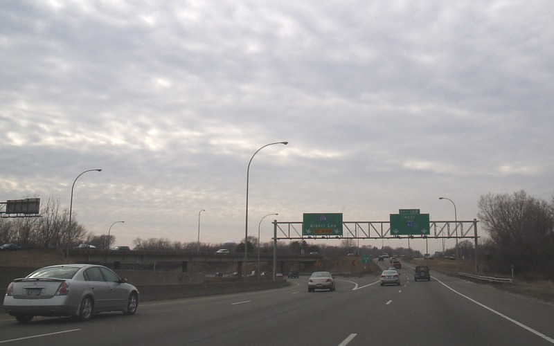 | Southbound at the western end of the "Crosstown Commons". Photo by Don Greiskalns, taken March 4, 2006. |
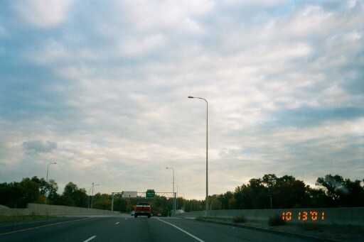 | The first of four photos showing the recently reconstructed segment of I-35W between 66th St and I-494 in Richfield. In this picture, the bridge over 66th is widened, but still 2 lanes. The 3rd southbound lane begins just south of the bridge, and is an HOV lane running from here south to MN 13. Photo by Glenn Olsen, taken October 13, 2001. |
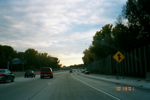 | Continuing southbound, where the on-ramp from 66th Street merges in. This section was reconstructed in concrete, with special grooves, and using stainless steel for the reinforcement bars. It is hoped that these and other special techniques used in construction will give a longer pavement life, as it is unlikely this section will be reconstructed in the future. Photo by Glenn Olsen, taken October 13, 2001. |
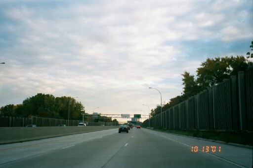 | Further south, between 66th and 76th. Photo by Glenn Olsen, taken October 13, 2001. |
 | Approaching the pedestrian bridge at 73rd St. The reconstructed segment wraps up right at about 76th Street, tying into the existing 6-lane section of I-35W south of there that was completed in the mid '90s. Photo by Glenn Olsen, taken October 13, 2001. |
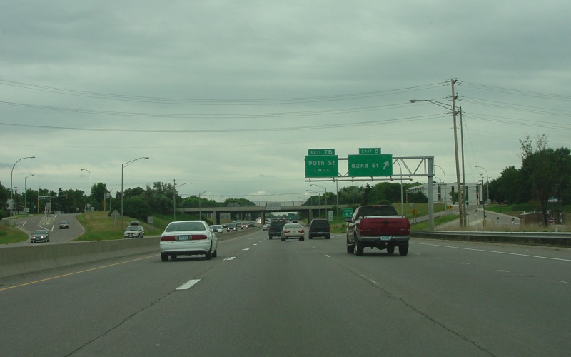 | Southbound exit to 82nd St, just south of the I-494 interchange. Just beyond is the sign noting the speed limit increase to 65 MPH. Photo by Adam Froehlig, taken June 27, 2004. |
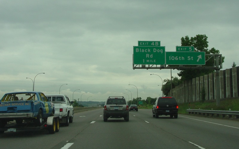 | Southbound exit to 106th St. This is the last exit in Bloomington and Hennepin County, as Black Dog Rd sits across the Minnesota River in Dakota County. Photo by Adam Froehlig, taken June 27, 2004. |
 | Southbound exit to Black Dog Rd. This exit is just south of the Minnesota River and is on some tight confines, hence the 15 MPH speed advisory on the loop. Photo by Adam Froehlig, taken June 27, 2004. |
 | Southbound exit to Cliff Rd. Although unsigned here, Cliff Rd is Dakota CSAH 32. Photo by Adam Froehlig, taken June 27, 2004. |
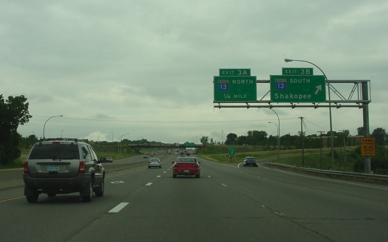 | At the MN 13 interchange, which is a cloverleaf. Photo by Adam Froehlig, taken June 27, 2004. |
 | At the loop to northbound MN 13. This is where the HOV restrictions end on the inside lane, as southbound I-35W drops to 2 lanes about a mile ahead. Photo by Adam Froehlig, taken June 27, 2004. |
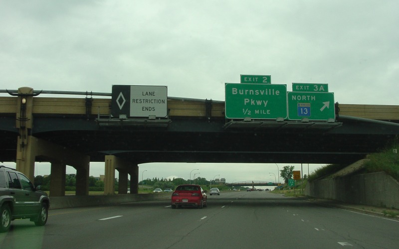
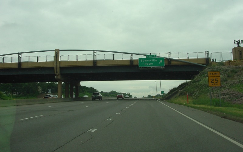 | Southbound exit to Burnsville Pkwy, which is a modern day incarnation of what was once a *VERY* old alignment for US 65. Photo by Adam Froehlig, taken June 27, 2004. |
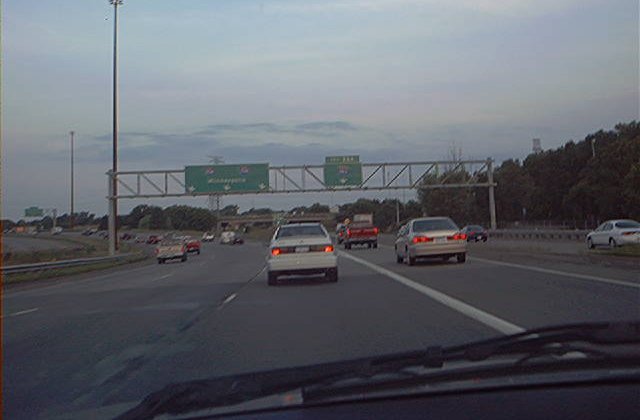
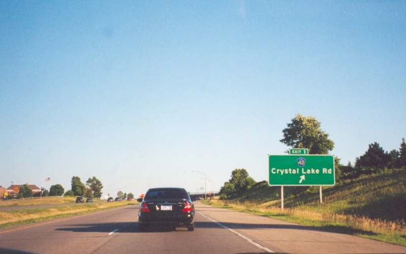 | The last exit on southbound I-35W before merging with I-35E back into I-35 is at CSAH 42 near Burnsville Center. Photo by Adam Froehlig, taken late July, 2002. |
I-35W at Interstate
Guide
Go to MN Highway
Endings
Go to Minnesota Photography
Go to Highway Photography
![]()
Page last modified 12 April, 2008
(C) 2008-2003 Adam Froehlig