|
Western Terminus |
Eastern Terminus |
|
|
Minnesota |
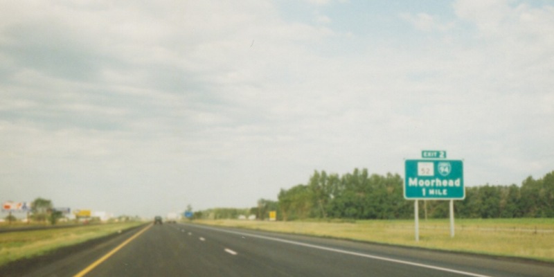
ND/MN State Line at Moorhead, MN |
MN/WI State Line at Lakeland, MN |
|
Nationally |
At I-90 near Billings, MT |
U.S./Canada International border at Port Huron, MI |
This page documents photos from various locations along I-94 in Minnesota, including terminus photos.
Scroll down to the westbound photos
Scroll down to other related photos
Eastern Terminus Photos
|
|
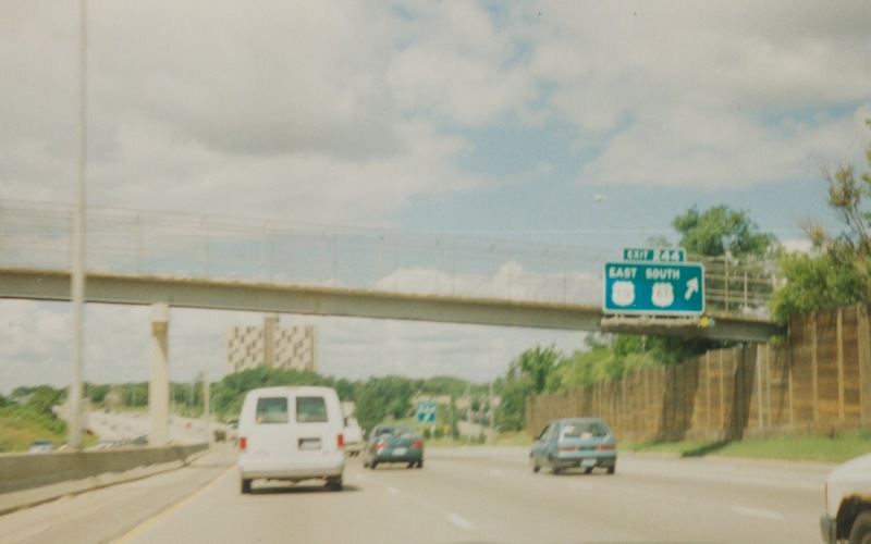
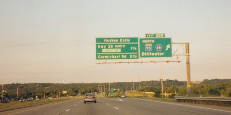
Eastbound on the bridge over the St. Croix River, headed into Wisconsin. The guide sign in the background is for the exit at WI 35 North/Hudson. Photo by Monte Castleman. |
|
|
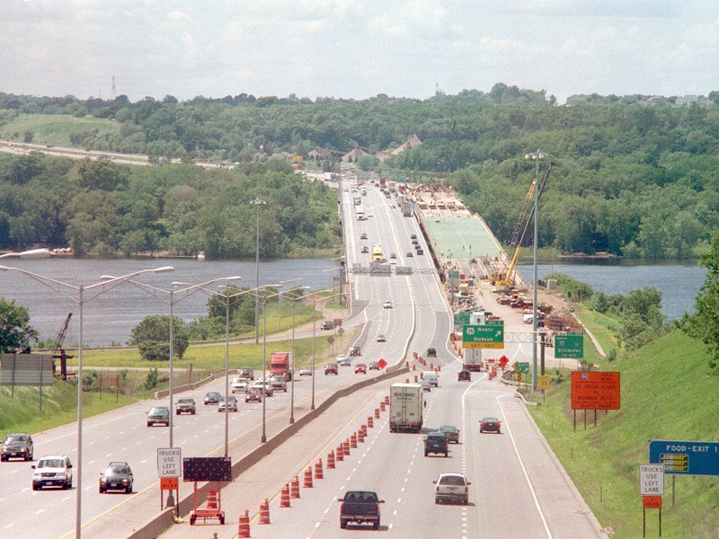
This image looks west at the St. Croix River bridge from an overpass in Hudson, WI. At the time, a project was underway to widen and redeck the westbound bridge, forcing all traffic onto the eastbound span. MnDOT and WisDOT utilized a "zipper lane" to help mitigate traffic flow in the peak direction during rush hours. Photo by Monte Castleman, taken in 2004. |
Eastbound Photos
|
|
Guide sign at the exit to MN 4. Photo by Adam Froehlig, taken April 27, 2003. |
|
|
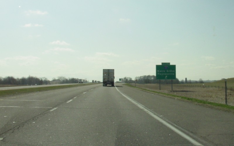
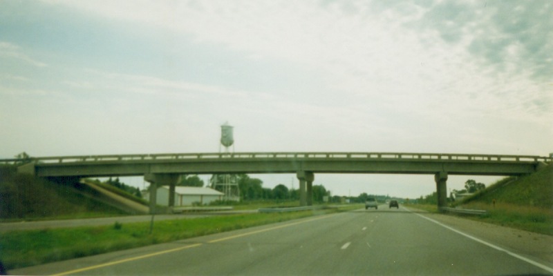
At the Stearns CSAH 13 overpass, with the Melrose water tower in the background. Photo by Adam Froehlig, taken in 1999. |
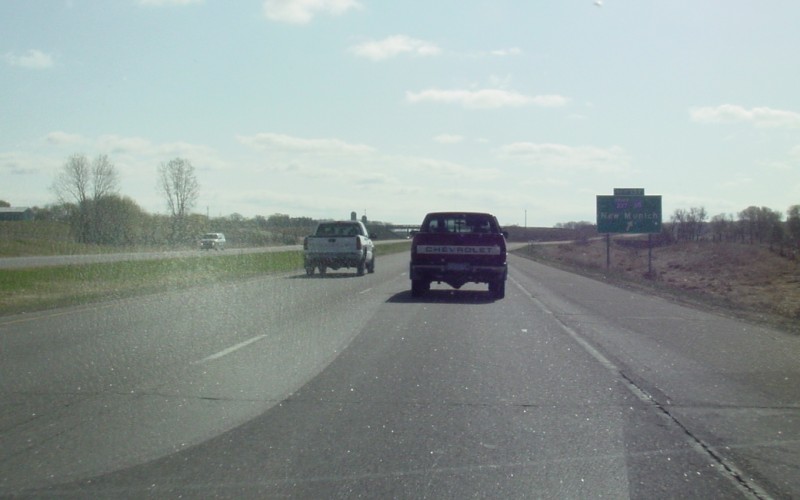
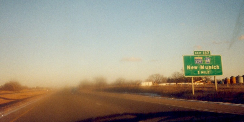 | Advance guide sign approaching MN 237 in Stearns County. Photo by Adam Froehlig, taken in December, 1998. |
|
|
Guide sign at the exit to MN 237. Notice that CSAH 65, which serves as a frontage road, is also signed. Photo by Adam Froehlig, taken April 27, 2003. |
 | Blurry view of overhead guide signage at the interchange with Stearns CSAH 75, west of St. Joseph. Stearns CSAH 75 follows US 52's old routing into St. Cloud. Photo by Adam Froehlig, taken in December, 1998. |
 | A view of the then-new overpass at 93rd Ave N in Maple Grove. The extra bridge spans were built to accommodate a redesigned/relocated interchange at Dunkirk Ln/Maple Grove Pkwy that was completed in 2008. Photo by Adam Froehlig, taken July 31, 2002. |
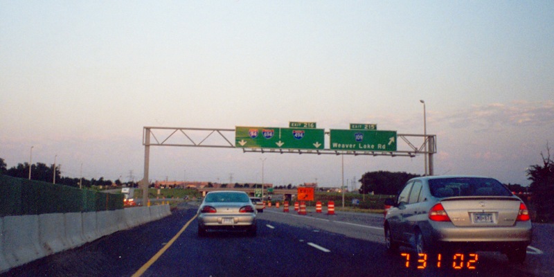 | At the Weaver Lake Rd exit, about 1 mile before the 94/494 split. Photo by Adam Froehlig, taken July 31, 2002. |
|
|
Overhead guide signage at the 94/494 split in Maple Grove. Photo by Monte Castleman. |
|
|
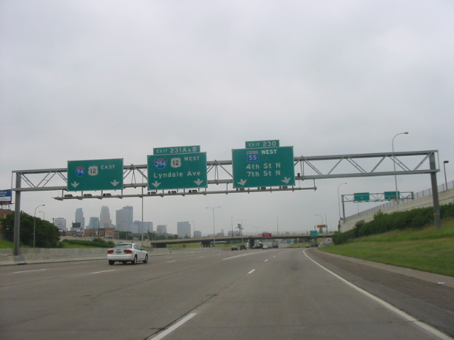
Overhead signage at Exit 230, which is basically a very long split-diamond interchange to 7th St and MN 55 West/Olson Mem Hwy. The interchange also features the direct access ramp into downtown at 4th St (and the return ramp from 3rd St), which carried US 52 at one point and is now part of the unmarked and "hidden" US 952A. Photo by Glenn Olson, taken in June, 2005. |
|
|
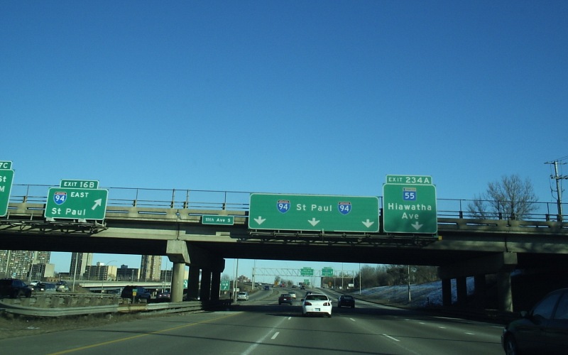
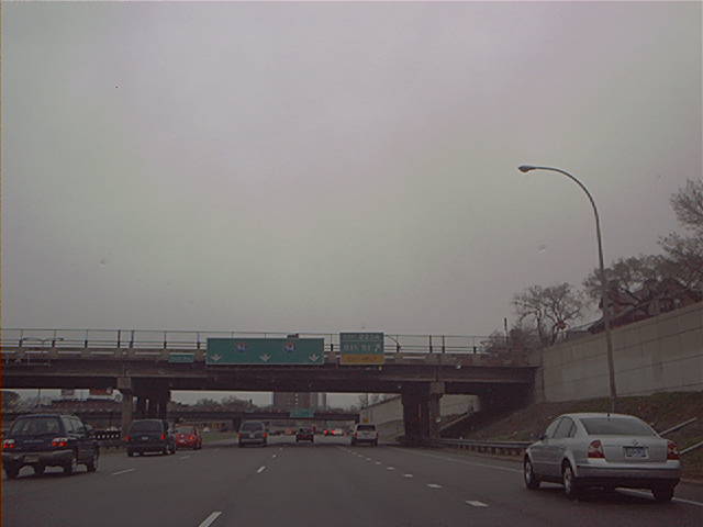
Overhead guide signage within the I-35W/I-94 "Spaghetti Junction". Just ahead is the eastbound exit to MN 55 East and Hiawatha Ave. Photo by Don Greiskalns, taken February 5, 2006. |
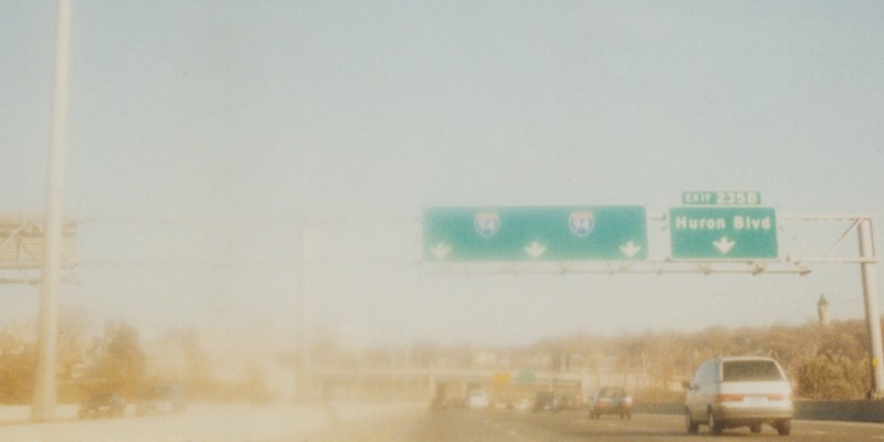 | Blurry view of eastbound I-94 crossing the Mississippi River in Minneapolis. Photo by Adam Froehlig, taken in December, 1998. |
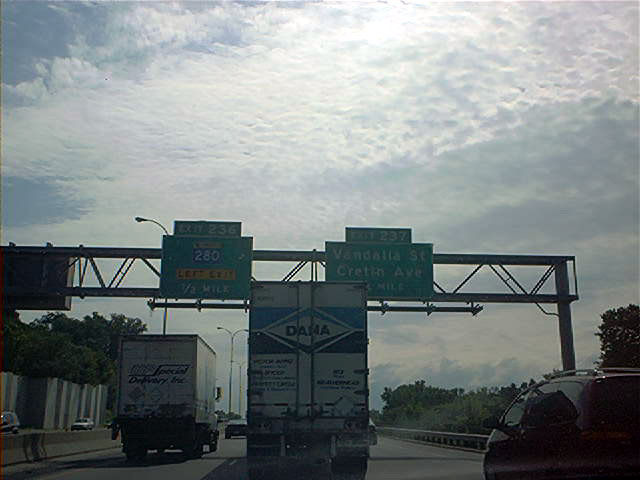 | Approaching the interchange with MN 280. This view is just before crossing the city line from Minneapolis into St. Paul. Photo by Don Greiskalns, date unknown. |
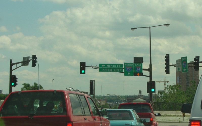
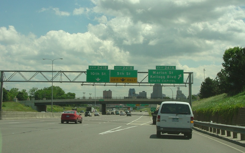 | Eastbound exit to Marion St and Kellogg Blvd, on the western edge of downtown St. Paul. This is also the main route to the state capitol area coming from the west. Photo by Adam Froehlig, taken June 21, 2004. |
 | Overhead guide signage at MN 120, which is in the process of being "turned back" (i.e. decommissioned). This segment was also widened in 2005. Photo by Don Greiskalns, taken prior to 2005. |
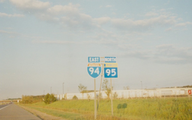 | Reassurance shields along the I-94/MN 95 duplex in Washington County. Photo by Adam Froehlig, taken July 14, 2000. |
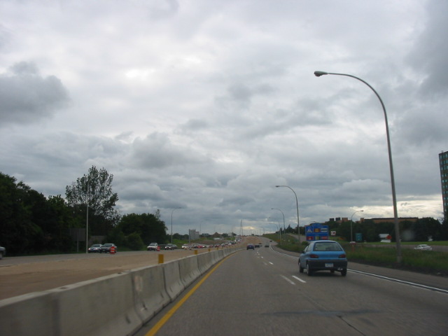
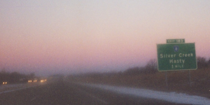
 | Overhead guide signage at the exit to MN 95 North. This is the last eastbound exit in Minnesota. Shortly following is the I-94 bridge over the St. Croix River, then the interchange at WI 35 North. Photo by Adam Froehlig, taken July 14, 2000. |
|
|
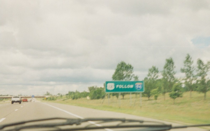
About even with the truck weigh station just west of MN 95/CSAH 18 is this sign stating that US 12 traffic follows I-94. This is the only US 12 signage one sees along westbound I-94 until the I-394 interchange. Photo by Adam Froehlig, date unknown. |
|
|
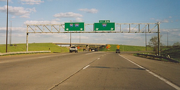
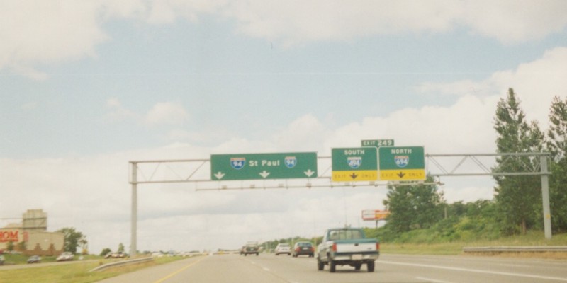
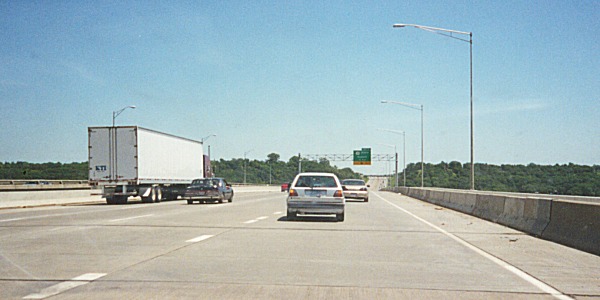
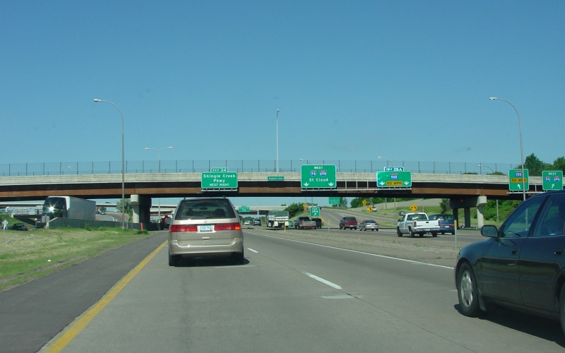
Overhead guide signage at the exit to I-494/694 in Oakdale and Woodbury. Photo by Adam Froehlig, date unknown. |
|
|
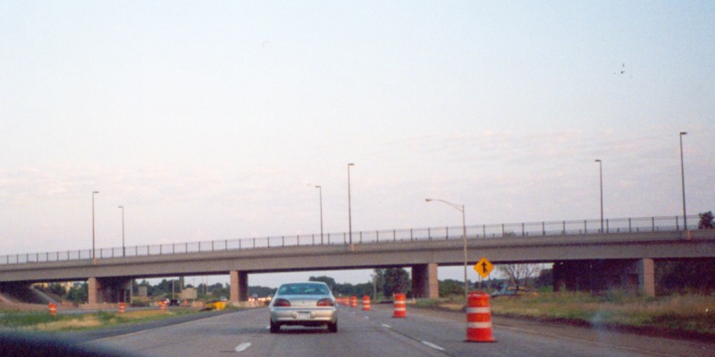
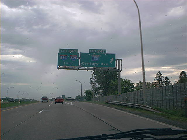
Westbound between MN 120/Century Ave and McKnight Rd. This construction project is adding a 3rd lane in each direction, filling in a gap and eliminating a major bottleneck along I-94. Photo by Glenn Olson, taken in June, 2005. |
|
|
Exit to US 10/61 South in St. Paul. Photo by Adam Froehlig, date unknown. |
 | Approaching the exit to MN 280 in St. Paul. The overpass behind the sign and above the railroad bridge is Pelham Blvd. Photo by Adam Froehlig, taken August 8, 2005. |
 | At the exit to 11th St in Minneapolis, within the I-35W/I-94 "Spaghetti Junction". Photo by Don Greiskalns. |
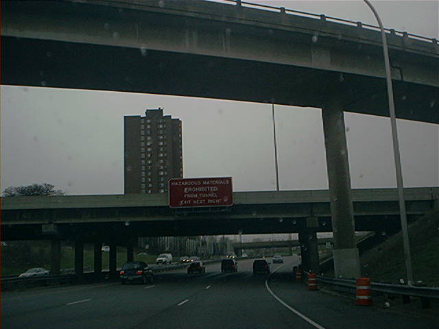 | A westbound tunnel advisory sign warning that vehicles carrying hazardous materials are prohibited from the upcoming Lowry Hill Tunnel, and are directed to get off at the next exit, which is Hennepin/Lyndale Aves. The flyover at the top of the photo carries traffic from northbound I-35W to westbound I-94. Photo by Don Greiskalns. |
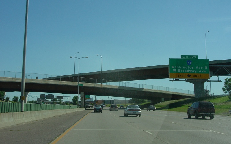 | Approaching the exit to West Broadway, which carries Hennepin CSAH 81. The long flyover above the Plymouth Ave overpass takes EB I-94 traffic to 4th St in downtown Minneapolis. Photo by Adam Froehlig, taken June 22, 2004. |
 | Overhead guide signage at the 53rd Ave N overpass, which is the boundary between Minneapolis and Brooklyn Center. Photo by Adam Froehlig, taken June 22, 2004. |
 | Overhead signage at the westbound split to MN 252. The right lane here also serves as the access from WB I-94 to EB I-694. The Mississippi River is just off-camera to the right. Photo by Adam Froehlig, taken June 22, 2004. |
 | Just west of MN 252, and before WB I-94 and WB I-694 merge, MN 100 splits off from I-694. On the far right is the access ramp from SB MN 252 to MN 100 and WB 94/694. Photo by Adam Froehlig, taken June 22, 2004. |
 | On westbound I-94 between Albertville and Monticello, at the beginning of the internationally-known MnROAD Project. MnROAD is an extensive, multi-national and multi-agency research project that is taking a deep look at how winters like those in Minnesota affect pavement condition. The poles show in this photo mark which set of lanes westbound I-94 traffic should follow. You can check out the MnROAD website here. Agency partners include WisDOT, FHWA, and Finland's National Road Administration. Photo by Adam Froehlig, taken in July, 2000. |
 | Westbound guide sign for the interchange at Wright CSAH 8. Some counties, like Wright, use the blue pentagon county route shield, while others use the "standard" Minnesota white square shield for their county routes. Photo by Adam Froehlig, taken in December, 1998. |
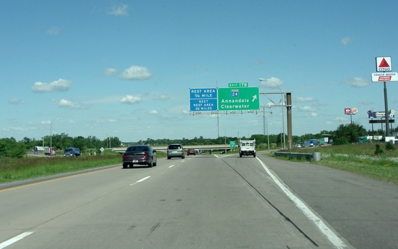 | Overhead signage at the MN 24 exit. MN 24 is a major connector route between I-94 and US 10. Photo by Adam Froehlig, taken June 22, 2004. |
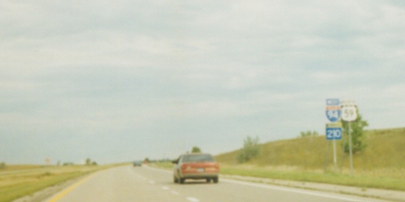 | Oversized shields (including a rare 3di-sized MN shield) along the I-94/US 59/MN 210 triplex near Fergus Falls. Photo by Adam Froehlig, taken in August, 1999. |
 | Westbound guide sign for the interchange where US 59 splits off of I-94, northwest of Fergus Falls. Photo by Adam Froehlig, taken in August, 1999. |
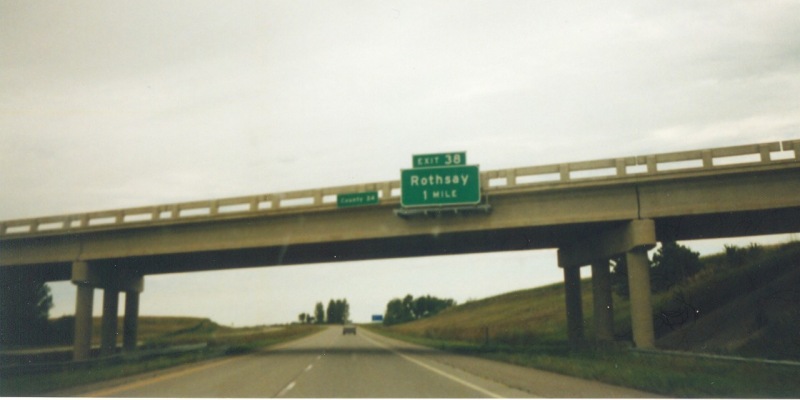 | Westbound guide sign for the Rothsay exit on the Wilkin/Otter Tail County line. This guide sign is a rarity in Minnesota in that it does not include a route shield or a street name. Photo by Adam Froehlig, taken in August, 1999. |
 | Westbound guide sign at what was originally US 52, then MN 231, and is now Clay CSAH 52 and a rare Interstate Business Loop in Minnesota. Photo by Adam Froehlig, taken in August, 1999. |
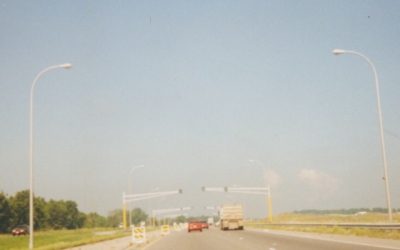
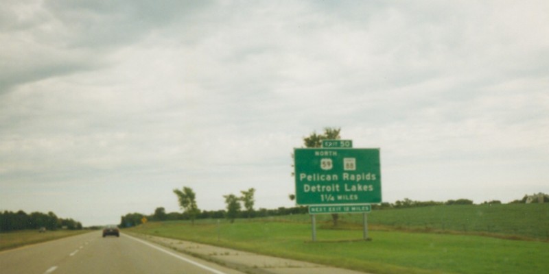
 | A traffic signal where the westbound ramps meet MN 24 near Clearwater. MN 24 is an important and heavily-used connector between I-94 and US 10 on the other side of the Mississippi River. Photo by Adam Froehlig, taken in December, 1998. |
 | These two photos show the new, completed 93rd Ave bridge across I-94 in Maple Grove. The bridge was built to accommodate the eventual replacement of the I-94 interchange at CSAH 30 (Exit 213) with what will be a new folded-diamond interchange connecting to Dunkirk Ln and a realigned CSAH 121. The new interchange, completed in 2008, was also built to provide adequate spacing between it and the proposed I-94/MN 610 interchange. The lower photo shows a view of the new bridge while getting onto eastbound I-94 from CSAH 30. Photos by Monte Castleman. |
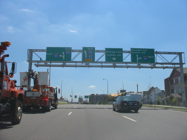 |
This image is southbound on Lyndale Ave approaching
MN 55/Olson Memorial Hwy. This segment of Lyndale Ave serves as an ad-hoc
frontage road for I-94. Notice the two left guide signs. Originally, MN 55 continued east of Lyndale and into downtown Minneapolis. Recently, MN 55 was dropped through downtown and rerouted to follow I-94 around downtown. The "I-94 East" sign was modified to include a MN 55 shield, but the original sign for MN 55 East into downtown wasn't changed, creating a situation now where drivers may be confused which route MN 55 East takes. Photo by Glenn Olson, taken in July, 2005. |
|
| Waiting at the light at the end of the offramp from eastbound I-94 to Marion St and Kellogg Blvd, on the west edge of downtown St. Paul. Photo by Adam Froehlig, taken June 21, 2004. |
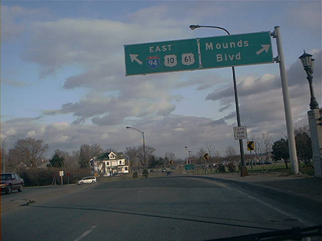 | This sign, on Mounds Blvd east of downtown St. Paul, directs southbound US 61 traffic either onto eastbound I-94, or to continue on Mounds Blvd. Photo by Don Greiskalns. |
Back to the top
Photos of the
I-94/I-694 duplex
I-94 at Interstate Guide
Go to MN Highway
Endings
Go to Minnesota Photography
Go to Highway Photography
![]()
Page last modified 20 May, 2009
(C) 2009-2003 Adam Froehlig