**
**
**
|
Duplex Location |
Length (mi) |
Signed directions |
| NE Hennepin County |
6.3 |
I-94 E-W |
** - US 52 is also multiplexed along here, but is considered a "hidden route".
This page details the I-94/694 duplex through the northern Minneapolis suburbs, including the recently completed widening of most of the segment. In the photos below, notice that the exit numbers utilize the Beltway (I-494/694) mileage and not I-94's mileage.
Scroll down to Westbound Photos
Scroll down to Westbound Construction Photos (from the 2003-2005 widening
project)
Eastbound Photos
|
|
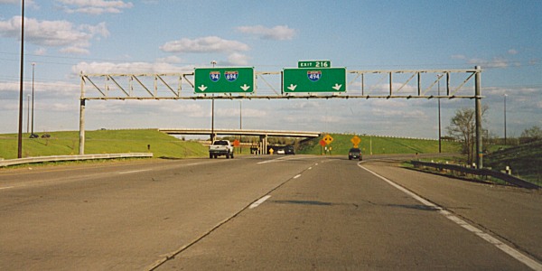
Overhead guide signs at the 94/494/694 split in Maple Grove. Photo by Monte Castleman. |
|
|
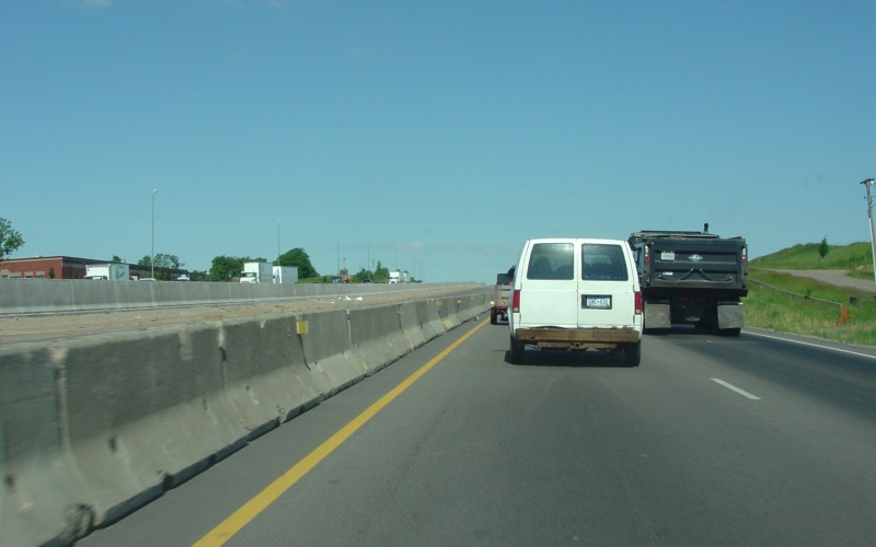
At the CSAH 61/Hemlock Ln exit. Photo by Don Greiskalns, taken March 4, 2006. |
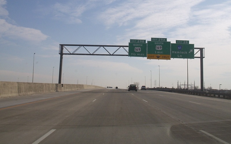
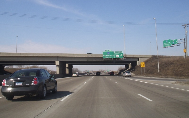
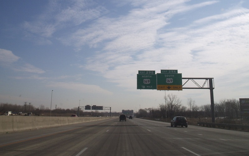 | Guide signage approaching the US 169 interchange. The rightmost lane is an exit-only lane to southbound US 169. Photo by Don Greiskalns, taken March 4, 2006. |
|
|
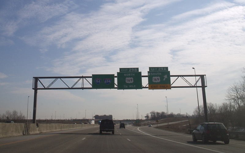
At the exit to southbound US 169. Photo by Don Greiskalns, taken March 4, 2006. |
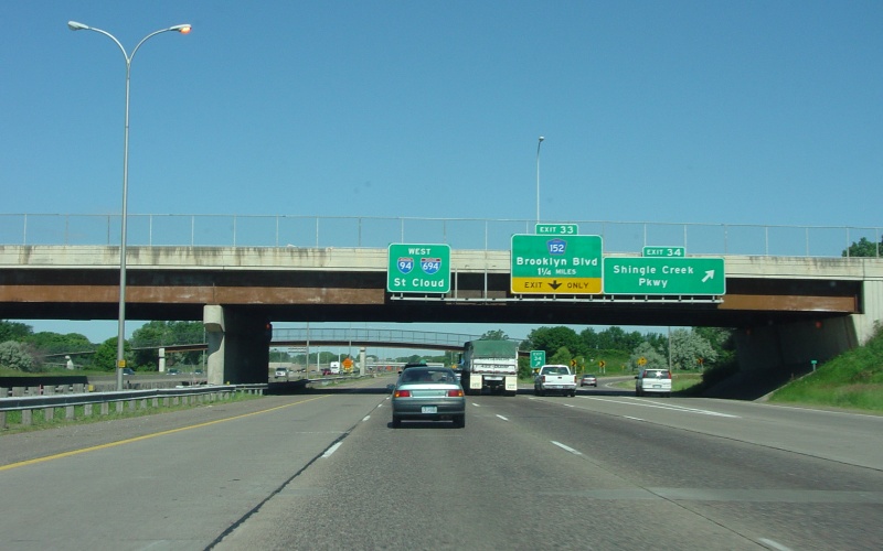
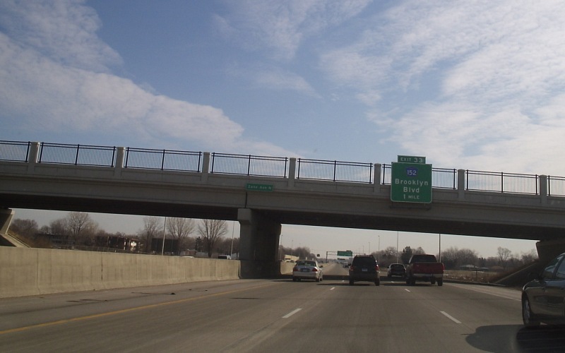 | Advance guide sign for CSAH 152/Brooklyn Blvd. Photo by Don Greiskalns, taken March 4, 2006. |
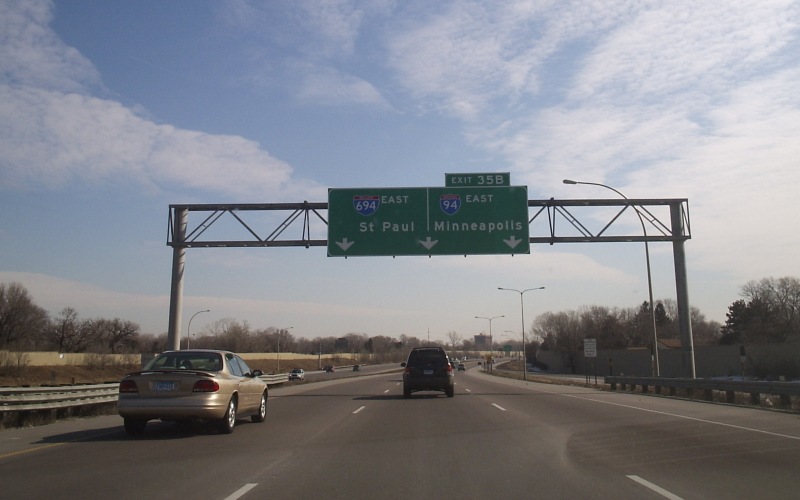
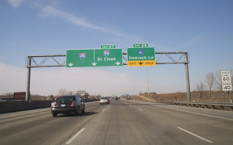
j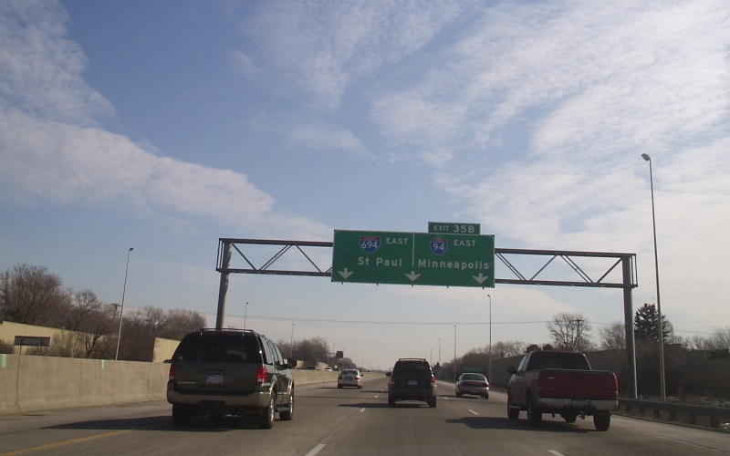 | The first of a few guide signs announcing the I-94/694 split up ahead. Photo by Don Greiskalns, taken March 4, 2006. |
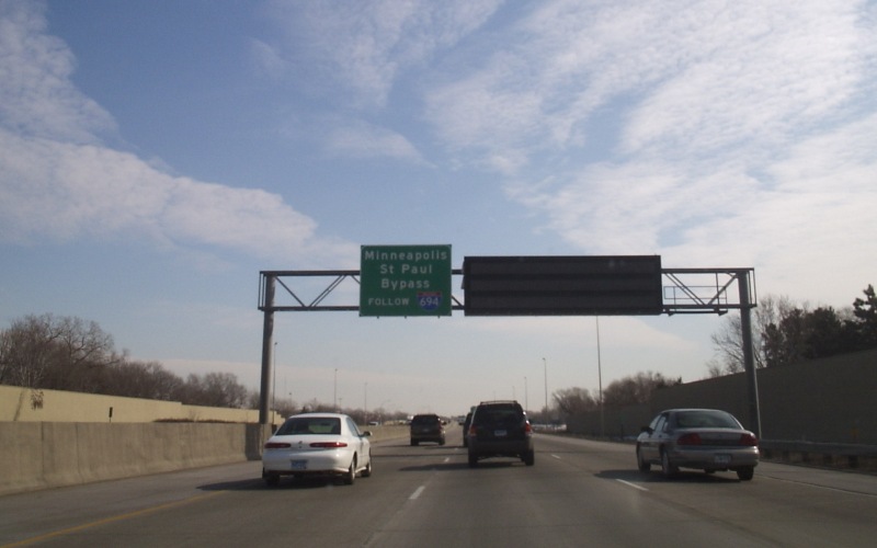 | This signage says to use I-694 for a "Minneapolis/St. Paul Bypass". Photo by Don Greiskalns, taken March 4, 2006. |
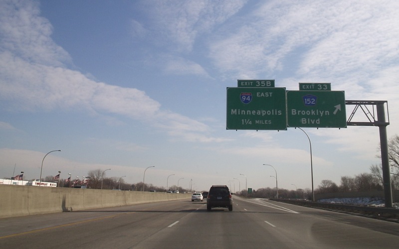 | At the exit to CSAH 152/Brooklyn Blvd. Photo by Don Greiskalns, taken March 4, 2006. |
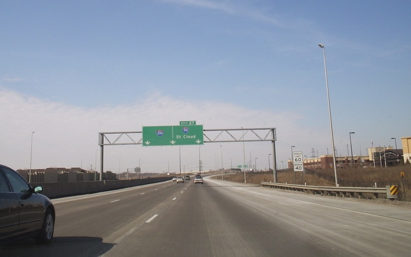
 | Another overhead sign for the I-94/694 split. This location also marks the end of the widening project done in the early 2000's. Photo by Don Greiskalns, taken March 4, 2006. |
Westbound Photos
|
|
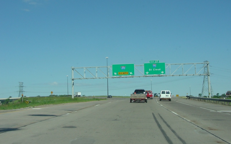
The interchange at Shingle Creek Pkwy is the first interchange on the westbound I-94/I-694 duplex. Photo by Adam Froehlig, taken June 22, 2004. |
|
|
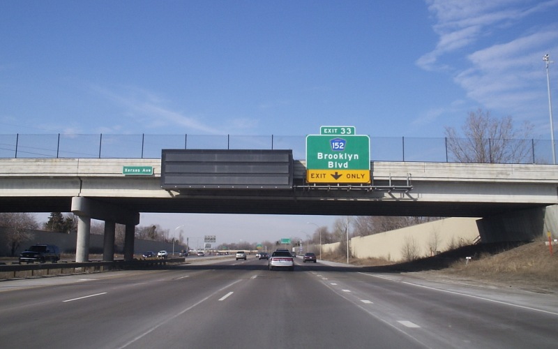
Advance guide sign for CSAH 152/Brooklyn Blvd. This location, at Xerxes Ave, used to be the location of a half-diamond interchange until the early '80s, when it was taken out to build the Shingle Creek Pkwy interchange and upgrade the 94/694/100/252 junctions. Photo by Don Greiskalns, taken March 4, 2006. |
 | At the exit to CSAH 152/Brooklyn Blvd. Prior to completion of the recent widening project, westbound 94/694 went from 4 lanes to 3 to 2 within a short span, losing the rightmost lane here and the leftmost lane about 1/2 mile further down. Photo by Don Greiskalns, taken March 4, 2006. |
|
|
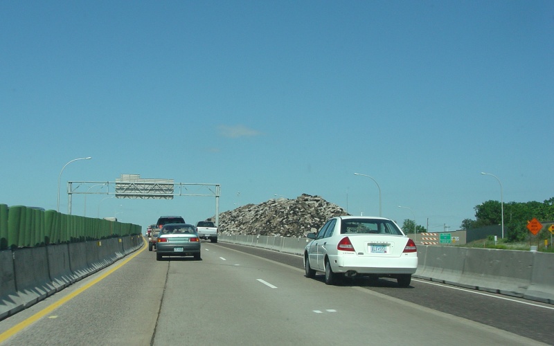
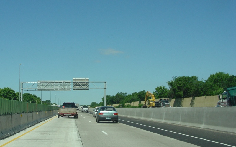
A large rubbled pavement pile sits in the old westbound lanes at the CSAH 152 interchange. This was during the I-94/694 widening project MnDOT was undertaking at the time. Photo by Adam Froehlig, taken June 22, 2004. |
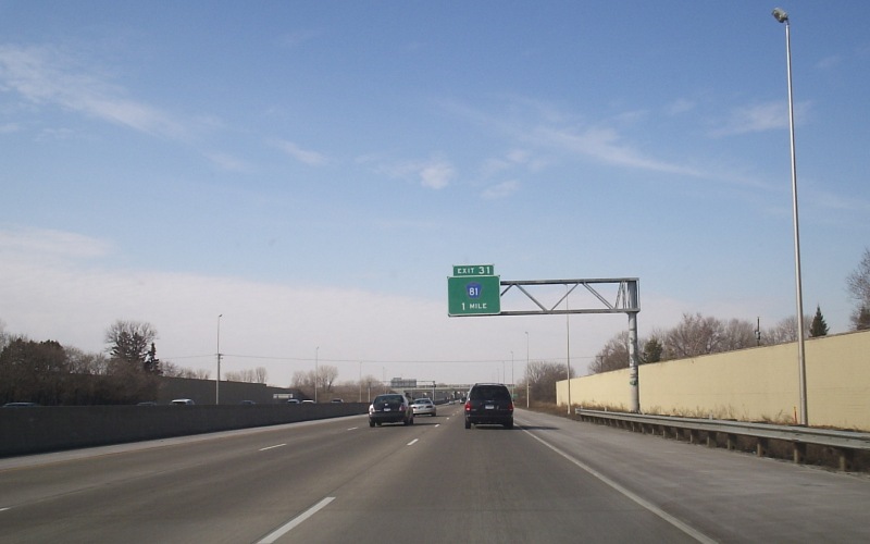 | Advance guide signage for CSAH 81. This is the first location in Minnesota that I've seen this particular style of mast lighting. Photo by Don Greiskalns, taken March 4, 2006. |
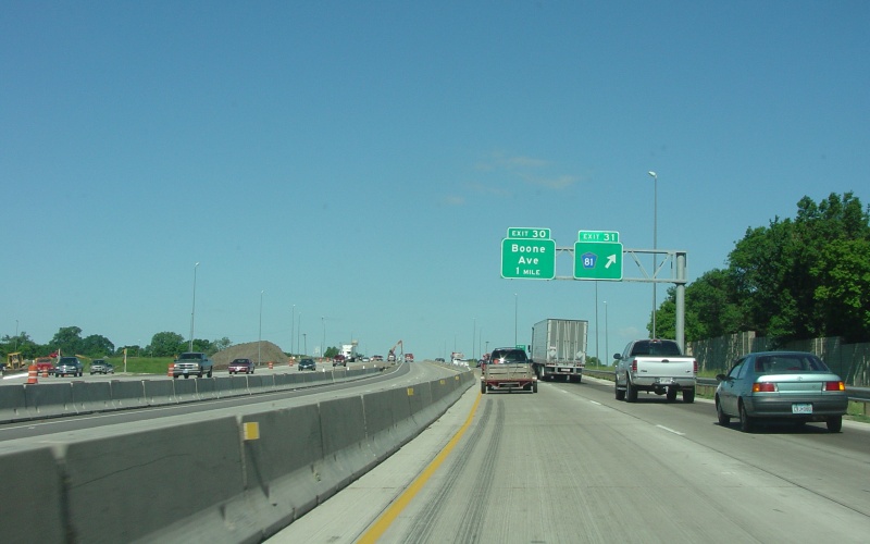
 | Westbound exit to CSAH 81. Photo by Don Greiskalns, taken March 4, 2006. |
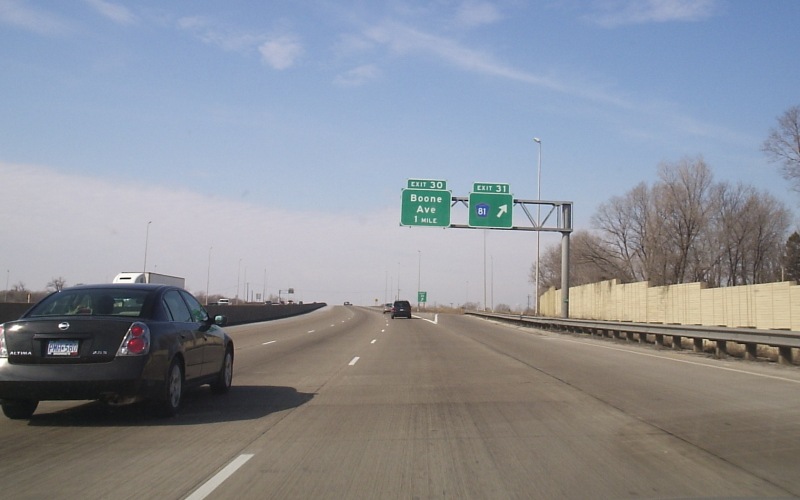
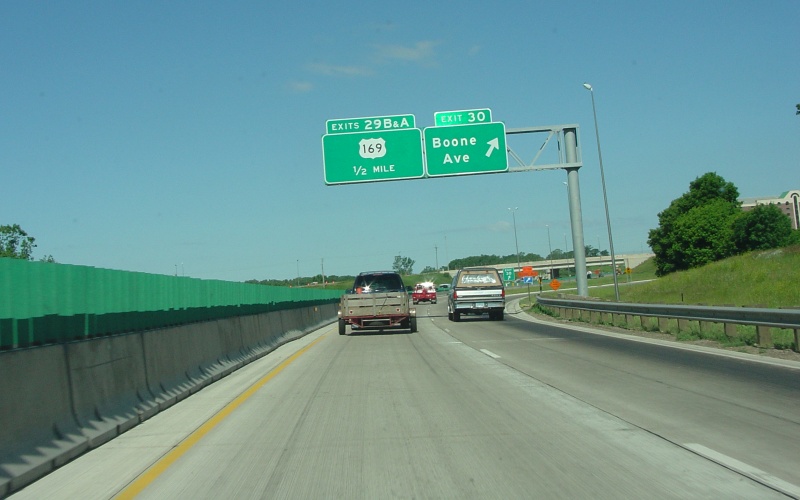
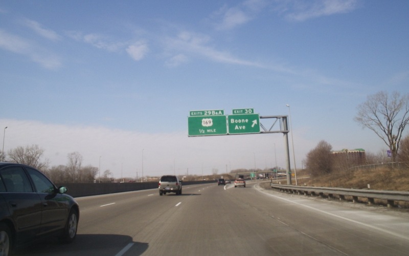 | Westbound exit to Boone Ave, which used to be a half-diamond interchange until sometime in the '80s when it was made a folded-diamond. Photo by Don Greiskalns, taken March 4, 2006. |
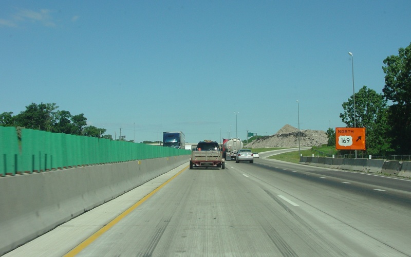
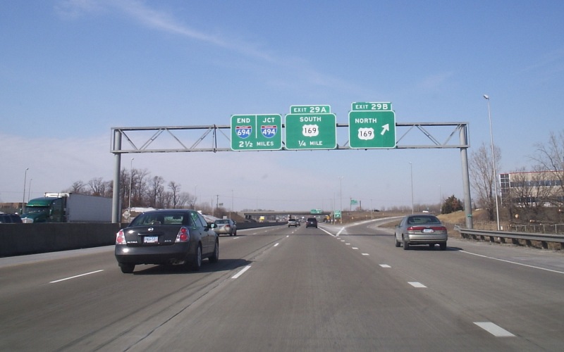 | Westbound exit to northbound US 169. Notice the END I-694 signage on the left. Although generally unsigned going westbound from this point, I-694's western terminus is at the I-94/494 interchange, making I-694 rare in not only duplexing with its parent route, but also ending while duplexed. Photo by Don Greiskalns, taken March 4, 2006. |
 | Westbound loop to southbound US 169. The rightmost lane begins right here as an auxiliary lane. Photo by Don Greiskalns, taken March 4, 2006. |
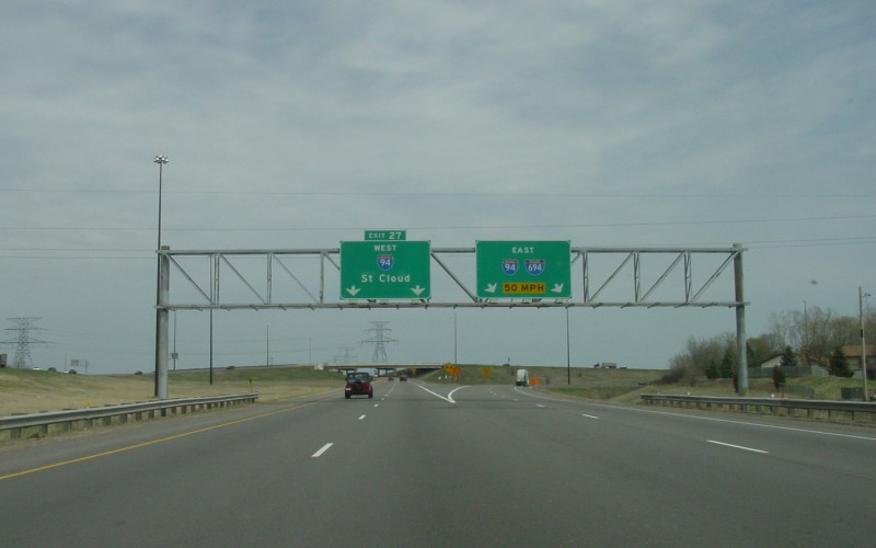
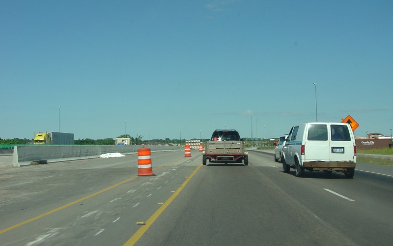
 | Overhead signage for both the CSAH 61/Hemlock Ln interchange and the upcoming split at I-494. Photo by Don Greiskalns, taken March 4, 2006. |
 | Overhead signage for the westbound 94/494(Beltway) split, just west of CSAH 61. Photo by Don Greiskalns, taken March 4, 2006. |
 | I-494/694's western terminus, as seen from westbound I-94. Photo by Adam Froehlig, taken June 22, 2004. |
Westbound Construction Photos
This set of photos is from the I-94/I-694 widening project that MnDOT undertook between 2003 and 2005.
|
|
A large rubbled pavement pile sits in the old westbound lanes at the CSAH 152 interchange. CSAH 152 marked the east end of the widening project. Photo by Adam Froehlig, taken June 22, 2004. |
 | Between CSAH 152 and the Zane Ave overpass. Westbound traffic is shifted onto part of the newly-reconstructed eastbound lanes so that the westbound lanes can be rebuilt and widened. Photo by Adam Froehlig, taken June 22, 2004. |
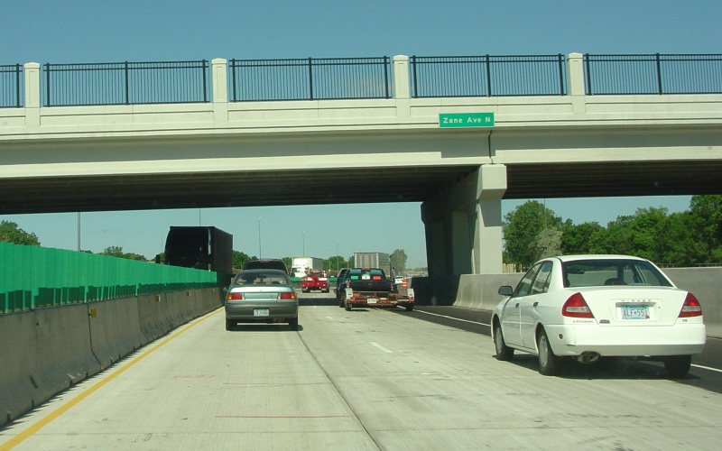 | The new Zane Ave overpass, which was replaced to accommodate the widening project. Photo by Adam Froehlig, taken June 22, 2004. |
 | At the CSAH 81 exit. Note how westbound traffic is back on its own side. Photo by Adam Froehlig, taken June 22, 2004. |
 | At the Boone Ave exit. By this point, eastbound traffic is now following part of the westbound lanes. Photo by Adam Froehlig, taken June 22, 2004. |
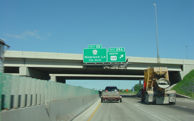
 | Temporary guide sign for the exit to northbound US 169. Photo by Adam Froehlig, taken June 22, 2004. |
 | Signage hung from the northbound US 169 overpass. Note the missing CSAH 61 shield. Also, the eastbound lanes are still hugging part of the westbound side here. Photo by Adam Froehlig, taken June 22, 2004. |
 | West of US 169, the pavement changes to asphalt and eastbound traffic is back on its own side. Photo by Adam Froehlig, taken June 22, 2004. |
 | On the CSAH 61/Hemlock Ln underpass. This is near the west end of the project. Photo by Adam Froehlig, taken June 22, 2004. |
Other Related Photos
|
|
Overhead guide signage on northbound I-494 at the "Fish Lake Interchange", where I-494 meets I-94/694. Photo by Adam Froehlig, taken April 25, 2003. |
More photos from along
I-94 in Minnesota
I-94 at Interstate Guide
Go to Minnesota Multiplexes
Go to Minnesota Photography
Go to Highway Photography
![]()
Page last modified 24 March, 2009
(C) 2009-2003 Adam Froehlig