Interstate 35E in Minnesota
|
Southern Terminus |
Northern Terminus |
| I-35/I-35W Junction in Burnsville, MN | I-35/I-35W Junction near Lino Lakes, MN |
This page documents photos from various locations along I-35E through the Twin Cities metro area, including terminus photos.
Terminus Photos
|
|
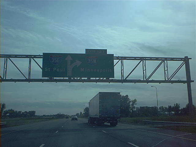
Overhead guide signage at the southern I-35E/I-35W split. Note that the exit number is for I-35W, as I-35's milemarkers and exit numbers are continued along I-35E. Photo by Don Greiskalns. |
|
|
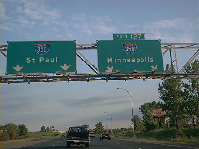
Overhead diagrammatic guide sign approaching the northern I-35E/I-35W split on southbound I-35. Photo by Don Greiskalns. |
|
|
Overhead guide sign at the northern split itself. Photo by Don Greiskalns. |
Northbound Photos
|
|
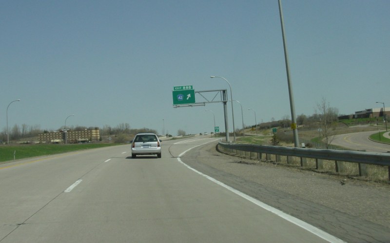
First northbound exit on I-35E is at Dakota CSAH 42, a major east-west route through Dakota County. Photo by Adam Froehlig, taken April 22, 2003. |
|
|
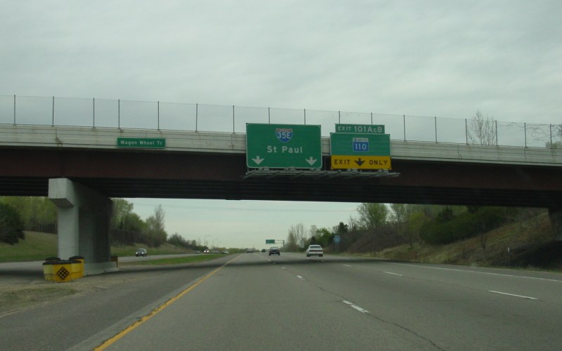
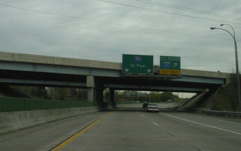
Approaching MN 110 and the transition from the newer segment through Dakota County to the older segment across the Mississippi River. Photo by Adam Froehlig, taken April 29, 2003. |
|
|
At the MN 110 exit, which is a loop ramp. Photo by Adam Froehlig, taken April 29, 2003. |
|
|
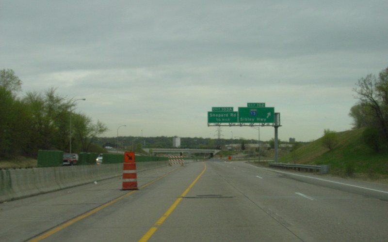
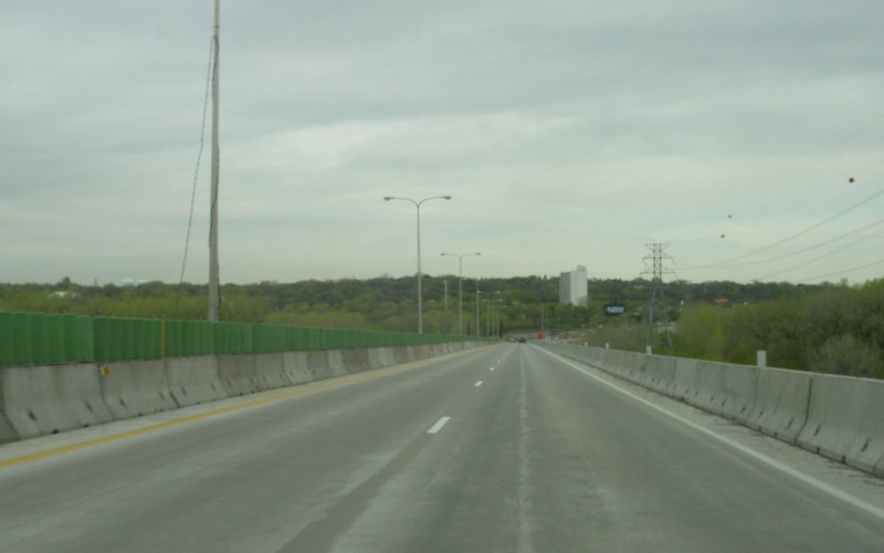
Northbound at the MN 13 exit. The lane shift was due to reconstruction of the "Lexington Bridge" across the Mississippi River. Photo by Adam Froehlig, taken April 29, 2003. |
|
|
On the newly-constructed northbound lanes of the "Lexington Bridge". At the time, all traffic was on the northbound side while the southbound bridge was being replaced. Photo by Adam Froehlig, taken April 29, 2003. |
|
|
At the Shepard Rd exit, complete with temporary signage. The interchange with Shepard Rd is a half-diamond to/from the south. Photo by Adam Froehlig, taken April 29, 2003. |
|
|
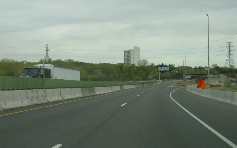
Northbound at MN 5. Trucks heavier than 9,000 pounds are required to exit here. Photo by Adam Froehlig, taken April 29, 2003. |
|
|
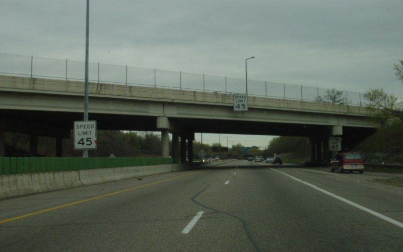
At the MN 5 overpass, the speed limit drops to 45 MPH. This lower speed limit was part of the legal settlement that allowed the segment of I-35E through southern St. Paul to be built. Photo by Adam Froehlig, taken April 29, 2003. |
|
|
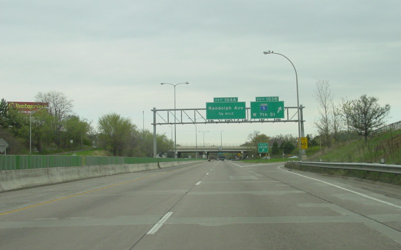
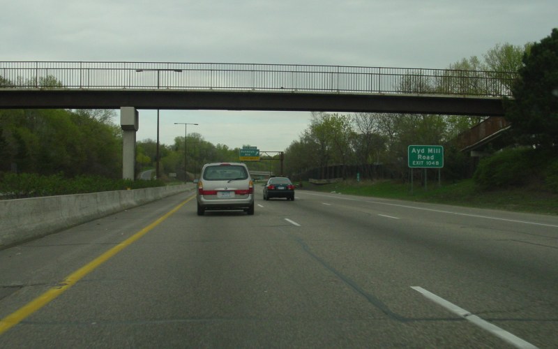
A pedestrian overpass, about halfway between MN 5 and Randolph Ave. To the right is the advance sign for Ayd Mill Rd. Photo by Adam Froehlig, taken April 29, 2003. |
|
|
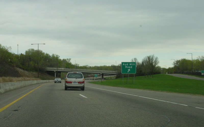
The Ayd Mill Rd exit was 40 years in the making. Originally conceived in the early 1960s as a connection to a freeway-grade MN 51, the now-abbreviated Ayd Mill Rd was built as an at-grade expressway between Selby Ave and St. Clair Ave instead. When construction on I-35E first began in the early 1970s, this connection at Ayd Mill Rd was graded, but a court injunction and the later legal settlement stopped the ramps from being paved. Around 2001/2002, the ramps were finally paved as part of a city experiment on reducing traffic on nearby neighborhood streets. The ramp is still open. Photo by Adam Froehlig, taken April 29, 2003. |
|
|
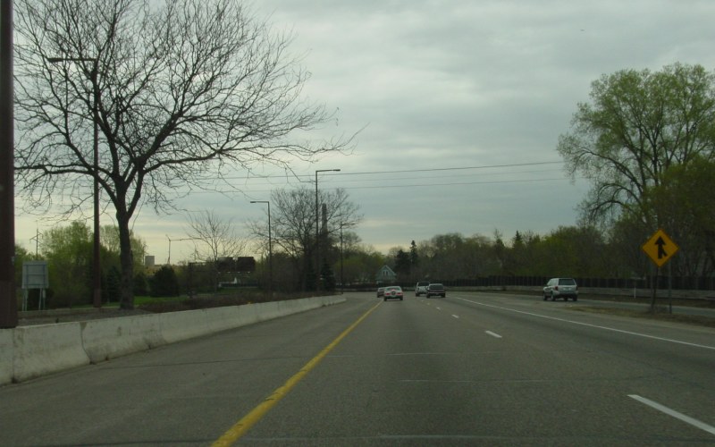
Northbound on-ramp from Victoria St. Photo by Adam Froehlig, taken April 29, 2003. |
|
|
At the Grand Ave exit, approaching downtown St. Paul. Photo by Adam Froehlig, taken April 29, 2003. |
|
|
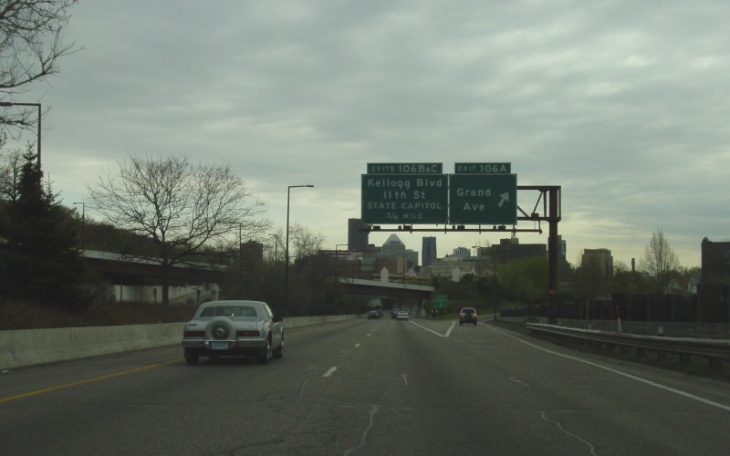
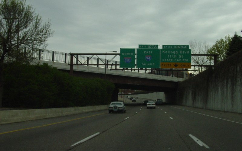
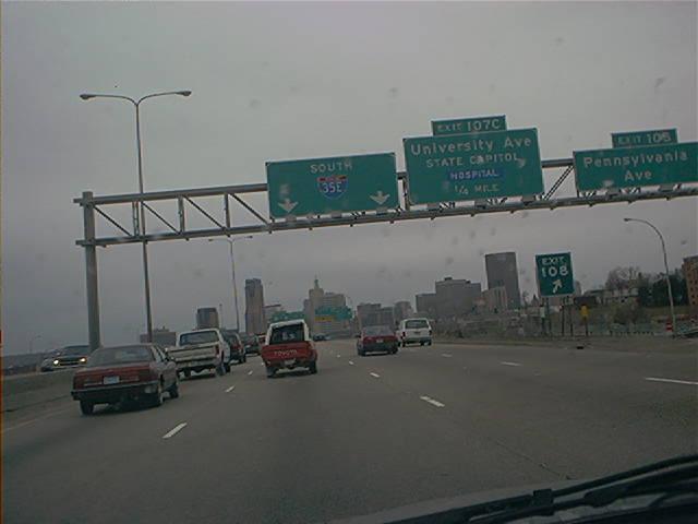
Overhead signage for the Kellogg Blvd and 11th St exits, the other northbound exits into downtown St. Paul. Photo by Adam Froehlig, taken April 29, 2003. |
|
|
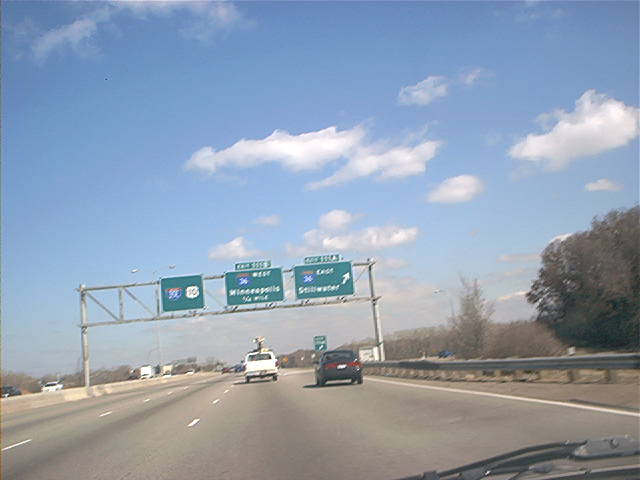
Northbound at MN 36 in Roseville. Photo by Don Greiskalns. |
|
|
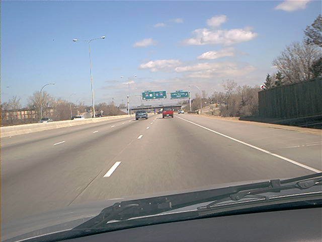
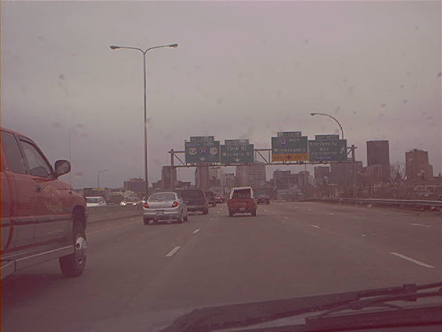
Further north, approaching Little Canada Rd. Photo by Don Greiskalns. |
Southbound Photos
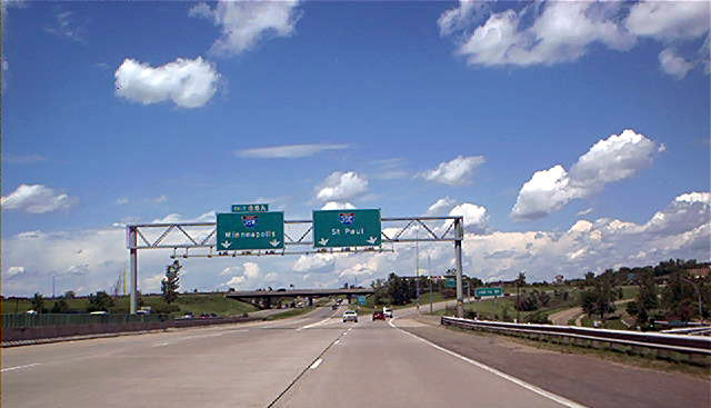
 | Southbound I-35E approaching downtown St. Paul, MN. Photo by Don Greiskalns. |
 | Closer in, showing the guide sign that was in the background in the above photo. Photo by Don Greiskalns. |
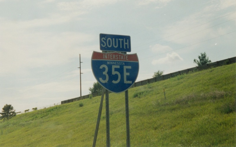 | Southbound shield that includes the state name. This was located somewhere in Eagan. Photo by Adam Froehlig, taken in 1999. |
Photos of the I-35E/I-694 duplex and "Unweave
the Weave"
I-35E at Interstate
Guide
Go to MN Highway Endings
Go to Minnesota Photography
Go to Highway Photography
![]()
Page last modified 12 April, 2008
(C) 2008-2003 Adam Froehlig